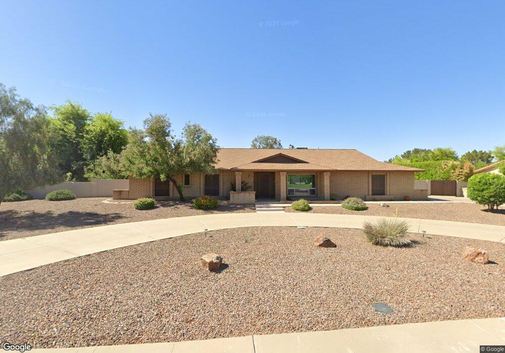
6313 W Aster Dr Glendale, AZ 85304
Estimated Value: $842,000 - $923,000
4
Beds
3
Baths
2,922
Sq Ft
$301/Sq Ft
Est. Value
About This Home
This home is located at 6313 W Aster Dr, Glendale, AZ 85304 and is currently estimated at $879,963, approximately $301 per square foot. 6313 W Aster Dr is a home located in Maricopa County with nearby schools including Desert Valley Elementary School, Ironwood High School, and Legacy Traditional School - Glendale.
Ownership History
Date
Name
Owned For
Owner Type
Purchase Details
Closed on
Jun 23, 2014
Sold by
Chenault Gary C and Chenault Cheryl A
Bought by
Tapp Curtis L and Tapp Victoria L
Current Estimated Value
Home Financials for this Owner
Home Financials are based on the most recent Mortgage that was taken out on this home.
Original Mortgage
$372,000
Outstanding Balance
$115,710
Interest Rate
4.16%
Mortgage Type
New Conventional
Estimated Equity
$764,253
Purchase Details
Closed on
Aug 29, 2003
Sold by
Chenault Gary C and Chenault Cheryl A
Bought by
Chenaultl Gary C and Chenault Cheryl A
Home Financials for this Owner
Home Financials are based on the most recent Mortgage that was taken out on this home.
Original Mortgage
$90,397
Interest Rate
6.22%
Mortgage Type
Purchase Money Mortgage
Create a Home Valuation Report for This Property
The Home Valuation Report is an in-depth analysis detailing your home's value as well as a comparison with similar homes in the area
Home Values in the Area
Average Home Value in this Area
Purchase History
| Date | Buyer | Sale Price | Title Company |
|---|---|---|---|
| Tapp Curtis L | $488,000 | Great American Title Agency | |
| Chenaultl Gary C | -- | First American Title Insuran |
Source: Public Records
Mortgage History
| Date | Status | Borrower | Loan Amount |
|---|---|---|---|
| Open | Tapp Curtis L | $372,000 | |
| Previous Owner | Chenaultl Gary C | $90,397 |
Source: Public Records
Tax History
| Year | Tax Paid | Tax Assessment Tax Assessment Total Assessment is a certain percentage of the fair market value that is determined by local assessors to be the total taxable value of land and additions on the property. | Land | Improvement |
|---|---|---|---|---|
| 2025 | $3,402 | $42,758 | -- | -- |
| 2024 | $3,368 | $40,722 | -- | -- |
| 2023 | $3,368 | $58,600 | $11,720 | $46,880 |
| 2022 | $3,328 | $46,860 | $9,370 | $37,490 |
| 2021 | $3,537 | $43,730 | $8,740 | $34,990 |
| 2020 | $3,590 | $41,770 | $8,350 | $33,420 |
| 2019 | $3,490 | $37,200 | $7,440 | $29,760 |
| 2018 | $3,409 | $37,620 | $7,520 | $30,100 |
| 2017 | $3,432 | $32,730 | $6,540 | $26,190 |
| 2016 | $3,410 | $31,460 | $6,290 | $25,170 |
| 2015 | $3,198 | $28,420 | $5,680 | $22,740 |
Source: Public Records
Map
Nearby Homes
- 6316 W Sweetwater Ave
- 6504 W Corrine Dr
- 13201 N 64th Dr
- 6107 W Windrose Dr
- 13217 N 65th Dr
- 6614 W Sweetwater Ave
- 12465 N 67th Dr
- 12223 N 60th Ln
- 6428 W Eugie Ave
- 12099 N 66th Ave
- 6409 W Riviera Dr
- 6201 W Riviera Dr
- 6626 W Laurel Ave
- 6739 W Cactus Rd
- 6605 W Laurel Ave
- 6237 W Altadena Ave
- 6715 W Cherry Hills Dr
- 11944 N 68th Ave
- 6422 W Cortez St
- 6933 W Bloomfield Rd
- 6325 W Aster Dr
- 6301 W Aster Dr
- 6316 W Corrine Dr
- 6314 W Aster Dr
- 6328 W Corrine Dr
- 6304 W Corrine Dr
- 6302 W Aster Dr
- 6326 W Aster Dr
- 6337 W Aster Dr
- 6340 W Corrine Dr
- 6245 W Windrose Dr
- 6315 W Sweetwater Ave
- 6315 W Corrine Dr
- 6338 W Aster Dr
- 6327 W Sweetwater Ave
- 6303 W Sweetwater Ave
- 6327 W Corrine Dr
- 6303 W Corrine Dr
- 6239 W Windrose Dr
- 6339 W Sweetwater Ave
Your Personal Tour Guide
Ask me questions while you tour the home.