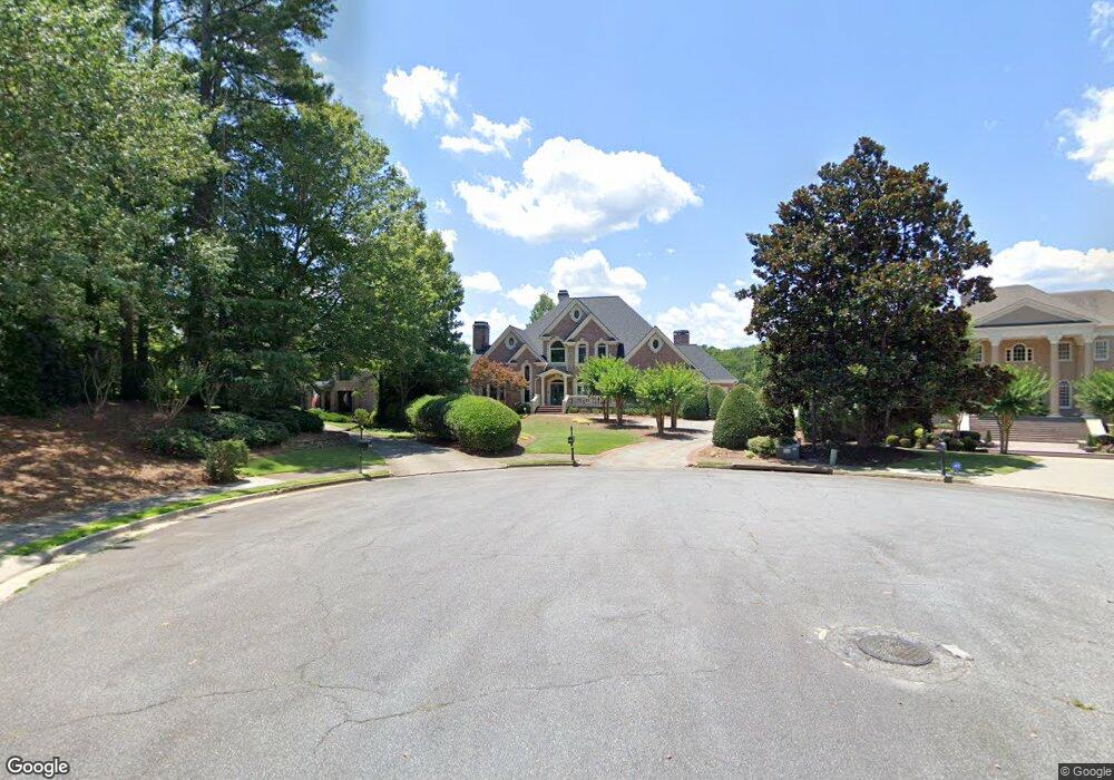
6314 Harrow Trace Norcross, GA 30092
Estimated Value: $1,117,000 - $2,563,000
6
Beds
6
Baths
4,528
Sq Ft
$388/Sq Ft
Est. Value
About This Home
This home is located at 6314 Harrow Trace, Norcross, GA 30092 and is currently estimated at $1,755,295, approximately $387 per square foot. 6314 Harrow Trace is a home located in Gwinnett County with nearby schools including Simpson Elementary School, Pinckneyville Middle School, and Norcross High School.
Ownership History
Date
Name
Owned For
Owner Type
Purchase Details
Closed on
May 12, 2022
Sold by
Ives Thomas P
Bought by
Long Robert and Long Erin Maria
Current Estimated Value
Home Financials for this Owner
Home Financials are based on the most recent Mortgage that was taken out on this home.
Original Mortgage
$1,200,000
Outstanding Balance
$1,133,970
Interest Rate
5%
Mortgage Type
New Conventional
Estimated Equity
$621,325
Create a Home Valuation Report for This Property
The Home Valuation Report is an in-depth analysis detailing your home's value as well as a comparison with similar homes in the area
Home Values in the Area
Average Home Value in this Area
Purchase History
| Date | Buyer | Sale Price | Title Company |
|---|---|---|---|
| Long Robert | $1,800,000 | -- |
Source: Public Records
Mortgage History
| Date | Status | Borrower | Loan Amount |
|---|---|---|---|
| Open | Long Robert | $1,200,000 |
Source: Public Records
Tax History Compared to Growth
Tax History
| Year | Tax Paid | Tax Assessment Tax Assessment Total Assessment is a certain percentage of the fair market value that is determined by local assessors to be the total taxable value of land and additions on the property. | Land | Improvement |
|---|---|---|---|---|
| 2025 | -- | $586,960 | $95,560 | $491,400 |
| 2024 | $17,574 | $559,200 | $105,040 | $454,160 |
| 2023 | $17,574 | $482,680 | $96,040 | $386,640 |
| 2022 | $0 | $409,840 | $81,040 | $328,800 |
| 2021 | $12,350 | $340,000 | $71,040 | $268,960 |
| 2020 | $12,430 | $340,000 | $71,040 | $268,960 |
| 2019 | $10,445 | $369,320 | $71,040 | $298,280 |
| 2018 | $10,483 | $290,080 | $66,440 | $223,640 |
| 2016 | $9,843 | $273,120 | $66,440 | $206,680 |
| 2015 | $9,966 | $273,120 | $66,440 | $206,680 |
| 2014 | $8,895 | $245,000 | $55,680 | $189,320 |
Source: Public Records
Map
Nearby Homes
- 4575 Dairy Way
- 4410 River Trail Dr Unit 383
- 4405 River Trail Dr
- 0 Hawk Run Unit 7571401
- 0 Hawk Run
- 4291 River Bottom Dr
- 6040 Neely Farm Dr Unit 3
- 225 Brassy Ct
- 9062 Riverbend Manor
- 102 Hawkstone Way
- 0 Niblick Dr Unit 7655286
- 3156 E Addison Dr
- 917 Wentworth Ct
- 5970 Rachel Ridge Unit 2
- 606 Cypress Pointe St
- 1003 Sandy Lane Dr
- 1106 Sandy Lane Dr Unit 206
- 712 Cypress Pointe St
- 703 Cypress Pointe St Unit 123
- 6304 Harrow Trace
- 6315 Harrow Trace
- 6294 Harrow Trace
- 4588 Holstein Hill Dr Unit X
- 6285 Harrow Trace
- 6283 Indian Field Unit X
- 4578 Holstein Hill Dr
- 4578 Holstein Hill Dr Unit X
- 6275 Harrow Trace
- 4568 Holstein Hill Dr Unit X
- 4589 Holstein Hill Dr
- 6282 Indian Field
- 4569 Holstein Hill Dr
- 6265 Harrow Trace
- 4558 Holstein Hill Dr
- 0 Holstein Hill Dr Unit 7004556
- 0 Holstein Hill Dr Unit 3231543
- 4584 Dairy Way
- 4559 Holstein Hill Dr
- 6272 Indian Field