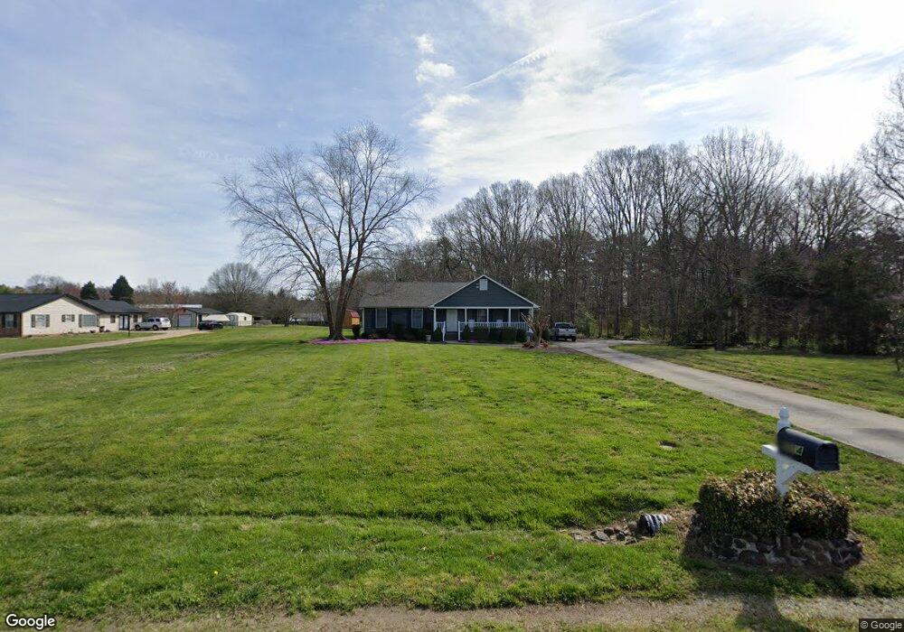
6314 Scott Long Rd Indian Trail, NC 28079
Estimated Value: $345,000 - $394,000
3
Beds
2
Baths
1,368
Sq Ft
$263/Sq Ft
Est. Value
About This Home
This home is located at 6314 Scott Long Rd, Indian Trail, NC 28079 and is currently estimated at $360,190, approximately $263 per square foot. 6314 Scott Long Rd is a home located in Union County with nearby schools including Sardis Elementary School, Porter Ridge Middle School, and Porter Ridge High School.
Ownership History
Date
Name
Owned For
Owner Type
Purchase Details
Closed on
Sep 30, 2004
Sold by
Purser Tim Martin and Purser Kristy S
Bought by
Huncke Brian C and Huncke Dina L
Current Estimated Value
Home Financials for this Owner
Home Financials are based on the most recent Mortgage that was taken out on this home.
Original Mortgage
$105,600
Outstanding Balance
$52,158
Interest Rate
5.73%
Mortgage Type
Purchase Money Mortgage
Estimated Equity
$308,032
Create a Home Valuation Report for This Property
The Home Valuation Report is an in-depth analysis detailing your home's value as well as a comparison with similar homes in the area
Home Values in the Area
Average Home Value in this Area
Purchase History
| Date | Buyer | Sale Price | Title Company |
|---|---|---|---|
| Huncke Brian C | $132,000 | Chicago Title Insurance Co |
Source: Public Records
Mortgage History
| Date | Status | Borrower | Loan Amount |
|---|---|---|---|
| Open | Huncke Brian C | $105,600 | |
| Closed | Huncke Brian C | $26,400 |
Source: Public Records
Tax History Compared to Growth
Tax History
| Year | Tax Paid | Tax Assessment Tax Assessment Total Assessment is a certain percentage of the fair market value that is determined by local assessors to be the total taxable value of land and additions on the property. | Land | Improvement |
|---|---|---|---|---|
| 2024 | $1,864 | $0 | $0 | $0 |
| 2023 | $1,848 | $0 | $0 | $0 |
| 2022 | $1,381 | $0 | $0 | $0 |
| 2021 | $1,848 | $218,400 | $44,900 | $173,500 |
| 2020 | $941 | $120,670 | $25,970 | $94,700 |
| 2019 | $1,228 | $120,670 | $25,970 | $94,700 |
| 2018 | $941 | $120,670 | $25,970 | $94,700 |
| 2017 | $1,290 | $120,700 | $26,000 | $94,700 |
| 2016 | $984 | $120,670 | $25,970 | $94,700 |
| 2015 | $999 | $120,670 | $25,970 | $94,700 |
| 2014 | $1,119 | $156,650 | $44,980 | $111,670 |
Source: Public Records
Map
Nearby Homes
- 1010 Glen Hollow Dr
- 272 Briana Marie Way
- 269 Briana Marie Way
- 261 Briana Marie Way
- 3702 Arthur St
- 2006 Paddington Dr
- 3900 Crimson Wing Dr
- 3013 Doughton Ln
- 1018 Equipoise Dr
- 0 Saratoga Blvd
- 149 Briana Marie Way
- 3612 Esther St
- 1021 Hercules Dr
- 4311 Ethel Sustar Dr
- 2026 Union Grove Ln
- 1305 Belmont Stakes Ave
- 1009 Kemp Rd
- 5706 Sustar Dr
- 7607 Taft Place
- 1011 Phar Lap Dr
- 6320 Scott Long Rd
- 6306 Scott Long Rd
- 1000 Glen Hollow Dr
- 6402 Scott Long Rd
- 1002 Glen Hollow Dr
- 1001 Glen Hollow Dr
- 2008 Oakbriar Cir
- 6406 Scott Long Rd
- 2006 Oakbriar Cir
- 1004 Glen Hollow Dr
- 2011 Oakbriar Cir
- 1003 Glen Hollow Dr
- 1005 Glen Hollow Dr
- 1006 Glen Hollow Dr
- 2009 Oakbriar Cir
- 6307 Scott Long Rd
- 6226 Scott Long Rd
- 1007 Glen Hollow Dr
- 1008 Glen Hollow Dr
- 2007 Oakbriar Cir