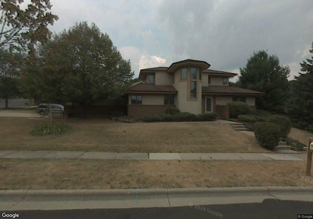
6315 Clovernook Rd Middleton, WI 53562
Stonefield NeighborhoodEstimated Value: $758,000 - $843,392
--
Bed
--
Bath
--
Sq Ft
0.3
Acres
About This Home
This home is located at 6315 Clovernook Rd, Middleton, WI 53562 and is currently estimated at $805,098. 6315 Clovernook Rd is a home located in Dane County with nearby schools including Elm Lawn Elementary School, Kromrey Middle School, and Middleton High School.
Ownership History
Date
Name
Owned For
Owner Type
Purchase Details
Closed on
Aug 27, 2008
Sold by
Delea William F and Delea Sarah K
Bought by
Ullsvik Thomas H and Ullsvik Susan R
Current Estimated Value
Home Financials for this Owner
Home Financials are based on the most recent Mortgage that was taken out on this home.
Original Mortgage
$356,250
Interest Rate
6.31%
Mortgage Type
Purchase Money Mortgage
Create a Home Valuation Report for This Property
The Home Valuation Report is an in-depth analysis detailing your home's value as well as a comparison with similar homes in the area
Home Values in the Area
Average Home Value in this Area
Purchase History
| Date | Buyer | Sale Price | Title Company |
|---|---|---|---|
| Ullsvik Thomas H | $356,300 | None Available |
Source: Public Records
Mortgage History
| Date | Status | Borrower | Loan Amount |
|---|---|---|---|
| Closed | Ullsvik Thomas H | $356,250 |
Source: Public Records
Tax History Compared to Growth
Tax History
| Year | Tax Paid | Tax Assessment Tax Assessment Total Assessment is a certain percentage of the fair market value that is determined by local assessors to be the total taxable value of land and additions on the property. | Land | Improvement |
|---|---|---|---|---|
| 2024 | $10,673 | $601,300 | $150,600 | $450,700 |
| 2023 | $9,914 | $601,300 | $150,600 | $450,700 |
| 2021 | $8,300 | $420,500 | $150,600 | $269,900 |
| 2020 | $8,410 | $420,500 | $150,600 | $269,900 |
| 2019 | $7,922 | $420,500 | $150,600 | $269,900 |
| 2018 | $7,293 | $420,500 | $150,600 | $269,900 |
| 2017 | $7,355 | $367,800 | $143,700 | $224,100 |
| 2016 | $7,644 | $384,800 | $143,700 | $241,100 |
| 2015 | $7,819 | $384,800 | $143,700 | $241,100 |
| 2014 | $7,749 | $360,500 | $122,100 | $238,400 |
| 2013 | $6,847 | $360,500 | $122,100 | $238,400 |
Source: Public Records
Map
Nearby Homes
- 6341 Briarcliff Ln
- 1030 Rooster Run Unit 19
- 2 Hidden Hollow Trail
- 6233 Countryside Ln
- 1222 N Gammon Rd
- 7009 Fortune Dr
- 6322 Elmwood Ave
- 6242 University Ave
- 6251 Charing Cross Ln Unit D
- 6829 Cooper Ave
- 2051 Allen Blvd Unit 402
- 21 Torrey Pines Ct
- 1705 Camelot Dr
- 2146 Allen Blvd Unit 3
- 30 Morningdale Cir
- 1626 Laurel Crest
- 1634 Norman Way Unit 6
- 6205 Mendota Ave
- 517 Isle Royal Dr
- 6907 Old Sauk Ct
- 6326 Stonefield Rd
- 6321 Briarcliff Ln
- 6325 Briarcliff Ln
- 6329 Briarcliff Ln
- 6314 Clovernook Rd
- 6330 Stonefield Rd
- 1401 Club Cir
- 6325 Stonefield Rd
- 6333 Briarcliff Ln
- 6321 Stonefield Rd
- 6329 Stonefield Rd
- 6334 Stonefield Rd
- 1405 Club Cir
- 6314 Stonefield Rd
- 6327 Clovernook Rd
- 6317 Stonefield Rd
- 6337 Briarcliff Ln
- 1378 Boundary Rd
- 6324 Briarcliff Ln
- 6328 Briarcliff Ln