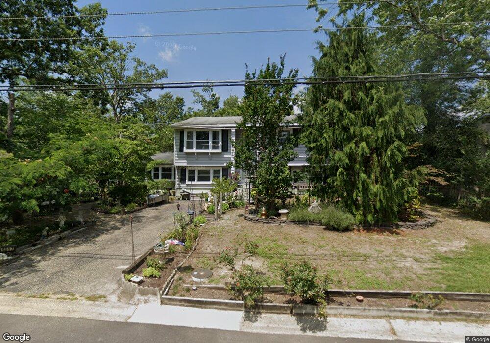
6317 Crocus St Mays Landing, NJ 08330
Estimated Value: $359,000 - $391,000
--
Bed
--
Bath
2,130
Sq Ft
$173/Sq Ft
Est. Value
About This Home
This home is located at 6317 Crocus St, Mays Landing, NJ 08330 and is currently estimated at $369,544, approximately $173 per square foot. 6317 Crocus St is a home located in Atlantic County with nearby schools including Joseph Shaner School, George L. Hess Educational Complex, and William Davies Middle School.
Ownership History
Date
Name
Owned For
Owner Type
Purchase Details
Closed on
May 28, 2003
Sold by
Hofman Frank
Bought by
Hablitz Arthur and Hablitz Carolyn
Current Estimated Value
Home Financials for this Owner
Home Financials are based on the most recent Mortgage that was taken out on this home.
Original Mortgage
$133,600
Outstanding Balance
$51,999
Interest Rate
4.25%
Mortgage Type
Purchase Money Mortgage
Estimated Equity
$317,545
Create a Home Valuation Report for This Property
The Home Valuation Report is an in-depth analysis detailing your home's value as well as a comparison with similar homes in the area
Home Values in the Area
Average Home Value in this Area
Purchase History
| Date | Buyer | Sale Price | Title Company |
|---|---|---|---|
| Hablitz Arthur | $167,000 | -- | |
| Hablitz Arthur C | $167,000 | -- |
Source: Public Records
Mortgage History
| Date | Status | Borrower | Loan Amount |
|---|---|---|---|
| Open | Hablitz Arthur C | $133,600 | |
| Closed | Hablitz Arthur | $133,600 |
Source: Public Records
Tax History Compared to Growth
Tax History
| Year | Tax Paid | Tax Assessment Tax Assessment Total Assessment is a certain percentage of the fair market value that is determined by local assessors to be the total taxable value of land and additions on the property. | Land | Improvement |
|---|---|---|---|---|
| 2025 | $6,447 | $187,900 | $50,700 | $137,200 |
| 2024 | $6,447 | $187,900 | $50,700 | $137,200 |
| 2023 | $6,062 | $187,900 | $50,700 | $137,200 |
| 2022 | $6,062 | $187,900 | $50,700 | $137,200 |
| 2021 | $6,049 | $187,900 | $50,700 | $137,200 |
| 2020 | $6,049 | $187,900 | $50,700 | $137,200 |
| 2019 | $6,064 | $187,900 | $50,700 | $137,200 |
| 2018 | $5,851 | $187,900 | $50,700 | $137,200 |
| 2017 | $5,759 | $187,900 | $50,700 | $137,200 |
| 2016 | $5,598 | $187,900 | $50,700 | $137,200 |
| 2015 | $5,408 | $187,900 | $50,700 | $137,200 |
| 2014 | $5,656 | $215,300 | $58,700 | $156,600 |
Source: Public Records
Map
Nearby Homes
- 6314 Lance Ave
- 0 Harding Hwy Unit NJAC2019438
- 0 Harding Hwy Unit 597638
- 6310 Phillips Ave
- 6301 Roberts Ave
- 6301 Knight Ave
- 6206 Roberts Ave
- 37 Delancy Ct
- 150 Rainbow Dr
- 6140 Robin Dr
- 5 Camac Ave
- 80 Mill St
- 16 Holly Ct
- 24 Holly Ct
- 6062 Main St
- 13 Hickory Ln
- 14 Hickory Ln
- 10 Locust Ct
- 32 Hickory Ln Unit 215
- 43 Hickory Ln