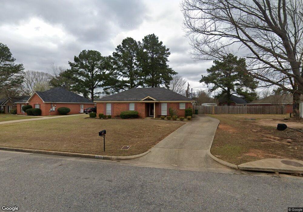
6317 Sonnie Ct Montgomery, AL 36117
East Montgomery NeighborhoodEstimated Value: $179,000 - $201,000
3
Beds
2
Baths
1,419
Sq Ft
$133/Sq Ft
Est. Value
About This Home
This home is located at 6317 Sonnie Ct, Montgomery, AL 36117 and is currently estimated at $189,396, approximately $133 per square foot. 6317 Sonnie Ct is a home located in Montgomery County with nearby schools including William Silas Garrett Elementary School, Goodwyn Middle School, and Dr. Percy L. Julian High School.
Ownership History
Date
Name
Owned For
Owner Type
Purchase Details
Closed on
Nov 24, 2003
Sold by
Carr Gregory Todd and Carr Alice Carol
Bought by
Parker Antwan J
Current Estimated Value
Home Financials for this Owner
Home Financials are based on the most recent Mortgage that was taken out on this home.
Original Mortgage
$93,532
Outstanding Balance
$43,572
Interest Rate
6.07%
Mortgage Type
FHA
Estimated Equity
$145,824
Create a Home Valuation Report for This Property
The Home Valuation Report is an in-depth analysis detailing your home's value as well as a comparison with similar homes in the area
Home Values in the Area
Average Home Value in this Area
Purchase History
| Date | Buyer | Sale Price | Title Company |
|---|---|---|---|
| Parker Antwan J | $95,032 | -- |
Source: Public Records
Mortgage History
| Date | Status | Borrower | Loan Amount |
|---|---|---|---|
| Open | Parker Antwan J | $93,532 |
Source: Public Records
Tax History Compared to Growth
Tax History
| Year | Tax Paid | Tax Assessment Tax Assessment Total Assessment is a certain percentage of the fair market value that is determined by local assessors to be the total taxable value of land and additions on the property. | Land | Improvement |
|---|---|---|---|---|
| 2025 | $776 | $16,640 | $2,500 | $14,140 |
| 2024 | $757 | $16,240 | $2,500 | $13,740 |
| 2023 | $757 | $15,920 | $2,500 | $13,420 |
| 2022 | $439 | $13,150 | $2,500 | $10,650 |
| 2021 | $385 | $11,660 | $0 | $0 |
| 2020 | $385 | $11,650 | $2,500 | $9,150 |
| 2019 | $354 | $10,820 | $2,500 | $8,320 |
| 2018 | $389 | $10,660 | $2,500 | $8,160 |
| 2017 | $328 | $20,220 | $5,000 | $15,220 |
| 2014 | $344 | $10,530 | $2,500 | $8,030 |
| 2013 | -- | $11,360 | $2,500 | $8,860 |
Source: Public Records
Map
Nearby Homes
- 925 Brookland Curve
- 6429 Sandy Ridge Curve
- 6500 Sweet Gum Dr
- 5728 Sweet Meadow Dr
- 1308 Dunbarton Rd
- 5805 Acacia Ct
- 970 Countryside Ln
- 6104 Bald Cypress Ct
- 5701 Bangor Ct
- 1308 Pondcypress Dr
- 5821 Hyde Park Dr
- 709 Balfour Rd
- 767 N Burbank Dr
- 749 Amity Ln
- 6201 Dalford Dr
- 6241 Wares Ferry Rd
- 740 Havelock Ln
- 6520 Pinebrook Dr
- 5737 Darien Dr
- 5743 Belleau Dr
- 6309 Sonnie Ct
- 6240 Sandy Ridge Curve
- 6228 Sandy Ridge Curve
- 6232 Sandy Ridge Curve
- 6305 Sonnie Ct
- 6216 Sandy Ridge Curve
- 6220 Sandy Ridge Curve
- 6248 Sandy Ridge Curve
- 6316 Sonnie Ct
- 6312 Sonnie Ct
- 6212 Sandy Ridge Curve
- 6308 Sonnie Ct
- 6301 Sonnie Ct
- 6208 Sandy Ridge Curve
- 6252 Sandy Ridge Curve
- 6237 Sandy Ridge Curve
- 6304 Sonnie Ct
- 6300 Sonnie Ct
- 6241 Sandy Ridge Curve
- 6204 Sandy Ridge Curve