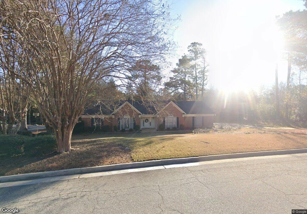
6318 Cape Cod Dr Columbus, GA 31904
North Columbus NeighborhoodEstimated Value: $412,280 - $428,000
4
Beds
4
Baths
2,694
Sq Ft
$157/Sq Ft
Est. Value
About This Home
This home is located at 6318 Cape Cod Dr, Columbus, GA 31904 and is currently estimated at $422,570, approximately $156 per square foot. 6318 Cape Cod Dr is a home located in Muscogee County with nearby schools including River Road Elementary School, Double Churches Middle School, and Northside High School.
Ownership History
Date
Name
Owned For
Owner Type
Purchase Details
Closed on
Aug 10, 2011
Sold by
Turner Billy G
Bought by
Durbin Ronald R and Durbin Ludwik A
Current Estimated Value
Home Financials for this Owner
Home Financials are based on the most recent Mortgage that was taken out on this home.
Original Mortgage
$198,000
Outstanding Balance
$136,901
Interest Rate
4.54%
Mortgage Type
New Conventional
Estimated Equity
$285,669
Create a Home Valuation Report for This Property
The Home Valuation Report is an in-depth analysis detailing your home's value as well as a comparison with similar homes in the area
Home Values in the Area
Average Home Value in this Area
Purchase History
We collect this data history from publicly available records. To have your information removed, we recommend requesting removal directly through your county’s website.
| Date | Buyer | Sale Price | Title Company |
|---|---|---|---|
| Durbin Ronald R | $298,000 | -- |
Source: Public Records
Mortgage History
We collect this data history from publicly available records. To have your information removed, we recommend requesting removal directly through your county’s website.
| Date | Status | Borrower | Loan Amount |
|---|---|---|---|
| Open | Durbin Ronald R | $198,000 |
Source: Public Records
Tax History
| Year | Tax Paid | Tax Assessment Tax Assessment Total Assessment is a certain percentage of the fair market value that is determined by local assessors to be the total taxable value of land and additions on the property. | Land | Improvement |
|---|---|---|---|---|
| 2025 | $5,495 | $140,368 | $26,236 | $114,132 |
| 2024 | $5,495 | $140,368 | $26,236 | $114,132 |
| 2023 | $5,529 | $140,368 | $26,236 | $114,132 |
| 2022 | $4,634 | $113,484 | $26,236 | $87,248 |
| 2021 | $4,376 | $107,180 | $26,236 | $80,944 |
| 2020 | $4,377 | $107,180 | $26,236 | $80,944 |
| 2019 | $4,391 | $107,180 | $26,236 | $80,944 |
| 2018 | $4,391 | $107,180 | $26,236 | $80,944 |
| 2017 | $4,405 | $107,180 | $26,236 | $80,944 |
| 2016 | $5,082 | $123,188 | $12,960 | $110,228 |
| 2015 | $5,088 | $123,188 | $12,960 | $110,228 |
| 2014 | $5,094 | $123,188 | $12,960 | $110,228 |
| 2013 | -- | $123,188 | $12,960 | $110,228 |
Source: Public Records
Map
Nearby Homes
- 6320 Brookstone Blvd
- 6100 Bristol Blvd
- 867 Lismore Dr
- 6289 Brookstone Blvd
- 6129 Cape Cod Ct
- 1 Stoneshoal Ct
- 20 Pinecreek Dr
- 737 Mobley Rd
- 6638 Highridge Dr
- 6101 River Rd Unit 5
- 6101 River Rd Unit 13
- 6101 River Rd Unit 15
- 6101 River Rd Unit 2
- 253 Pebblebrook Ln
- 1332 Autumnridge Dr
- 6 Cascade Rd
- 6400 Green Island Dr Unit 42
- 6400 Green Island Dr Unit 22
- 6400 Green Island Dr Unit 2
- 6400 Green Island Dr Unit 77
- 6326 Cape Cod Dr
- 6310 Cape Cod Dr
- 5 Milton Ct
- 6317 Cape Cod Dr
- 6334 Cape Cod Dr
- 4 Milton Ct
- 6325 Cape Cod Dr
- 6309 Cape Cod Dr
- 6238 Cape Cod Dr
- 6301 Cape Cod Dr
- 6333 Cape Cod Dr
- 2 Milton Ct
- 3 Milton Ct
- 6342 Cape Cod Dr
- 6235 Cape Cod Dr
- 6228 Cape Cod Dr
- 6252 Seminary Rd
- 6260 Seminary Rd
- 6244 Seminary Rd
- 6341 Cape Cod Dr
Your Personal Tour Guide
Ask me questions while you tour the home.