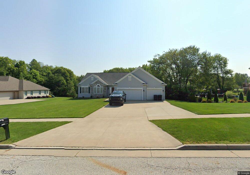
6319 Highridge Dr Streetsboro, OH 44241
Estimated Value: $445,394 - $513,000
3
Beds
3
Baths
2,066
Sq Ft
$227/Sq Ft
Est. Value
About This Home
This home is located at 6319 Highridge Dr, Streetsboro, OH 44241 and is currently estimated at $469,849, approximately $227 per square foot. 6319 Highridge Dr is a home located in Portage County with nearby schools including Campus Intermediate Elementary School, Henry Defer Intermediate Elementary School, and Streetsboro Middle School.
Ownership History
Date
Name
Owned For
Owner Type
Purchase Details
Closed on
Aug 19, 2009
Sold by
Mccracken Development Llc
Bought by
Lindamood Mark D and Lindamood Kathy S
Current Estimated Value
Home Financials for this Owner
Home Financials are based on the most recent Mortgage that was taken out on this home.
Original Mortgage
$222,686
Interest Rate
5.29%
Mortgage Type
Future Advance Clause Open End Mortgage
Create a Home Valuation Report for This Property
The Home Valuation Report is an in-depth analysis detailing your home's value as well as a comparison with similar homes in the area
Home Values in the Area
Average Home Value in this Area
Purchase History
| Date | Buyer | Sale Price | Title Company |
|---|---|---|---|
| Lindamood Mark D | $55,000 | Chicago Title Insurance Co |
Source: Public Records
Mortgage History
| Date | Status | Borrower | Loan Amount |
|---|---|---|---|
| Closed | Lindamood Mark D | $222,686 |
Source: Public Records
Tax History Compared to Growth
Tax History
| Year | Tax Paid | Tax Assessment Tax Assessment Total Assessment is a certain percentage of the fair market value that is determined by local assessors to be the total taxable value of land and additions on the property. | Land | Improvement |
|---|---|---|---|---|
| 2024 | $5,893 | $142,590 | $17,080 | $125,510 |
| 2023 | $5,154 | $102,100 | $17,080 | $85,020 |
| 2022 | $5,161 | $102,100 | $17,080 | $85,020 |
| 2021 | $5,180 | $102,100 | $17,080 | $85,020 |
| 2020 | $5,217 | $94,360 | $17,080 | $77,280 |
| 2019 | $5,266 | $94,360 | $17,080 | $77,280 |
| 2018 | $4,113 | $82,920 | $17,080 | $65,840 |
| 2017 | $4,113 | $82,920 | $17,080 | $65,840 |
| 2016 | $4,116 | $82,920 | $17,080 | $65,840 |
| 2015 | $4,123 | $82,920 | $17,080 | $65,840 |
| 2014 | $4,159 | $82,920 | $17,080 | $65,840 |
| 2013 | $4,142 | $82,920 | $17,080 | $65,840 |
Source: Public Records
Map
Nearby Homes
- 139 Mccracken Rd
- 9005 Sandpiper Dr
- 6167 Burr Oak Way
- 9011 Wood Thursh
- 8929 Falcon Dr
- 9085 Sandpiper Dr
- 792 State Route 303
- 701 Gold Leaf Ct
- 939 State Route 303
- 9251 Chestnut Ct
- 9247 Chestnut Ct
- 1011 Ashwood Ln
- 1013 Ashwood Ln
- 5890 Eastham Way
- 5361 Diana Lynn Dr
- 708 Diane Ave
- 572 David Dr
- 1401 Colony Dr
- 2798 E Celeste View Dr
- 9015 Patriot Dr Unit K4
- 6319 Highridge Dr Unit 45
- 6327 Highridge Dr Unit 44
- 6327 Highridge Dr
- 255 Mccracken Rd Unit 35
- 255 Mccracken Rd
- 6332 Highridge Dr
- 6324 Stoneridge Dr Unit 38
- 6330 Highridge Dr Unit Lot31
- 265 Mccracken Rd Unit 36
- 265 Mccracken Rd
- 6335 Highridge Dr
- 6322 Highridge Dr
- 6314 Highridge Dr Unit 33
- 250 Mccracken Rd
- 6336 Stoneridge Dr
- 275 Mccracken Rd Unit 37
- 6306 Highridge Dr Unit 34
- 6338 Highridge Dr Unit 30
- S/L 33 Stoneridge
- 260 Mccracken Rd