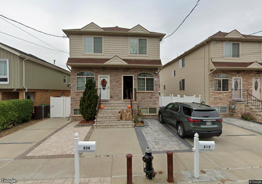
632-634 Britton Ave Staten Island, NY 10304
Concord NeighborhoodEstimated Value: $739,000 - $859,000
--
Bed
--
Bath
1,788
Sq Ft
$447/Sq Ft
Est. Value
About This Home
This home is located at 632-634 Britton Ave, Staten Island, NY 10304 and is currently estimated at $799,889, approximately $447 per square foot. 632-634 Britton Ave is a home located in Richmond County with nearby schools including P.S. 48 - William C. Wilcox, I.S. 49 Berta A Dreyfus, and New Dorp High School.
Ownership History
Date
Name
Owned For
Owner Type
Purchase Details
Closed on
Jul 13, 2015
Sold by
Jake Rock Llc
Bought by
Chen Qun and Chen Yu Hua
Current Estimated Value
Home Financials for this Owner
Home Financials are based on the most recent Mortgage that was taken out on this home.
Original Mortgage
$200,000
Outstanding Balance
$156,761
Interest Rate
4.01%
Mortgage Type
New Conventional
Estimated Equity
$643,128
Create a Home Valuation Report for This Property
The Home Valuation Report is an in-depth analysis detailing your home's value as well as a comparison with similar homes in the area
Home Values in the Area
Average Home Value in this Area
Purchase History
| Date | Buyer | Sale Price | Title Company |
|---|---|---|---|
| Chen Qun | $436,020 | None Available |
Source: Public Records
Mortgage History
| Date | Status | Borrower | Loan Amount |
|---|---|---|---|
| Open | Chen Qun | $200,000 |
Source: Public Records
Tax History Compared to Growth
Tax History
| Year | Tax Paid | Tax Assessment Tax Assessment Total Assessment is a certain percentage of the fair market value that is determined by local assessors to be the total taxable value of land and additions on the property. | Land | Improvement |
|---|---|---|---|---|
| 2025 | $6,321 | $48,600 | $3,915 | $44,685 |
| 2024 | $6,321 | $45,360 | $4,163 | $41,197 |
| 2023 | $6,030 | $29,689 | $3,325 | $26,364 |
| 2022 | $5,591 | $47,700 | $6,000 | $41,700 |
| 2021 | $5,561 | $40,740 | $6,000 | $34,740 |
| 2020 | $5,593 | $36,660 | $6,000 | $30,660 |
| 2019 | $5,503 | $35,580 | $6,000 | $29,580 |
| 2018 | $5,043 | $24,741 | $3,946 | $20,795 |
| 2017 | $4,758 | $23,341 | $4,863 | $18,478 |
| 2016 | $1,173 | $22,020 | $6,000 | $16,020 |
| 2015 | $1,198 | $6,000 | $6,000 | $0 |
| 2014 | $1,198 | $6,241 | $3,240 | $3,001 |
Source: Public Records
Map
Nearby Homes
- 72 Alan Loop
- 164 Stonegate Dr
- 31 Alan Loop Unit 65
- 24 Roosevelt St
- 63 Gateway Dr Unit 172
- 456 Oder Ave
- 89 Columbus Ave
- 13 Wilson Terrace
- 62 Columbus Ave
- 1890 Clove Rd
- 6 Eltinge St
- 0 Douglas Rd
- 76 Douglas Rd
- 1 Douglas Ct
- 4 Sheridan Ave
- 98 N Railroad Ave
- 22 Scranton St
- 14 Eltinge St
- 16 Tacoma St
- 78 Sparkill Ave
- 634 Britton Ave
- 632 Britton Ave
- 630 Britton Ave
- 628 Britton Ave
- 636 Britton Ave
- 626 Britton Ave
- 545 Oder Ave
- 541 Oder Ave
- 15 Hay St
- 539 Oder Ave
- 644 Britton Ave
- 535 Oder Ave
- 618 Britton Ave
- 533 Oder Ave
- 646 Britton Ave
- 633 Britton Ave Unit 2
- 633 Britton Ave Unit 1
- 629 Britton Ave
- 529 Oder Ave
- 637 Britton Ave