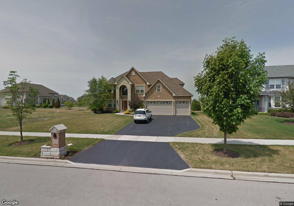
632 Bennett Dr North Aurora, IL 60542
Nelson Lake NeighborhoodEstimated Value: $565,956 - $642,000
4
Beds
4
Baths
3,573
Sq Ft
$173/Sq Ft
Est. Value
About This Home
This home is located at 632 Bennett Dr, North Aurora, IL 60542 and is currently estimated at $617,989, approximately $172 per square foot. 632 Bennett Dr is a home located in Kane County with nearby schools including Fearn Elementary School, Herget Middle School, and West Aurora High School.
Ownership History
Date
Name
Owned For
Owner Type
Purchase Details
Closed on
Mar 31, 2021
Sold by
Assmann Craig F and Assmann Bobbi Jo
Bought by
Assmann Craig F and Assmann Bobbi Jo
Current Estimated Value
Purchase Details
Closed on
Nov 3, 2006
Sold by
Mccue Builders Inc
Bought by
Assmann Craig F and Assmann Bobbi Jo
Home Financials for this Owner
Home Financials are based on the most recent Mortgage that was taken out on this home.
Original Mortgage
$369,227
Outstanding Balance
$233,831
Interest Rate
7.5%
Mortgage Type
Purchase Money Mortgage
Estimated Equity
$384,158
Create a Home Valuation Report for This Property
The Home Valuation Report is an in-depth analysis detailing your home's value as well as a comparison with similar homes in the area
Home Values in the Area
Average Home Value in this Area
Purchase History
| Date | Buyer | Sale Price | Title Company |
|---|---|---|---|
| Assmann Craig F | -- | Attorney | |
| Assmann Craig F | $462,000 | Law Title Insurance Agency |
Source: Public Records
Mortgage History
| Date | Status | Borrower | Loan Amount |
|---|---|---|---|
| Open | Assmann Craig F | $369,227 |
Source: Public Records
Tax History Compared to Growth
Tax History
| Year | Tax Paid | Tax Assessment Tax Assessment Total Assessment is a certain percentage of the fair market value that is determined by local assessors to be the total taxable value of land and additions on the property. | Land | Improvement |
|---|---|---|---|---|
| 2024 | $10,844 | $149,307 | $14,860 | $134,447 |
| 2023 | $10,528 | $134,754 | $13,412 | $121,342 |
| 2022 | $11,349 | $140,483 | $12,309 | $128,174 |
| 2021 | $10,839 | $134,459 | $11,781 | $122,678 |
| 2020 | $10,757 | $131,308 | $11,505 | $119,803 |
| 2019 | $11,114 | $129,380 | $11,336 | $118,044 |
| 2018 | $12,065 | $135,497 | $11,336 | $124,161 |
| 2017 | $12,263 | $130,576 | $11,207 | $119,369 |
| 2016 | $12,567 | $129,987 | $10,911 | $119,076 |
| 2015 | -- | $127,110 | $10,485 | $116,625 |
| 2014 | -- | $112,138 | $11,666 | $100,472 |
| 2013 | -- | $134,296 | $11,666 | $122,630 |
Source: Public Records
Map
Nearby Homes
- 512 Bennett Dr
- 483 Glover Dr
- 2045 Bartram Rd
- 921 N Deerpath Rd
- 868 Fair Meadow Ct
- 876 Fair Meadow Ct
- 867 Fair Meadow Ct
- 875 Fair Meadow Ct
- 916 Fair Meadow St
- 909 Fair Meadow St
- 917 Fair Meadow St
- Maxfield Plan at Autumn Ridge
- Morgan Plan at Autumn Ridge
- Newbury Plan at Autumn Ridge
- Quinn Plan at Autumn Ridge
- Paxton Plan at Autumn Ridge
- Leyden Plan at Autumn Ridge
- 1799 Breton Ave
- 1679 Patterson Ave
- 1663 Patterson Ave
- 640 Bennett Dr
- 2411 Imgrund Rd
- 648 Bennett Dr
- 2403 Imgrund Rd
- 2419 Imgrund Rd
- 2427 Imgrund Rd
- 656 Bennett Dr
- 631 Bennett Dr
- 623 Bennett Dr
- 639 Bennett Dr
- 2435 Imgrund Rd
- 615 Bennett Dr
- 647 Bennett Dr
- 664 Bennett Dr
- 607 Bennett Dr
- 2443 Imgrund Rd
- 655 Bennett Dr Unit 5
- 543 Bennett Dr
- 672 Bennett Dr
- 2420 Imgrund Rd