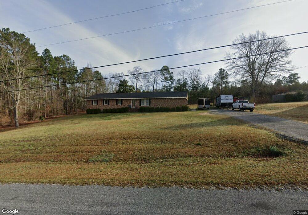
632 Brentwood Dr Thomson, GA 30824
Estimated Value: $240,846 - $286,000
4
Beds
2
Baths
1,653
Sq Ft
$158/Sq Ft
Est. Value
About This Home
This home is located at 632 Brentwood Dr, Thomson, GA 30824 and is currently estimated at $261,962, approximately $158 per square foot. 632 Brentwood Dr is a home located in McDuffie County with nearby schools including Thomson High School.
Ownership History
Date
Name
Owned For
Owner Type
Purchase Details
Closed on
Jun 10, 2010
Sold by
Secretary Of Housing & Urban Development
Bought by
Grant Christopher Hill
Current Estimated Value
Home Financials for this Owner
Home Financials are based on the most recent Mortgage that was taken out on this home.
Original Mortgage
$103,604
Outstanding Balance
$68,233
Interest Rate
4.62%
Mortgage Type
FHA
Estimated Equity
$193,730
Purchase Details
Closed on
Nov 3, 2009
Sold by
Battle Aretha M
Bought by
Wells Fargo Bank Na
Purchase Details
Closed on
Feb 14, 2005
Sold by
Jenkins Otis
Bought by
Battle Aretha M
Home Financials for this Owner
Home Financials are based on the most recent Mortgage that was taken out on this home.
Original Mortgage
$103,377
Interest Rate
5.68%
Mortgage Type
FHA
Purchase Details
Closed on
May 31, 1991
Bought by
Jenkins Otis
Create a Home Valuation Report for This Property
The Home Valuation Report is an in-depth analysis detailing your home's value as well as a comparison with similar homes in the area
Home Values in the Area
Average Home Value in this Area
Purchase History
| Date | Buyer | Sale Price | Title Company |
|---|---|---|---|
| Grant Christopher Hill | $105,000 | -- | |
| Wells Fargo Bank Na | $111,885 | -- | |
| Battle Aretha M | $105,000 | -- | |
| Jenkins Otis | $63,000 | -- |
Source: Public Records
Mortgage History
| Date | Status | Borrower | Loan Amount |
|---|---|---|---|
| Open | Grant Christopher Hill | $103,604 | |
| Previous Owner | Battle Aretha M | $103,377 |
Source: Public Records
Tax History Compared to Growth
Tax History
| Year | Tax Paid | Tax Assessment Tax Assessment Total Assessment is a certain percentage of the fair market value that is determined by local assessors to be the total taxable value of land and additions on the property. | Land | Improvement |
|---|---|---|---|---|
| 2024 | $1,717 | $74,012 | $11,151 | $62,861 |
| 2023 | $1,717 | $70,956 | $10,600 | $60,356 |
| 2022 | $1,663 | $65,762 | $10,600 | $55,162 |
| 2021 | $1,337 | $52,474 | $9,540 | $42,934 |
| 2020 | $1,139 | $44,418 | $7,200 | $37,218 |
| 2019 | $1,152 | $44,418 | $7,200 | $37,218 |
| 2018 | $1,263 | $48,346 | $7,200 | $41,146 |
| 2017 | $1,219 | $48,346 | $7,200 | $41,146 |
| 2016 | $1,219 | $48,346 | $7,200 | $41,146 |
| 2015 | $1,111 | $48,346 | $7,200 | $41,146 |
| 2014 | $1,113 | $48,346 | $7,200 | $41,146 |
| 2013 | -- | $48,346 | $7,200 | $41,146 |
Source: Public Records
Map
Nearby Homes
- 563 Lakewood Dr
- O Meadowood Dr
- 0 Meadowood Dr
- 1290 Elias Station
- 1302 Elias Station
- 1282 Elias Station
- 1379 Elias Station
- 219 Devonshire Dr
- 122 Willow Oak Cir
- 123 Willow Oak Cir
- 2592 White Oak Rd
- 146 Willow Oak Cir
- 125 Willow Oak Cir
- 338 Devonshire Dr
- 137 Willow Oak Cir
- 421 Liberty St
- 651 Moose Club Rd
- 0 Walnut St
- 0 Cobbham Rd Unit 10601573
- 0 Cobbham Rd Unit 10601578
- 637 Brentwood Dr
- 615 Brentwood Dr
- 649 Brentwood Dr
- 672 Brentwood Dr
- 590 Brentwood Dr
- 595 Brentwood Dr
- 554 Ravenwood Dr
- 530 Ravenwood Dr
- 570 Ravenwood Dr
- 512 Ravenwood Dr
- 594 Ravenwood Dr
- 571 Brentwood Dr
- 688 Brentwood Dr
- 2226 Tanglewood Ln
- 2776 Ginger Branch Rd
- 555 Ravenwood Dr
- 2131 Thornwood Ln
- 551 Brentwood Dr
- 2113 Thornwood Ln