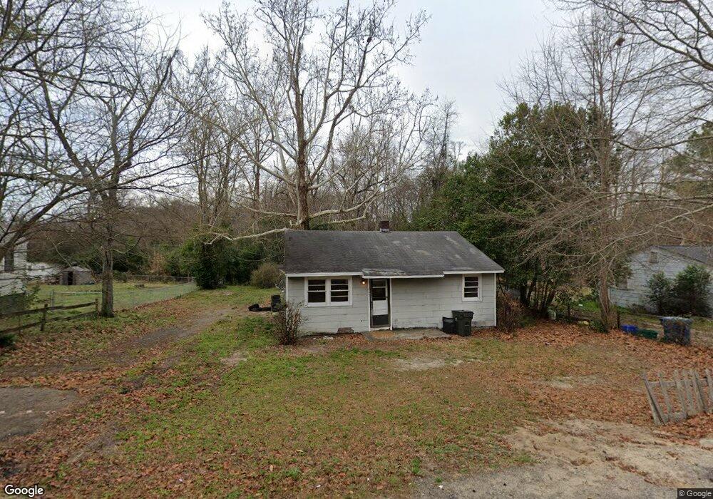
632 Brooks Ave West Columbia, SC 29169
Estimated Value: $113,608 - $231,000
2
Beds
1
Bath
780
Sq Ft
$198/Sq Ft
Est. Value
About This Home
This home is located at 632 Brooks Ave, West Columbia, SC 29169 and is currently estimated at $154,402, approximately $197 per square foot. 632 Brooks Ave is a home located in Lexington County with nearby schools including Cayce Elementary, Cyril B. Busbee Creative Arts Academy, and Brookland-Cayce High School.
Ownership History
Date
Name
Owned For
Owner Type
Purchase Details
Closed on
Aug 26, 2022
Sold by
Larimore Nancy P
Bought by
Larimore Properties Llc
Current Estimated Value
Purchase Details
Closed on
Jul 20, 2022
Sold by
Lee Larimore Sr Harold
Bought by
Larimore Kenney Wilson
Purchase Details
Closed on
Dec 10, 2020
Sold by
Lawrimore Bertha S and The Bertha S Lawrimore Revocab
Bought by
Larimore Harold L
Home Financials for this Owner
Home Financials are based on the most recent Mortgage that was taken out on this home.
Original Mortgage
$57,383
Interest Rate
2.8%
Mortgage Type
New Conventional
Purchase Details
Closed on
Oct 31, 2019
Sold by
Lawrimore Bertha S
Bought by
Lawrimore Bertha S and Lawrimore Revocable T Bertha S
Purchase Details
Closed on
Feb 5, 2019
Sold by
Estate Of Albert Carol Lawrimore
Bought by
Lawrimore Bertha S
Create a Home Valuation Report for This Property
The Home Valuation Report is an in-depth analysis detailing your home's value as well as a comparison with similar homes in the area
Home Values in the Area
Average Home Value in this Area
Purchase History
| Date | Buyer | Sale Price | Title Company |
|---|---|---|---|
| Larimore Properties Llc | -- | Dooley Law Firm Pa | |
| Larimore Kenney Wilson | -- | Mcmillan Claude R | |
| Larimore Harold L | $84,319 | None Available | |
| Lawrimore Bertha S | -- | None Available | |
| Lawrimore Bertha S | -- | None Available |
Source: Public Records
Mortgage History
| Date | Status | Borrower | Loan Amount |
|---|---|---|---|
| Previous Owner | Larimore Harold L | $57,383 |
Source: Public Records
Tax History
| Year | Tax Paid | Tax Assessment Tax Assessment Total Assessment is a certain percentage of the fair market value that is determined by local assessors to be the total taxable value of land and additions on the property. | Land | Improvement |
|---|---|---|---|---|
| 2024 | $1,172 | $2,724 | $864 | $1,860 |
| 2023 | $1,074 | $2,724 | $864 | $1,860 |
| 2022 | $1,017 | $2,724 | $864 | $1,860 |
| 2020 | $964 | $2,724 | $864 | $1,860 |
| 2019 | $1,031 | $2,882 | $864 | $2,018 |
| 2018 | $1,023 | $2,882 | $864 | $2,018 |
| 2017 | $1,004 | $2,882 | $864 | $2,018 |
| 2016 | $1,016 | $2,882 | $864 | $2,018 |
| 2014 | $1,041 | $3,403 | $972 | $2,431 |
| 2013 | -- | $3,400 | $970 | $2,430 |
Source: Public Records
Map
Nearby Homes
- 170 Whiteside Cir
- 629 Westside Dr
- 165 Whiteside Cir
- 117 Bonnie St
- 309 Hammond Ave
- 135 Silver Run Place
- 145 Silver Run Place
- 2024 Platt Springs Rd
- 940 Glenn St Unit 303
- 313 Ocala Dr
- 339 Ocala Dr
- 307 Ocala Dr
- 401 Ocala Dr
- 315 Ocala Dr
- 321 Ocala Dr
- 323 Ocala Dr
- 1802 D Ave
- 526 Rainbow Cir
- 300 Dale Ln
- 147 Cavendish Dr
- 630 Brooks Ave
- 634 Brooks Ave
- 507 White Ave
- 638 Brooks Ave
- 635 Brooks Ave
- 637 Brooks Ave
- 639 Brooks Ave
- 505 White Ave
- 640 Brooks Ave
- 503 White Ave
- 626 Brooks Ave
- 625 Brooks Ave
- 504 White Ave
- 506 White Ave
- 500 White Ave
- 178 Whiteside Cir
- 182 Whiteside Cir
- 180 Whiteside Cir
- 174 Whiteside Cir
- 603 White Ave
Your Personal Tour Guide
Ask me questions while you tour the home.