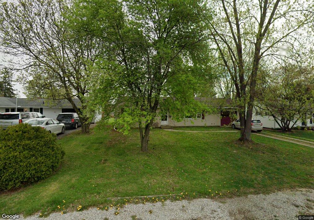
632 Euclid Ave Newark, OH 43055
Estimated Value: $205,000 - $244,000
3
Beds
2
Baths
1,044
Sq Ft
$209/Sq Ft
Est. Value
About This Home
This home is located at 632 Euclid Ave, Newark, OH 43055 and is currently estimated at $218,413, approximately $209 per square foot. 632 Euclid Ave is a home located in Licking County with nearby schools including John Clem Elementary School, Liberty Middle School, and Newark High School.
Ownership History
Date
Name
Owned For
Owner Type
Purchase Details
Closed on
Aug 7, 2018
Sold by
Siesta Ventures Ltd
Bought by
Sellers Connor Carla Wynn
Current Estimated Value
Home Financials for this Owner
Home Financials are based on the most recent Mortgage that was taken out on this home.
Original Mortgage
$97,990
Outstanding Balance
$86,873
Interest Rate
5.5%
Mortgage Type
FHA
Estimated Equity
$131,540
Purchase Details
Closed on
Dec 14, 2006
Sold by
Siesta Ventures
Bought by
Sellers Carla W
Purchase Details
Closed on
Aug 9, 2006
Sold by
Redman Jr Jay R and Redman Nadine L
Bought by
Siesta Ventures Ltd
Home Financials for this Owner
Home Financials are based on the most recent Mortgage that was taken out on this home.
Original Mortgage
$90,000
Interest Rate
6.85%
Mortgage Type
Unknown
Create a Home Valuation Report for This Property
The Home Valuation Report is an in-depth analysis detailing your home's value as well as a comparison with similar homes in the area
Home Values in the Area
Average Home Value in this Area
Purchase History
| Date | Buyer | Sale Price | Title Company |
|---|---|---|---|
| Sellers Connor Carla Wynn | $90,000 | None Available | |
| Sellers Carla W | $103,000 | None Available | |
| Siesta Ventures Ltd | $90,000 | None Available |
Source: Public Records
Mortgage History
| Date | Status | Borrower | Loan Amount |
|---|---|---|---|
| Open | Sellers Connor Carla Wynn | $97,990 | |
| Previous Owner | Siesta Ventures Ltd | $90,000 | |
| Closed | Sellers Carla W | $0 |
Source: Public Records
Tax History
| Year | Tax Paid | Tax Assessment Tax Assessment Total Assessment is a certain percentage of the fair market value that is determined by local assessors to be the total taxable value of land and additions on the property. | Land | Improvement |
|---|---|---|---|---|
| 2024 | $1,929 | $53,940 | $19,010 | $34,930 |
| 2023 | $1,925 | $53,940 | $19,010 | $34,930 |
| 2022 | $1,783 | $44,450 | $10,920 | $33,530 |
| 2021 | $1,870 | $44,450 | $10,920 | $33,530 |
| 2020 | $1,913 | $44,450 | $10,920 | $33,530 |
| 2019 | $1,577 | $35,290 | $9,490 | $25,800 |
| 2018 | $1,620 | $0 | $0 | $0 |
| 2017 | $1,519 | $0 | $0 | $0 |
| 2016 | $1,455 | $0 | $0 | $0 |
| 2015 | $1,487 | $0 | $0 | $0 |
| 2014 | $1,855 | $0 | $0 | $0 |
| 2013 | $1,570 | $0 | $0 | $0 |
Source: Public Records
Map
Nearby Homes
- 476 W Shields St
- 188 Meadow Dr
- 184 Meadow Dr
- 565 Granville St
- 361 Granville St
- 574 Blakeley Place Unit 574
- 469 King Ct
- 385 Woods Ave
- 293 Merchant St
- 584 Moull St Unit A
- 355 Eddy St
- 218 Granville St
- 792 Stone Ridge Way Unit 792
- 185 N 10th St
- 632 Moull St
- 122 W Shields St
- 377 Saint James Gate
- 207 Buckingham St
- 69 Wallace St
- 189 N Quentin Rd
Your Personal Tour Guide
Ask me questions while you tour the home.