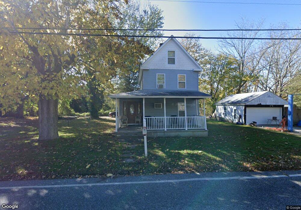
632 Jonathan Hoffman Rd Cape May, NJ 08204
Estimated Value: $555,412 - $670,000
Studio
--
Bath
1,385
Sq Ft
$444/Sq Ft
Est. Value
About This Home
This home is located at 632 Jonathan Hoffman Rd, Cape May, NJ 08204 and is currently estimated at $615,603, approximately $444 per square foot. 632 Jonathan Hoffman Rd is a home located in Cape May County with nearby schools including Carl T. Mitnick School, David C. Douglass Veterans Memorial School, and Maud Abrams School.
Ownership History
Date
Name
Owned For
Owner Type
Purchase Details
Closed on
Mar 21, 1994
Sold by
Wagner Harry J
Bought by
Wolfenden Deborah A
Current Estimated Value
Home Financials for this Owner
Home Financials are based on the most recent Mortgage that was taken out on this home.
Original Mortgage
$82,000
Interest Rate
7.15%
Create a Home Valuation Report for This Property
The Home Valuation Report is an in-depth analysis detailing your home's value as well as a comparison with similar homes in the area
Home Values in the Area
Average Home Value in this Area
Purchase History
| Date | Buyer | Sale Price | Title Company |
|---|---|---|---|
| Wolfenden Deborah A | $87,000 | -- |
Source: Public Records
Mortgage History
| Date | Status | Borrower | Loan Amount |
|---|---|---|---|
| Previous Owner | Wolfenden Deborah A | $82,000 |
Source: Public Records
Tax History
| Year | Tax Paid | Tax Assessment Tax Assessment Total Assessment is a certain percentage of the fair market value that is determined by local assessors to be the total taxable value of land and additions on the property. | Land | Improvement |
|---|---|---|---|---|
| 2025 | $4,348 | $214,400 | $155,000 | $59,400 |
| 2024 | $4,286 | $214,400 | $155,000 | $59,400 |
Source: Public Records
Map
Nearby Homes
- 3941 Bayshore Rd
- 3911 Bayshore Rd
- 14 Wakefield Place
- 569 New England Rd
- 720 Town Bank Rd
- 7 Bottle Creek Dr
- 602 Gorham Ave
- 53 Summer Cir
- 503 Howland Ave
- 668 Crawford Rd
- 1 Robin Ln
- 753 Route 9 Unit U
- 402 Whildam Ave
- 44 Heron Way
- 302 Gorham Ave
- 207 Old Mill Dr
- 118 Old Mill Dr
- 200 Willow Dr
- 300 Eldredge Ave
- 23 Taylor Ln
- 940 Shunpike Rd
- 633 Jonathan Hoffman Rd
- 631 Jonathan Hoffman Rd
- 937 Shunpike Rd
- 939 Shunpike Rd
- 702 Jonathan Hoffman Rd
- 704 Jonathan Hoffman Rd
- 932 Shunpike Rd
- 703 Jonathan Hoffman Rd
- 622 Jonathan Hoffman Rd
- 625 Jonathan Hoffman Rd
- 629 Jonathan Hoffman Rd
- 705 Jonathan Hoffman Rd
- 933 Shunpike Rd
- 930 Shunpike Rd
- 623 Jonathan Hoffman Rd
- 708 Jonathan Hoffman Rd
- 627 Jonathan Hoffman Rd
- 621 Jonathan Hoffman Rd
- 928 Shunpike Rd
Your Personal Tour Guide
Ask me questions while you tour the home.