Estimated Value: $183,223 - $200,000
3
Beds
1
Bath
1,080
Sq Ft
$175/Sq Ft
Est. Value
About This Home
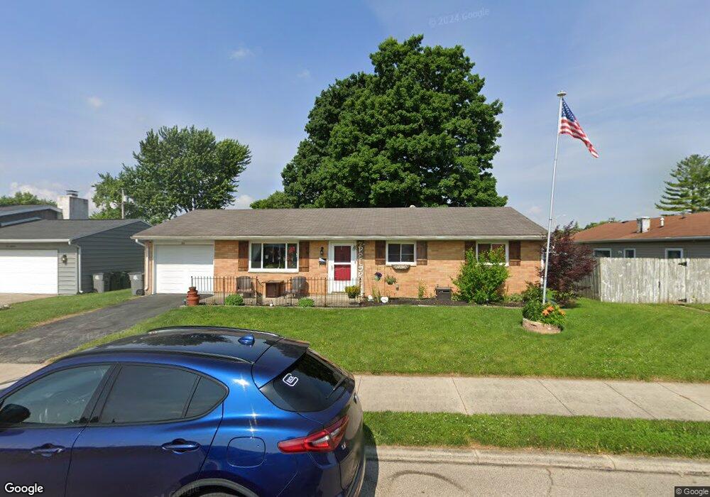
This home is located at 632 Locust Ln, Troy, OH 45373 and is currently estimated at $188,556, approximately $174 per square foot. 632 Locust Ln is a home located in Miami County with nearby schools including Cookson Elementary School, Troy Junior High School, and Van Cleve Elementary School.
Ownership History
Date
Name
Owned For
Owner Type
Purchase Details
Closed on
Nov 19, 2012
Sold by
Gibboney Daniel Lee
Bought by
House Samantha J
Current Estimated Value
Home Financials for this Owner
Home Financials are based on the most recent Mortgage that was taken out on this home.
Original Mortgage
$74,623
Outstanding Balance
$51,517
Interest Rate
3.37%
Mortgage Type
FHA
Estimated Equity
$137,039
Purchase Details
Closed on
Jul 27, 2005
Sold by
Welch Steve M and Welch Barbara J
Bought by
Gibboney Shirley A
Purchase Details
Closed on
Oct 14, 2004
Sold by
Davis David A
Bought by
Welch Steve M and Welch Barbara J
Home Financials for this Owner
Home Financials are based on the most recent Mortgage that was taken out on this home.
Original Mortgage
$62,550
Interest Rate
5.89%
Mortgage Type
New Conventional
Purchase Details
Closed on
Apr 1, 1986
Bought by
Davis David A
Create a Home Valuation Report for This Property
The Home Valuation Report is an in-depth analysis detailing your home's value as well as a comparison with similar homes in the area
Home Values in the Area
Average Home Value in this Area
Purchase History
| Date | Buyer | Sale Price | Title Company |
|---|---|---|---|
| House Samantha J | $76,000 | None Available | |
| Gibboney Shirley A | $101,900 | -- | |
| Welch Steve M | $69,500 | -- | |
| Davis David A | $42,900 | -- |
Source: Public Records
Mortgage History
| Date | Status | Borrower | Loan Amount |
|---|---|---|---|
| Open | House Samantha J | $74,623 | |
| Previous Owner | Welch Steve M | $62,550 |
Source: Public Records
Tax History
| Year | Tax Paid | Tax Assessment Tax Assessment Total Assessment is a certain percentage of the fair market value that is determined by local assessors to be the total taxable value of land and additions on the property. | Land | Improvement |
|---|---|---|---|---|
| 2024 | $1,664 | $42,530 | $12,320 | $30,210 |
| 2023 | $1,640 | $42,530 | $12,320 | $30,210 |
| 2022 | $1,354 | $42,530 | $12,320 | $30,210 |
| 2021 | $1,100 | $32,730 | $9,490 | $23,240 |
| 2020 | $1,102 | $32,730 | $9,490 | $23,240 |
| 2019 | $1,111 | $32,730 | $9,490 | $23,240 |
| 2018 | $1,021 | $28,880 | $9,450 | $19,430 |
| 2017 | $1,031 | $28,880 | $9,450 | $19,430 |
| 2016 | $1,015 | $28,880 | $9,450 | $19,430 |
| 2015 | $982 | $26,740 | $8,750 | $17,990 |
| 2014 | $982 | $26,740 | $8,750 | $17,990 |
| 2013 | $988 | $26,740 | $8,750 | $17,990 |
Source: Public Records
Map
Nearby Homes
- 1063 Linwood Dr
- 491 Mayfield Square E
- 555 Miami St
- 1075 Crestview Dr
- 1008 Plymouth Ct
- 1117 Scenic Ct
- 1142 Lee Rd
- 1597 Old Staunton Rd
- 506 Michigan Ave
- 1206 Heritage Dr
- 1057 Stonyridge Ave
- 708 N Market St
- 1210 Charleston Ct
- 598 N Market St
- 1329 Lee Rd
- 1334 Skylark Dr
- 1257 Gettysburg Dr
- 607 W Bentley Cir
- 619 E Canal St
- 1424 Michael Dr
- 618 Locust Ln
- 920 Linwood Dr
- 631 Maplecrest Dr
- 617 Maplecrest Dr
- 908 Linwood Dr
- 604 Locust Ln
- 631 Locust Ln
- 617 Locust Ln
- 944 Linwood Dr
- 603 Maplecrest Dr
- 598 Locust Ln
- 917 Linwood Dr
- 603 Locust Ln
- 927 Linwood Dr
- 909 Linwood Dr
- 597 Maplecrest Dr
- 937 Linwood Dr
- 597 Locust Ln
- 632 Forrest Ln
- 592 Locust Ln
Your Personal Tour Guide
Ask me questions while you tour the home.