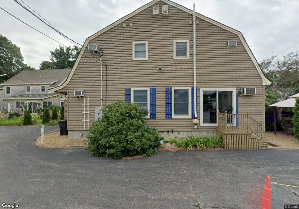
632 Main St Ogunquit, ME 03907
Ogunquit NeighborhoodEstimated Value: $834,000 - $1,718,000
4
Beds
3
Baths
2,640
Sq Ft
$452/Sq Ft
Est. Value
About This Home
This home is located at 632 Main St, Ogunquit, ME 03907 and is currently estimated at $1,194,488, approximately $452 per square foot. 632 Main St is a home located in York County with nearby schools including Wells Junior High School, Wells Elementary School, and Wells High School.
Ownership History
Date
Name
Owned For
Owner Type
Purchase Details
Closed on
Jun 30, 2015
Sold by
Rush Robert G
Bought by
Hsbc Bank Usa Na Tr
Current Estimated Value
Purchase Details
Closed on
May 15, 2006
Sold by
Distant Sands Llc
Bought by
Rush Robert G
Home Financials for this Owner
Home Financials are based on the most recent Mortgage that was taken out on this home.
Original Mortgage
$640,800
Interest Rate
7%
Mortgage Type
Commercial
Create a Home Valuation Report for This Property
The Home Valuation Report is an in-depth analysis detailing your home's value as well as a comparison with similar homes in the area
Home Values in the Area
Average Home Value in this Area
Purchase History
| Date | Buyer | Sale Price | Title Company |
|---|---|---|---|
| Hsbc Bank Usa Na Tr | -- | -- | |
| Rush Robert G | -- | -- |
Source: Public Records
Mortgage History
| Date | Status | Borrower | Loan Amount |
|---|---|---|---|
| Previous Owner | Rush Robert G | $640,800 |
Source: Public Records
Tax History
| Year | Tax Paid | Tax Assessment Tax Assessment Total Assessment is a certain percentage of the fair market value that is determined by local assessors to be the total taxable value of land and additions on the property. | Land | Improvement |
|---|---|---|---|---|
| 2024 | $5,844 | $904,700 | $75,000 | $829,700 |
| 2023 | $5,844 | $904,700 | $75,000 | $829,700 |
| 2022 | $5,718 | $904,700 | $75,000 | $829,700 |
| 2021 | $6,061 | $744,600 | $67,400 | $677,200 |
| 2020 | $5,957 | $744,600 | $67,400 | $677,200 |
| 2019 | $5,957 | $744,600 | $67,400 | $677,200 |
| 2018 | $3,748 | $473,800 | $67,400 | $406,400 |
| 2017 | $2,577 | $340,000 | $67,400 | $272,600 |
| 2016 | $6,821 | $843,200 | $67,400 | $775,800 |
| 2015 | $6,805 | $843,200 | $67,400 | $775,800 |
| 2014 | $6,543 | $843,200 | $67,400 | $775,800 |
Source: Public Records
Map
Nearby Homes
- 488 Main St Unit 7
- 31 Rebecca Rd
- 22 Adams Ln
- 76 Post Rd Unit 21M
- 14 Valleybrook Rd Unit 14
- 9 Bourne Ave Unit B6
- 191 Tatnic Rd Unit 73
- 25 Shore Rd Unit A
- 20 Shore Rd Unit 2A,B,C,D
- 168 Ocean Ave
- 1 Old County Rd Unit 165
- 1 Old County Rd Unit 155
- 69 Cottage St
- 47 Village Green Dr
- 14 Maple St
- 200 Shore Rd
- 55 Israel Head Rd Unit 203
- 33 Rocky Ln
- 412 Post Rd Unit 304
- 412 Post Rd Unit 145
- 632 Main St Unit 4
- 622 Main St
- 644 Main St
- 644 Main St Unit 1
- Lot 2 Captian Thomas
- 00 Captain Thomas
- Lot 2 Captain Thomas Rd
- Lot #2 Captain Thomas Rd
- 20 Riverbank Rd
- 20 Riverbank Rd Unit 3
- 20 Riverbank Rd Unit 1
- 646 Main St
- 646 Main St Unit 1
- 646 Main St Unit 2
- 24 Riverbank Rd
- 6 Riverbank Rd
- 168 Ocean St Unit 10
- 168 Ocean St Unit 9
- 168 Ocean St Unit 8
- 168 Ocean St Unit 7
Your Personal Tour Guide
Ask me questions while you tour the home.