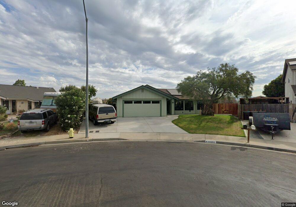
632 Maple Ct Santa Maria, CA 93454
Santa Maria East NeighborhoodEstimated Value: $683,830 - $792,000
3
Beds
2
Baths
1,600
Sq Ft
$455/Sq Ft
Est. Value
About This Home
This home is located at 632 Maple Ct, Santa Maria, CA 93454 and is currently estimated at $727,458, approximately $454 per square foot. 632 Maple Ct is a home located in Santa Barbara County with nearby schools including Washington Battles Elementary School, Fesler (Isaac) Junior High School, and Santa Maria High School.
Ownership History
Date
Name
Owned For
Owner Type
Purchase Details
Closed on
May 23, 2024
Sold by
Allison Scott L and Lewis-Allison Michelle
Bought by
Scott Allison And Michelle Lewis-Allison Revo and Allison
Current Estimated Value
Purchase Details
Closed on
Oct 29, 1997
Sold by
Lasseter James A
Bought by
Allison Scott L and Lewis Allison Michelle
Home Financials for this Owner
Home Financials are based on the most recent Mortgage that was taken out on this home.
Original Mortgage
$134,400
Interest Rate
7.19%
Create a Home Valuation Report for This Property
The Home Valuation Report is an in-depth analysis detailing your home's value as well as a comparison with similar homes in the area
Home Values in the Area
Average Home Value in this Area
Purchase History
| Date | Buyer | Sale Price | Title Company |
|---|---|---|---|
| Scott Allison And Michelle Lewis-Allison Revo | -- | None Listed On Document | |
| Allison Scott L | $168,000 | Chicago Title Co |
Source: Public Records
Mortgage History
| Date | Status | Borrower | Loan Amount |
|---|---|---|---|
| Previous Owner | Allison Scott L | $134,400 |
Source: Public Records
Tax History
| Year | Tax Paid | Tax Assessment Tax Assessment Total Assessment is a certain percentage of the fair market value that is determined by local assessors to be the total taxable value of land and additions on the property. | Land | Improvement |
|---|---|---|---|---|
| 2025 | $2,974 | $268,227 | $103,774 | $164,453 |
| 2023 | $2,974 | $257,814 | $99,746 | $158,068 |
| 2022 | $2,863 | $252,760 | $97,791 | $154,969 |
| 2021 | $2,780 | $247,805 | $95,874 | $151,931 |
| 2020 | $2,774 | $245,265 | $94,891 | $150,374 |
| 2019 | $2,739 | $240,457 | $93,031 | $147,426 |
| 2018 | $2,701 | $235,743 | $91,207 | $144,536 |
| 2017 | $2,667 | $231,121 | $89,419 | $141,702 |
| 2016 | $2,553 | $226,590 | $87,666 | $138,924 |
| 2014 | $2,398 | $218,817 | $84,659 | $134,158 |
Source: Public Records
Map
Nearby Homes
- 1865 Sequoia Dr
- 1825 Olive Dr
- 321 Inger Dr Unit D19
- 400 Mariott Rd
- 1981 Olive Dr
- 1920 S Mcclelland St Unit 33
- 1434 Swallow Ct
- 420 Calle Bonita
- 3920 Highway 101
- 2216 San Telmo
- 1900 S Lincoln St Unit F2
- 2228 Cordoban Ln
- 311 Lolita Ln Unit L
- 2335 El Mirlo
- 1838 Gable Ln
- 1701 S Thornburg St Unit 122
- 1701 S Thornburg St Unit 40
- 1701 S Thornburg St Unit 33
- 1701 S Thornburg St
- 1701 S Thornburg St Unit 150
Your Personal Tour Guide
Ask me questions while you tour the home.