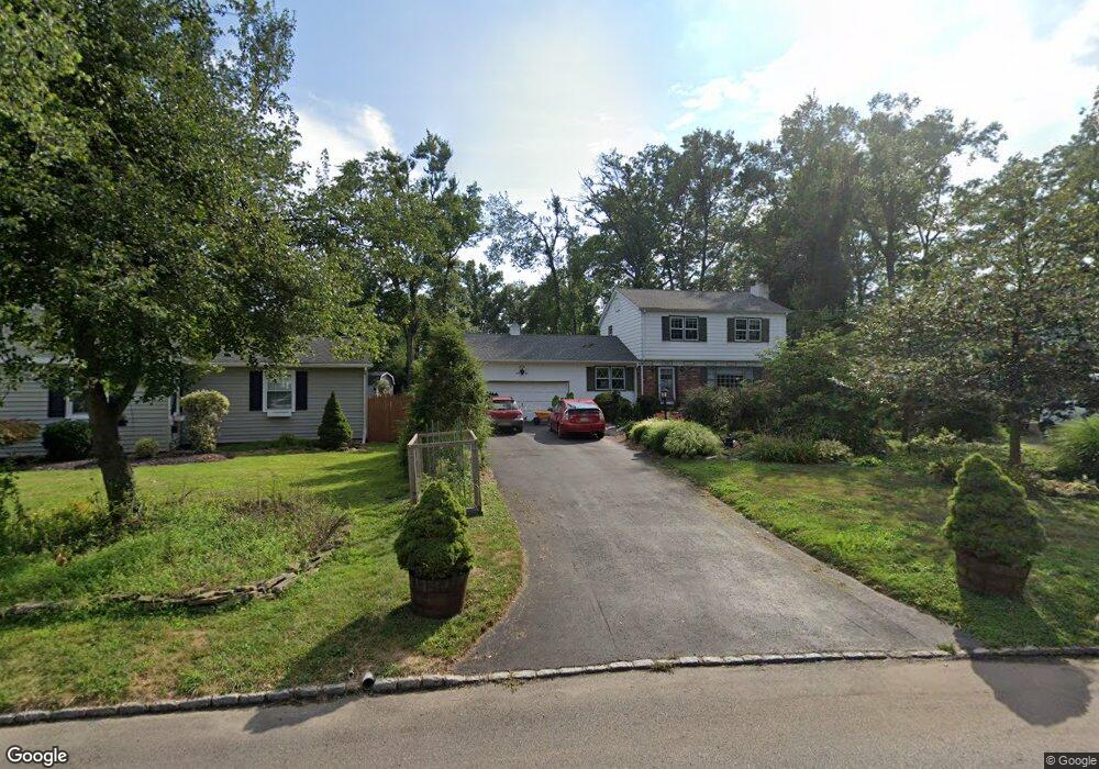
632 Metape Cir W Bound Brook, NJ 08805
Estimated Value: $561,000 - $609,000
--
Bed
--
Bath
1,720
Sq Ft
$339/Sq Ft
Est. Value
About This Home
This home is located at 632 Metape Cir W, Bound Brook, NJ 08805 and is currently estimated at $582,274, approximately $338 per square foot. 632 Metape Cir W is a home located in Somerset County with nearby schools including LaMonte Annex Elementary School, Lafayette Elementary School, and Bound Brook High School.
Ownership History
Date
Name
Owned For
Owner Type
Purchase Details
Closed on
Feb 1, 1994
Sold by
Herila Mary
Bought by
Senior Ken
Current Estimated Value
Home Financials for this Owner
Home Financials are based on the most recent Mortgage that was taken out on this home.
Original Mortgage
$200,000
Interest Rate
7.01%
Purchase Details
Closed on
Apr 20, 1989
Sold by
Stryker Douglas G and Stryker Susan J
Bought by
Herila William J and Herila Mary T
Create a Home Valuation Report for This Property
The Home Valuation Report is an in-depth analysis detailing your home's value as well as a comparison with similar homes in the area
Home Values in the Area
Average Home Value in this Area
Purchase History
| Date | Buyer | Sale Price | Title Company |
|---|---|---|---|
| Senior Ken | $230,500 | -- | |
| Herila William J | $232,500 | -- |
Source: Public Records
Mortgage History
| Date | Status | Borrower | Loan Amount |
|---|---|---|---|
| Closed | Senior Ken | $200,000 |
Source: Public Records
Tax History Compared to Growth
Tax History
| Year | Tax Paid | Tax Assessment Tax Assessment Total Assessment is a certain percentage of the fair market value that is determined by local assessors to be the total taxable value of land and additions on the property. | Land | Improvement |
|---|---|---|---|---|
| 2025 | $11,279 | $524,100 | $234,200 | $289,900 |
| 2024 | $11,279 | $497,100 | $215,200 | $281,900 |
| 2023 | $10,894 | $462,000 | $186,700 | $275,300 |
| 2022 | $9,641 | $392,400 | $162,900 | $229,500 |
| 2021 | $9,802 | $342,600 | $139,200 | $203,400 |
| 2020 | $9,641 | $312,300 | $124,900 | $187,400 |
| 2019 | $9,802 | $302,800 | $115,400 | $187,400 |
| 2018 | $9,889 | $296,600 | $105,900 | $190,700 |
| 2017 | $9,595 | $281,300 | $105,900 | $175,400 |
| 2016 | $10,192 | $301,000 | $96,400 | $204,600 |
| 2015 | $9,499 | $286,900 | $105,900 | $181,000 |
| 2014 | $8,745 | $255,100 | $74,100 | $181,000 |
Source: Public Records
Map
Nearby Homes
- 563 Winsor St
- 606 Vosseller Ave
- 617 Vosseller Ave
- 520 Winsor St
- 143 Vosseller Ave
- 307 W Union Ave
- 517 Vosseller Ave
- 650 Central Ave
- 745 Schoolhouse Ln
- 180 Farm Ln
- 102 W Franklin St
- 1740 Middlebrook Rd
- 14 E Maple Ave
- 601 Thompson Ave
- 130 W High St Unit 132
- 126 W High St
- 320 Church St
- 581 Mountain Ave
- 597 Mountain Ave
- 112 E Union Ave
- 292 Metape Cir S
- 287 Chestnut St
- 291 Chestnut St
- 285 Chestnut St
- 640 Metape Cir W
- 295 Chestnut St
- 283 Chestnut St
- 286 Metape Cir S
- 633 Metape Cir W
- 16 Hayward St
- 18 Hayward St
- 18 Hayward St
- 281 Chestnut St
- 644 Metape Cir W
- 14 Hayward St
- 289 Metape Cir S
- 20 Hayward St
- 279 Chestnut St
- 565 Kensington Dr
- 12 Hayward St