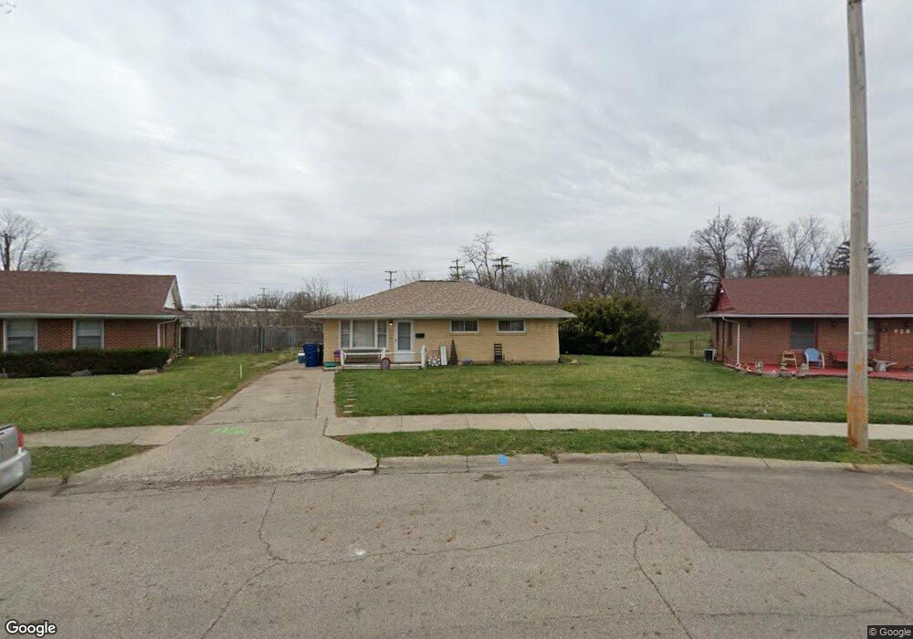
632 Portage Path Springfield, OH 45506
Estimated Value: $107,337 - $124,000
3
Beds
1
Bath
1,008
Sq Ft
$115/Sq Ft
Est. Value
About This Home
This home is located at 632 Portage Path, Springfield, OH 45506 and is currently estimated at $116,084, approximately $115 per square foot. 632 Portage Path is a home located in Clark County with nearby schools including Perrin Woods Elementary School, Hayward Middle School, and Springfield High School.
Ownership History
Date
Name
Owned For
Owner Type
Purchase Details
Closed on
Aug 29, 1997
Sold by
Frost Jeffery T
Bought by
Chaffin Carl W and Chaffin Kimberly
Current Estimated Value
Home Financials for this Owner
Home Financials are based on the most recent Mortgage that was taken out on this home.
Original Mortgage
$50,051
Outstanding Balance
$6,910
Interest Rate
7.57%
Mortgage Type
FHA
Estimated Equity
$109,174
Purchase Details
Closed on
Jun 12, 1996
Sold by
Arthur David A
Bought by
Frost Jeffery T and Frost Tonya
Home Financials for this Owner
Home Financials are based on the most recent Mortgage that was taken out on this home.
Original Mortgage
$40,500
Interest Rate
8.05%
Mortgage Type
New Conventional
Create a Home Valuation Report for This Property
The Home Valuation Report is an in-depth analysis detailing your home's value as well as a comparison with similar homes in the area
Home Values in the Area
Average Home Value in this Area
Purchase History
| Date | Buyer | Sale Price | Title Company |
|---|---|---|---|
| Chaffin Carl W | $50,000 | -- | |
| Frost Jeffery T | $31,000 | -- |
Source: Public Records
Mortgage History
| Date | Status | Borrower | Loan Amount |
|---|---|---|---|
| Open | Chaffin Carl W | $50,051 | |
| Previous Owner | Frost Jeffery T | $40,500 |
Source: Public Records
Tax History
| Year | Tax Paid | Tax Assessment Tax Assessment Total Assessment is a certain percentage of the fair market value that is determined by local assessors to be the total taxable value of land and additions on the property. | Land | Improvement |
|---|---|---|---|---|
| 2025 | $1,009 | $30,250 | $5,640 | $24,610 |
| 2024 | $983 | $20,350 | $4,270 | $16,080 |
| 2023 | $983 | $20,350 | $4,270 | $16,080 |
| 2022 | $1,007 | $20,350 | $4,270 | $16,080 |
| 2021 | $846 | $15,820 | $3,420 | $12,400 |
| 2020 | $848 | $15,820 | $3,420 | $12,400 |
| 2019 | $850 | $15,820 | $3,420 | $12,400 |
| 2018 | $581 | $10,390 | $3,020 | $7,370 |
| 2017 | $581 | $14,701 | $3,021 | $11,680 |
| 2016 | $581 | $14,701 | $3,021 | $11,680 |
| 2015 | $730 | $14,701 | $3,021 | $11,680 |
| 2014 | $727 | $14,701 | $3,021 | $11,680 |
| 2013 | $719 | $14,701 | $3,021 | $11,680 |
Source: Public Records
Map
Nearby Homes
- 550 W Parkwood Ave
- 518 Hazelbrook Ave
- 1730 Damascus Ave
- 506 W Southern Ave
- 405 W Southern Ave
- 1002 S Yellow Springs St
- 802 Innisfallen Ave
- 2000 Springmont Ave
- 1920 Russell Ave
- 311 W Grand Ave
- 326 W Grand Ave
- 929 S Western Ave
- 1619 S Center Blvd
- 410 W Liberty St
- 830 Dibert Ave
- 2140 Shawnee Ave
- 209 W Liberty St
- 1355 S Fountain Ave
- 0 W Perrin Ave Unit 1043508
- 0 W Perrin Ave Unit 951292
- 628 Portage Path
- 1603 Portage Path
- 1611 Portage Path
- 620 Portage Path
- 621 W Parkwood Ave
- 623 Portage Path
- 1555 Noel Dr
- 1617 Portage Path
- 616 Portage Path
- 615 W Parkwood Ave
- 615 Portage Path
- 1612 Portage Path
- 1623 Portage Path
- 610 Portage Path
- 609 Portage Path
- 611 W Parkwood Ave
- 1549 Noel Dr
- 612 Mead Ln
- 1629 Portage Path
- 602 Portage Path
Your Personal Tour Guide
Ask me questions while you tour the home.