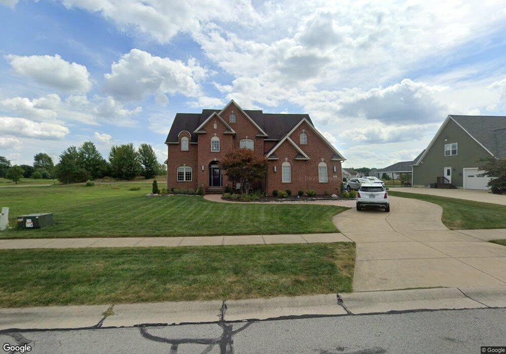
632 U s Grant St Lagrange, OH 44050
Estimated Value: $423,094 - $569,000
4
Beds
4
Baths
3,186
Sq Ft
$154/Sq Ft
Est. Value
About This Home
This home is located at 632 U s Grant St, Lagrange, OH 44050 and is currently estimated at $490,024, approximately $153 per square foot. 632 U s Grant St is a home located in Lorain County with nearby schools including Keystone Elementary School, Keystone Middle School, and Keystone High School.
Ownership History
Date
Name
Owned For
Owner Type
Purchase Details
Closed on
Oct 28, 2025
Sold by
Benko Nicholas Jason and Gonzalez Elena Louise
Bought by
Karnavas Painting Inc
Current Estimated Value
Purchase Details
Closed on
Mar 21, 2005
Sold by
Durham Ridge Investments Llc
Bought by
Karnavas Painting Inc
Home Financials for this Owner
Home Financials are based on the most recent Mortgage that was taken out on this home.
Original Mortgage
$293,580
Interest Rate
5.64%
Mortgage Type
Purchase Money Mortgage
Create a Home Valuation Report for This Property
The Home Valuation Report is an in-depth analysis detailing your home's value as well as a comparison with similar homes in the area
Home Values in the Area
Average Home Value in this Area
Purchase History
| Date | Buyer | Sale Price | Title Company |
|---|---|---|---|
| Karnavas Painting Inc | -- | Ohio Real Title | |
| Karnavas Painting Inc | $342,500 | Revere Title Agency Inc |
Source: Public Records
Mortgage History
| Date | Status | Borrower | Loan Amount |
|---|---|---|---|
| Previous Owner | Karnavas Painting Inc | $293,580 |
Source: Public Records
Tax History
| Year | Tax Paid | Tax Assessment Tax Assessment Total Assessment is a certain percentage of the fair market value that is determined by local assessors to be the total taxable value of land and additions on the property. | Land | Improvement |
|---|---|---|---|---|
| 2024 | $6,798 | $157,346 | $26,250 | $131,096 |
| 2023 | $5,482 | $105,945 | $17,217 | $88,729 |
| 2022 | $5,447 | $105,945 | $17,217 | $88,729 |
| 2021 | $5,449 | $105,945 | $17,217 | $88,729 |
| 2020 | $5,593 | $96,930 | $15,750 | $81,180 |
| 2019 | $5,562 | $96,930 | $15,750 | $81,180 |
| 2018 | $5,754 | $96,930 | $15,750 | $81,180 |
| 2017 | $6,125 | $103,240 | $12,300 | $90,940 |
| 2016 | $6,088 | $103,240 | $12,300 | $90,940 |
| 2015 | $6,080 | $103,240 | $12,300 | $90,940 |
| 2014 | $5,668 | $108,670 | $12,950 | $95,720 |
| 2013 | $5,504 | $108,670 | $12,950 | $95,720 |
Source: Public Records
Map
Nearby Homes
- 801 Willich Ct
- 800 Buckingham Dr
- 808 Buckingham Dr
- 829 Robinson Dr
- 607 Rundle St
- 548 William St
- 340 Granger Dr
- 516 Appomattox Ct
- 0 Dill Ct Unit 5072837
- 110 Railroad St
- 305 W Main St
- 40260 Whitney Rd
- 40175 Banks Rd
- 40163 Banks Rd
- 1033 Parsons Rd Unit 11
- 697 Main St
- 551 N Main St
- 779 Huron St
- 37352 Grafton Rd
- Alberti Ranch w/ Finished Basement Plan at Fox Run
- 636 U s Grant St
- 630 Us Grant St
- 628 U s Grant St
- 640 U s Grant St
- 629 U s Grant St
- 629 Us Grant St
- 633 U s Grant St
- 633 U s Grant St Unit Lot 1
- 625 U s Grant St
- 637 U s Grant St
- 637 U s Grant St Unit Lot 1
- 645 U s Grant St
- 625 Us Grant St
- 641 U s Grant St
- 621 U s Grant St
- 616 U s Grant St
- 621 Us Grant St
- 649 U s Grant St
- 649 Us Grant St
- 617 Us Grant St
Your Personal Tour Guide
Ask me questions while you tour the home.