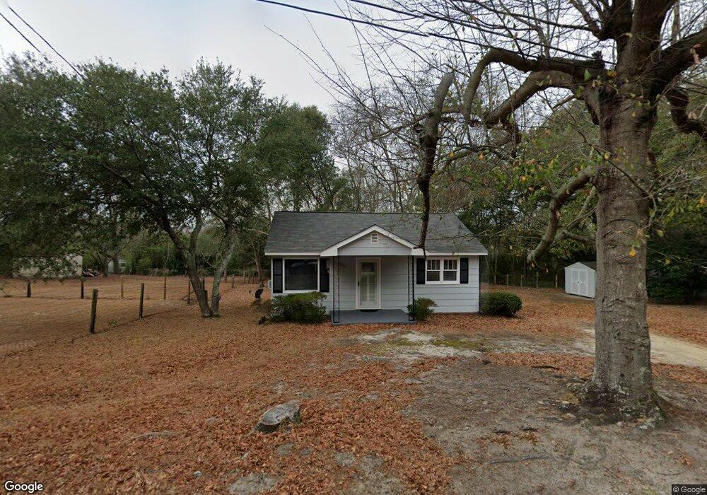
632 Westside Dr West Columbia, SC 29169
Estimated Value: $68,000 - $114,000
2
Beds
1
Bath
720
Sq Ft
$123/Sq Ft
Est. Value
About This Home
This home is located at 632 Westside Dr, West Columbia, SC 29169 and is currently estimated at $88,331, approximately $122 per square foot. 632 Westside Dr is a home located in Lexington County with nearby schools including Cayce Elementary, Cyril B. Busbee Creative Arts Academy, and Brookland-Cayce High School.
Ownership History
Date
Name
Owned For
Owner Type
Purchase Details
Closed on
Jun 20, 2012
Sold by
Estate Of Annie Hazel Baughman and Best Jamie M
Bought by
Overstreet Scott
Current Estimated Value
Home Financials for this Owner
Home Financials are based on the most recent Mortgage that was taken out on this home.
Original Mortgage
$36,000
Outstanding Balance
$5,114
Interest Rate
3.11%
Mortgage Type
Purchase Money Mortgage
Estimated Equity
$83,217
Create a Home Valuation Report for This Property
The Home Valuation Report is an in-depth analysis detailing your home's value as well as a comparison with similar homes in the area
Home Values in the Area
Average Home Value in this Area
Purchase History
| Date | Buyer | Sale Price | Title Company |
|---|---|---|---|
| Overstreet Scott | $36,000 | -- |
Source: Public Records
Mortgage History
| Date | Status | Borrower | Loan Amount |
|---|---|---|---|
| Open | Overstreet Scott | $36,000 |
Source: Public Records
Tax History Compared to Growth
Tax History
| Year | Tax Paid | Tax Assessment Tax Assessment Total Assessment is a certain percentage of the fair market value that is determined by local assessors to be the total taxable value of land and additions on the property. | Land | Improvement |
|---|---|---|---|---|
| 2024 | $380 | $1,789 | $640 | $1,149 |
| 2023 | $342 | $1,789 | $640 | $1,149 |
| 2022 | $345 | $1,789 | $640 | $1,149 |
| 2020 | $332 | $1,789 | $640 | $1,149 |
| 2019 | $358 | $1,886 | $640 | $1,246 |
| 2018 | $361 | $1,886 | $640 | $1,246 |
| 2017 | $347 | $1,886 | $640 | $1,246 |
| 2016 | $357 | $1,885 | $640 | $1,245 |
| 2014 | $324 | $2,262 | $720 | $1,542 |
| 2013 | -- | $2,260 | $720 | $1,540 |
Source: Public Records
Map
Nearby Homes
- 706 Westside Dr
- 2312 Rainbow Dr
- 725 Brooks Ave
- 2405 Rainbow Dr
- 309 Hammond Ave
- 2024 Platt Springs Rd
- 135 Silver Run Place
- 116 Silver Run Place
- 212 Alexandria St
- 826 Jefferson St
- 153 Cavendish Dr
- 151 Cavendish Dr
- 157 Cavendish Dr
- 339 Gum Swamp Trail
- 349 Gum Swamp Trail
- 1802 D Ave
- 1210 Decatur St
- TBD Woodfield Jupiter & Daisey Track
- Oak Plan at Faith Hills
- 1608 Crapps Ave
- 638 Westside Dr
- 628 Westside Dr
- 633 Westside Dr
- 640 Westside Dr
- 701 Shirley St
- 629 Westside Dr
- 626 Westside Dr
- 625 Westside Dr
- 705 Shirley St
- 635 Brooks Ave
- 637 Brooks Ave
- 646 Westside Dr
- 625 Brooks Ave
- 617 Westside Dr
- 639 Brooks Ave
- 618 Westside Dr
- 706 Shirley St
- 650 Westside Dr
- 621 Brooks Ave
- 615 Westside Dr