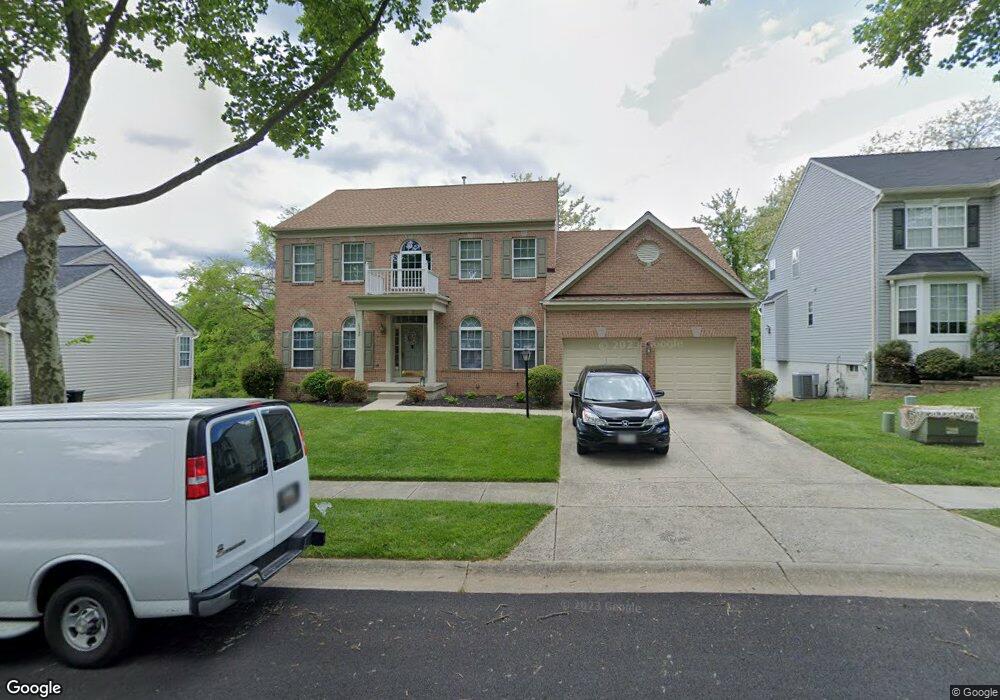
6320 Burnt Mountain Path Columbia, MD 21045
Long Reach NeighborhoodEstimated Value: $746,000 - $839,000
5
Beds
4
Baths
2,960
Sq Ft
$273/Sq Ft
Est. Value
About This Home
This home is located at 6320 Burnt Mountain Path, Columbia, MD 21045 and is currently estimated at $807,677, approximately $272 per square foot. 6320 Burnt Mountain Path is a home located in Howard County with nearby schools including Jeffers Hill Elementary School, Mayfield Woods Middle School, and Long Reach High School.
Ownership History
Date
Name
Owned For
Owner Type
Purchase Details
Closed on
Sep 28, 2005
Sold by
Cadogan Michael A
Bought by
Dunston Andre B and Dunston Kara
Current Estimated Value
Home Financials for this Owner
Home Financials are based on the most recent Mortgage that was taken out on this home.
Original Mortgage
$528,000
Outstanding Balance
$268,947
Interest Rate
5%
Mortgage Type
Adjustable Rate Mortgage/ARM
Estimated Equity
$538,730
Purchase Details
Closed on
May 11, 1998
Sold by
Ryland Group Inc The
Bought by
Cadogan Michael A and Cadogan Donna A
Create a Home Valuation Report for This Property
The Home Valuation Report is an in-depth analysis detailing your home's value as well as a comparison with similar homes in the area
Home Values in the Area
Average Home Value in this Area
Purchase History
| Date | Buyer | Sale Price | Title Company |
|---|---|---|---|
| Dunston Andre B | $660,000 | -- | |
| Cadogan Michael A | $280,450 | -- |
Source: Public Records
Mortgage History
| Date | Status | Borrower | Loan Amount |
|---|---|---|---|
| Open | Dunston Andre B | $528,000 | |
| Closed | Dunston Andre B | $99,000 | |
| Closed | Cadogan Michael A | -- |
Source: Public Records
Tax History Compared to Growth
Tax History
| Year | Tax Paid | Tax Assessment Tax Assessment Total Assessment is a certain percentage of the fair market value that is determined by local assessors to be the total taxable value of land and additions on the property. | Land | Improvement |
|---|---|---|---|---|
| 2025 | $9,568 | $695,600 | $0 | $0 |
| 2024 | $9,568 | $641,500 | $0 | $0 |
| 2023 | $9,003 | $587,400 | $182,500 | $404,900 |
| 2022 | $8,798 | $575,900 | $0 | $0 |
| 2021 | $8,467 | $564,400 | $0 | $0 |
| 2020 | $8,467 | $552,900 | $197,500 | $355,400 |
| 2019 | $8,341 | $544,133 | $0 | $0 |
| 2018 | $7,821 | $535,367 | $0 | $0 |
| 2017 | $7,634 | $526,600 | $0 | $0 |
| 2016 | $1,575 | $501,733 | $0 | $0 |
| 2015 | $1,575 | $476,867 | $0 | $0 |
| 2014 | $1,537 | $452,000 | $0 | $0 |
Source: Public Records
Map
Nearby Homes
- 6372 Wind Rider Way
- 6101 Silver Arrows Way
- 8740 Endless Ocean Way
- 8736 Endless Ocean Way
- 8790 Sage Brush Way
- 8656 Vast Rose Dr
- 6137 Quiet Times
- 6226 Deep Earth Ln
- 6125 Honeycomb Gate
- 8879 Warm Granite Dr
- 8820 Shining Oceans Way Unit 410
- 8861 Shining Oceans Way
- 6141 Golden Bell Way
- 5941 Millrace Ct Unit D101
- 6118 Starburn Path
- 5951 Millrace Ct Unit C104
- 8205 Tall Trees Ct
- 8106 Wooded Glen Ct
- 8587 Black Star Cir
- 8005 Hillrise Ct
- 6324 Burnt Mountain Path
- 6316 Burnt Mountain Path
- 6328 Burnt Mountain Path
- 6301 Canyon Head Ln
- 6312 Burnt Mountain Path
- 6300 Canyon Head Ln
- 6332 Burnt Mountain Path
- 6308 Burnt Mountain Path
- 6313 Burnt Mountain Path
- 6305 Canyon Head Ln
- 6335 Burnt Mountain Path
- 8415 Glad Rivers Row
- 6304 Canyon Head Ln
- 8413 Glad Rivers Row
- 8411 Glad Rivers Row
- 8409 Glad Rivers Row
- 8421 Glad Rivers Row
- 8407 Glad Rivers Row
- 6336 Burnt Mountain Path
- 6317 April Brook Cir