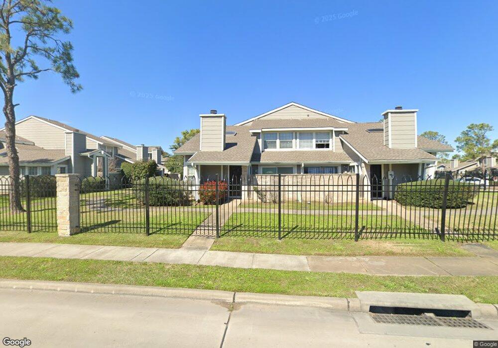
6320 W Airport Blvd Unit 632 Houston, TX 77035
Brays Oaks NeighborhoodEstimated Value: $127,000 - $213,000
3
Beds
2
Baths
1,244
Sq Ft
$123/Sq Ft
Est. Value
About This Home
This home is located at 6320 W Airport Blvd Unit 632, Houston, TX 77035 and is currently estimated at $153,377, approximately $123 per square foot. 6320 W Airport Blvd Unit 632 is a home located in Harris County with nearby schools including Anderson Elementary School, Fondren Middle School, and Westbury High School.
Ownership History
Date
Name
Owned For
Owner Type
Purchase Details
Closed on
Jan 3, 2001
Sold by
Hollis Annette
Bought by
Mills Bobbye
Current Estimated Value
Home Financials for this Owner
Home Financials are based on the most recent Mortgage that was taken out on this home.
Original Mortgage
$34,200
Outstanding Balance
$12,838
Interest Rate
7.78%
Estimated Equity
$140,539
Create a Home Valuation Report for This Property
The Home Valuation Report is an in-depth analysis detailing your home's value as well as a comparison with similar homes in the area
Home Values in the Area
Average Home Value in this Area
Purchase History
| Date | Buyer | Sale Price | Title Company |
|---|---|---|---|
| Mills Bobbye | -- | First American Title |
Source: Public Records
Mortgage History
| Date | Status | Borrower | Loan Amount |
|---|---|---|---|
| Open | Mills Bobbye | $34,200 |
Source: Public Records
Tax History Compared to Growth
Tax History
| Year | Tax Paid | Tax Assessment Tax Assessment Total Assessment is a certain percentage of the fair market value that is determined by local assessors to be the total taxable value of land and additions on the property. | Land | Improvement |
|---|---|---|---|---|
| 2025 | $2,620 | $134,287 | $31,935 | $102,352 |
| 2024 | $2,620 | $125,198 | $26,613 | $98,585 |
| 2023 | $2,620 | $118,045 | $21,290 | $96,755 |
| 2022 | $2,445 | $106,229 | $10,645 | $95,584 |
| 2021 | $1,912 | $82,028 | $10,645 | $71,383 |
| 2020 | $1,733 | $68,738 | $10,645 | $58,093 |
| 2019 | $1,716 | $65,239 | $5,056 | $60,183 |
| 2018 | $742 | $29,336 | $5,056 | $24,280 |
| 2017 | $1,381 | $52,537 | $5,056 | $47,481 |
| 2016 | $1,137 | $43,266 | $5,056 | $38,210 |
| 2015 | $803 | $43,266 | $5,056 | $38,210 |
| 2014 | $803 | $31,236 | $5,056 | $26,180 |
Source: Public Records
Map
Nearby Homes
- 12235 Lemon Ridge Ln Unit 122
- 6324 Shadow Tree Dr Unit 632
- 12227 Sandpiper Dr Unit 122
- 12225 Sandpiper Dr Unit 122
- 12123 Lemon Ridge Ln Unit 121
- 12111 Lemon Ridge Ln Unit 121
- 6317 Peacock Hills Dr
- 12232 Bob White Dr Unit 122
- 6383 Dryad Dr Unit 638
- 6305 Dryad Dr Unit 630
- 12102 Bob White Dr Unit 121
- 6202 W Airport Blvd
- 6172 W Airport Blvd
- 12380 Sandpiper Dr Unit 810
- 12380 Sandpiper Dr Unit 405
- 12033 Bob White Dr
- 12011 Bob White Dr
- 12019 Bob White Dr
- 6405 Dawnridge Dr
- 6128 Dryad Dr
- 6318 W Airport Blvd Unit 631
- 6333 Shadow Tree Dr
- 12250 Coppertree Ln
- 6331 Shadow Tree Dr
- 6335 Shadow Tree Dr
- 12248 Coppertree Ln
- 6337 Shadow Tree Dr
- 6339 Shadow Tree Dr
- 6345 Shadow Tree Dr
- 6343 Shadow Tree Dr
- 6341 Shadow Tree Dr
- 12447 Copper Tree Pvt Ln
- 6328 Shadow Tree Dr Unit 632
- 6326 W Airport Blvd Unit 632
- 6326 W Airport Blvd
- 12247 Lemon Ridge Ln Unit 122
- 6326 Shadow Tree Dr Unit 632
- 12249 Lemon Ridge Ln Unit 122
- 12251 Lemon Ridge Ln Unit 122
- 12253 Lemon Ridge Ln Unit 122