A
Seller's Agent in 2025
Amanda Warner
The Swanzer Agency
(440) 865-5822
1 in this area
32 Total Sales
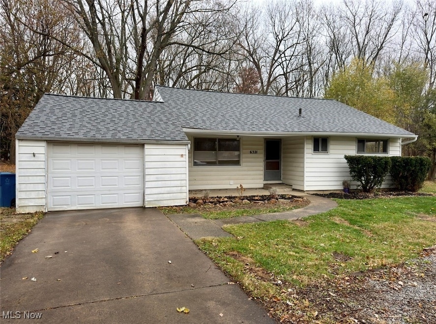
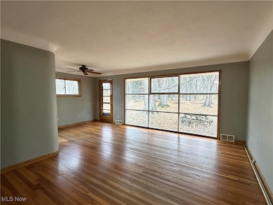
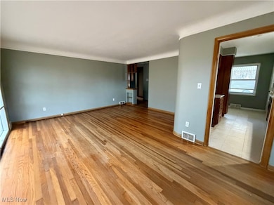
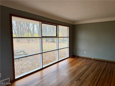
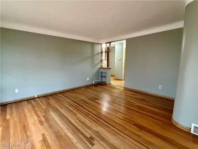
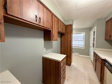
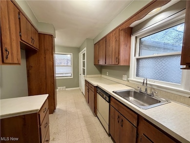
Welcome to 6321 Barton Road, a charming Cape Cod style home set on a generous 0.4 acre lot in North Olmsted. Inside, you'll find three comfortable bedrooms, a full bath, and hardwood floors that bring warmth and character throughout. This property is full of potential and ready for its new owner. Whether you're an investor looking for a promising project or a first-time buyer hoping to build equity, the opportunity awaits! This home also includes a one-car garage, and offers quick access to shopping, restaurants, parks, and major highways. Don't miss the chance to make this home yours!
Last Agent to Sell the Property
The Swanzer Agency Brokerage Email: amanda@swanzer.com, 440-865-5822 License #2021000047 Listed on: 11/21/2025
Co-Listed By
The Swanzer Agency Brokerage Email: amanda@swanzer.com, 440-865-5822 License #2002021311
| Date | Type | Sale Price | Title Company |
|---|---|---|---|
| Deed | $56,800 | -- | |
| Deed | -- | -- | |
| Deed | -- | -- | |
| Deed | -- | -- | |
| Deed | -- | -- |
| Date | Event | Price | List to Sale | Price per Sq Ft |
|---|---|---|---|---|
| 12/05/2025 12/05/25 | Sold | $155,000 | -3.1% | $148 / Sq Ft |
| 11/22/2025 11/22/25 | Pending | -- | -- | -- |
| 11/21/2025 11/21/25 | For Sale | $160,000 | -- | $153 / Sq Ft |
| Year | Tax Paid | Tax Assessment Tax Assessment Total Assessment is a certain percentage of the fair market value that is determined by local assessors to be the total taxable value of land and additions on the property. | Land | Improvement |
|---|---|---|---|---|
| 2024 | $4,336 | $63,280 | $7,630 | $55,650 |
| 2023 | $4,245 | $51,980 | $14,740 | $37,240 |
| 2022 | $4,223 | $51,980 | $14,740 | $37,240 |
| 2021 | $3,822 | $51,980 | $14,740 | $37,240 |
| 2020 | $3,507 | $42,250 | $11,970 | $30,280 |
| 2019 | $3,413 | $120,700 | $34,200 | $86,500 |
| 2018 | $3,331 | $42,250 | $11,970 | $30,280 |
| 2017 | $3,256 | $36,580 | $11,480 | $25,100 |
| 2016 | $3,227 | $36,580 | $11,480 | $25,100 |
| 2015 | $3,152 | $36,580 | $11,480 | $25,100 |
| 2014 | $3,152 | $35,530 | $11,130 | $24,400 |
A
Seller's Agent in 2025
Amanda Warner
The Swanzer Agency
(440) 865-5822
1 in this area
32 Total Sales
M
Seller Co-Listing Agent in 2025
Mark Wells
The Swanzer Agency
(440) 670-3890
2 in this area
23 Total Sales

Buyer's Agent in 2025
Husni Hasan
Howard Hanna
(234) 788-8948
1 in this area
62 Total Sales
Source: MLS Now
MLS Number: 5172970
APN: 234-15-014
Disclaimer: Certain information contained herein is derived from information provided by parties other than Homes.com. All information provided is deemed reliable, but is not guaranteed to be accurate and should be independently verified.
![]() IDX information is provided exclusively for personal, non-commercial use, and may not be used for any purpose other than to identify prospective properties consumers may be interested in purchasing. Information is deemed reliable but not guaranteed.
IDX information is provided exclusively for personal, non-commercial use, and may not be used for any purpose other than to identify prospective properties consumers may be interested in purchasing. Information is deemed reliable but not guaranteed.