Estimated Value: $274,000 - $308,000
3
Beds
2
Baths
1,114
Sq Ft
$265/Sq Ft
Est. Value
About This Home
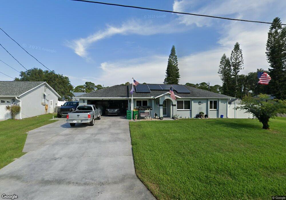
This home is located at 6321 Irving Rd, Cocoa, FL 32927 and is currently estimated at $294,713, approximately $264 per square foot. 6321 Irving Rd is a home located in Brevard County with nearby schools including Enterprise Elementary School, Space Coast Junior/Senior High School, and East Atlantic Prep of Brevard County.
Ownership History
Date
Name
Owned For
Owner Type
Purchase Details
Closed on
Mar 29, 2011
Sold by
Davis Mark V and Davis Kari L
Bought by
Davis Mark V
Current Estimated Value
Purchase Details
Closed on
Jul 20, 2007
Sold by
Renaud Danny Lee and Renaud Linda J
Bought by
Davis Mark V and Davis Kari L
Home Financials for this Owner
Home Financials are based on the most recent Mortgage that was taken out on this home.
Original Mortgage
$132,000
Interest Rate
6.71%
Create a Home Valuation Report for This Property
The Home Valuation Report is an in-depth analysis detailing your home's value as well as a comparison with similar homes in the area
Home Values in the Area
Average Home Value in this Area
Purchase History
| Date | Buyer | Sale Price | Title Company |
|---|---|---|---|
| Davis Mark V | -- | Attorney | |
| Davis Mark V | $165,000 | Landamerica Gulfatlantic Tit |
Source: Public Records
Mortgage History
| Date | Status | Borrower | Loan Amount |
|---|---|---|---|
| Previous Owner | Davis Mark V | $132,000 |
Source: Public Records
Tax History Compared to Growth
Tax History
| Year | Tax Paid | Tax Assessment Tax Assessment Total Assessment is a certain percentage of the fair market value that is determined by local assessors to be the total taxable value of land and additions on the property. | Land | Improvement |
|---|---|---|---|---|
| 2025 | $1,324 | $100,590 | -- | -- |
| 2024 | $1,289 | $97,760 | -- | -- |
| 2023 | $1,289 | $94,920 | $0 | $0 |
| 2022 | $1,199 | $92,160 | $0 | $0 |
| 2021 | $1,195 | $89,480 | $0 | $0 |
| 2020 | $1,144 | $88,250 | $0 | $0 |
| 2019 | $1,079 | $86,270 | $0 | $0 |
| 2018 | $1,072 | $84,670 | $0 | $0 |
| 2017 | $1,064 | $82,930 | $0 | $0 |
| 2016 | $1,063 | $81,230 | $18,000 | $63,230 |
| 2015 | $1,073 | $80,670 | $15,000 | $65,670 |
| 2014 | $1,072 | $80,030 | $11,000 | $69,030 |
Source: Public Records
Map
Nearby Homes
- 5460 Holden Rd
- 4650 N Highway 1 Hwy
- 5715 Fairbridge St
- 5446 Jamaica Rd
- 6309 Alleghany Ave
- 5575 Curtis Blvd
- 5940 Flamingo Ave
- 6017 Flamingo Ave
- 6581 Bancroft Ave
- 6003 Gilson
- 5997 Jenkins Ave
- 5275 Holden Rd
- 6615 Dock Ave
- 6643 Emil Ave
- 5220 Holden Rd
- 6365 Homestead Ave
- 5946 Deer Ln
- 23-35-21-JX-B-2 Aruin St
- 00 Unknown
- 5145 Fay Blvd
- 6333 Irving Rd Unit 4
- 6392 Hudson Rd
- 6396 Hudson Rd
- 5617 Banos Ave
- 5609 Banos Ave
- 6345 Irving Rd
- 6320 Irving Rd
- 6330 Irving Rd
- 5601 Banos Ave
- 5625 Banos Ave
- 6400 La Brea Ave
- 6351 Irving Rd
- 6408 Hudson Rd
- 5640 Banos Ave
- 6297 Deer Ln
- 6285 Deer Ln
- 6393 Hudson Rd
- 6389 Hudson Rd
- 6299 Deer Ln
- 6273 Deer Ln