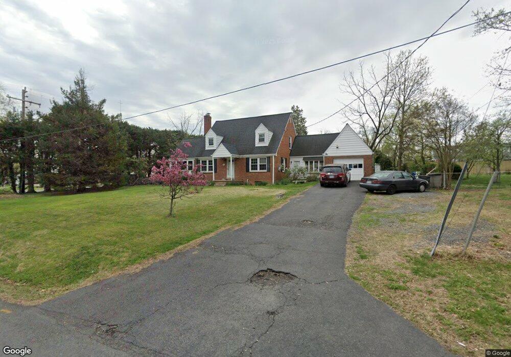
6321 Oak Ridge Dr Alexandria, VA 22312
Estimated Value: $676,000 - $798,000
3
Beds
3
Baths
1,440
Sq Ft
$513/Sq Ft
Est. Value
About This Home
This home is located at 6321 Oak Ridge Dr, Alexandria, VA 22312 and is currently estimated at $738,376, approximately $512 per square foot. 6321 Oak Ridge Dr is a home located in Fairfax County with nearby schools including Parklawn Elementary School, Glasgow Middle School, and Justice High School.
Ownership History
Date
Name
Owned For
Owner Type
Purchase Details
Closed on
Dec 10, 1998
Sold by
Decker Michael H
Bought by
Fisher Robert M
Current Estimated Value
Home Financials for this Owner
Home Financials are based on the most recent Mortgage that was taken out on this home.
Original Mortgage
$206,400
Outstanding Balance
$46,964
Interest Rate
6.8%
Estimated Equity
$691,412
Create a Home Valuation Report for This Property
The Home Valuation Report is an in-depth analysis detailing your home's value as well as a comparison with similar homes in the area
Home Values in the Area
Average Home Value in this Area
Purchase History
| Date | Buyer | Sale Price | Title Company |
|---|---|---|---|
| Fisher Robert M | $258,000 | -- |
Source: Public Records
Mortgage History
| Date | Status | Borrower | Loan Amount |
|---|---|---|---|
| Open | Fisher Robert M | $206,400 |
Source: Public Records
Tax History Compared to Growth
Tax History
| Year | Tax Paid | Tax Assessment Tax Assessment Total Assessment is a certain percentage of the fair market value that is determined by local assessors to be the total taxable value of land and additions on the property. | Land | Improvement |
|---|---|---|---|---|
| 2025 | $7,805 | $654,810 | $324,000 | $330,810 |
| 2024 | $7,805 | $615,700 | $294,000 | $321,700 |
| 2023 | $7,512 | $615,700 | $294,000 | $321,700 |
| 2022 | $7,004 | $565,000 | $269,000 | $296,000 |
| 2021 | $5,935 | $466,920 | $234,000 | $232,920 |
| 2020 | $5,952 | $466,920 | $234,000 | $232,920 |
| 2019 | $5,728 | $446,920 | $214,000 | $232,920 |
| 2018 | $4,945 | $429,960 | $206,000 | $223,960 |
| 2017 | $5,299 | $421,960 | $198,000 | $223,960 |
| 2016 | $5,297 | $421,960 | $198,000 | $223,960 |
| 2015 | $4,918 | $404,350 | $189,000 | $215,350 |
| 2014 | $5,119 | $423,080 | $189,000 | $234,080 |
Source: Public Records
Map
Nearby Homes
- 1045 Rynex Dr
- 4427 Brookside Dr
- 6352 Hillcrest Place
- 4600 Kling Dr
- 6108 Larstan Dr
- 6231 Yellowstone Dr
- 5953 Lowell Ave
- 4614 Kling Dr
- 4214 Pine Ln
- 301 N Beauregard St Unit 1508
- 301 N Beauregard St Unit 1114
- 301 N Beauregard St Unit 1605
- 301 N Beauregard St Unit 1617
- 527 N Armistead St Unit T3
- 525 N Armistead St Unit T2
- 523 N Armistead St Unit 102
- 5929 Quantrell Ave Unit 301
- 3905 Braddock Rd
- 5833 Colfax Ave
- 519 N Armistead St Unit T1
- 6325 Oak Ridge Dr
- 6330 Edgemoor Ln
- 6334 Edgemoor Ln
- 6301 Hillcrest Place
- 4322 Sano St
- 6324 Oak Ridge Dr
- 4329 Sano St
- 6329 Oak Ridge Dr
- 6338 Edgemoor Ln
- 6305 Hillcrest Place
- 6328 Oak Ridge Dr
- 6329 Edgemoor Ln
- 6333 Edgemoor Ln
- 6333 Oak Ridge Dr
- 6342 Edgemoor Ln
- 6307 Hillcrest Place
- 6337 Edgemoor Ln
- 6334 Oak Ridge Dr
- 6309 Hillcrest Place
- 6341 Edgemoor Ln