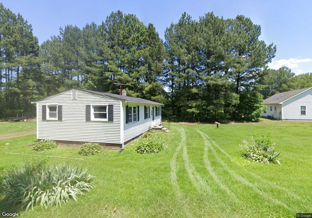
6323 Obama Rd Rock Hall, MD 21661
Estimated Value: $159,673 - $248,000
--
Bed
1
Bath
760
Sq Ft
$258/Sq Ft
Est. Value
About This Home
This home is located at 6323 Obama Rd, Rock Hall, MD 21661 and is currently estimated at $196,168, approximately $258 per square foot. 6323 Obama Rd is a home located in Kent County with nearby schools including Center for Innovation, Kent County Middle School, and Kent County High School.
Ownership History
Date
Name
Owned For
Owner Type
Purchase Details
Closed on
Jul 23, 2020
Sold by
Sisco Elizabeth C
Bought by
Sisco Elizabeth C and Sisco Sheldon
Current Estimated Value
Purchase Details
Closed on
Apr 18, 2008
Sold by
Sisco Elizabeth C
Bought by
Sisco Elizabeth C
Purchase Details
Closed on
Apr 14, 2008
Sold by
Sisco Elizabeth C
Bought by
Sisco Elizabeth C
Purchase Details
Closed on
Dec 23, 2003
Sold by
Sisco Elizabeth C Henry Emerson
Bought by
Sisco Elizabeth C and William Harrison Cotton
Create a Home Valuation Report for This Property
The Home Valuation Report is an in-depth analysis detailing your home's value as well as a comparison with similar homes in the area
Home Values in the Area
Average Home Value in this Area
Purchase History
| Date | Buyer | Sale Price | Title Company |
|---|---|---|---|
| Sisco Elizabeth C | -- | None Available | |
| Sisco Elizabeth C | -- | -- | |
| Sisco Elizabeth C | -- | -- | |
| Sisco Elizabeth C | $2,548 | -- | |
| Sisco Elizabeth C Etal | -- | -- |
Source: Public Records
Tax History Compared to Growth
Tax History
| Year | Tax Paid | Tax Assessment Tax Assessment Total Assessment is a certain percentage of the fair market value that is determined by local assessors to be the total taxable value of land and additions on the property. | Land | Improvement |
|---|---|---|---|---|
| 2025 | $1,355 | $120,000 | $0 | $0 |
| 2024 | $1,289 | $113,700 | $64,100 | $49,600 |
| 2023 | $0 | $112,400 | $0 | $0 |
| 2022 | $1,219 | $111,100 | $0 | $0 |
| 2021 | $1,124 | $109,800 | $64,100 | $45,700 |
| 2020 | $1,124 | $108,500 | $0 | $0 |
| 2019 | $0 | $107,200 | $0 | $0 |
| 2018 | $0 | $105,900 | $64,100 | $41,800 |
| 2017 | $985 | $105,900 | $0 | $0 |
| 2016 | -- | $105,900 | $0 | $0 |
| 2015 | -- | $106,900 | $0 | $0 |
| 2014 | -- | $106,900 | $0 | $0 |
Source: Public Records
Map
Nearby Homes
- 6345 Rock Hall Rd
- 22537 Shipyard Ln
- 21733 Centennial Ln
- 0 Rock Hall Rd
- 21745 Centennial Ln
- 21336 Haven Rd
- 21305 Haven Rd
- 5898 Williams St
- 0 Sharp St Unit MDKE2005760
- 5829 N Main St
- 21424 Catholic Ave
- 0 Judefind Ave Unit MDKE2001688
- 21332 E Sharp St
- 7224 Rock Hall Rd
- 5686 S Main St
- 21141 Striper Run
- 21139 Striper Run
- 21133 Striper Run
- 21131 Striper Run
- 21119 Striper Run
- 6338 Obama Rd
- 22104 Martin Wagner Rd
- 22072 Martin Wagner Rd
- 22056 Martin Wagner Rd
- 22091 Johnson Ave
- 22091 Johnson Ave
- 22071 Johnson Ave
- 22099 Johnson Ave
- 22057 Johnson Ave
- 22111 Johnson Ave
- 22064 Johnson Ave
- 6356 Edesville Rd
- 22140 Martin Wagner Rd
- 22044 Martin Wagner Rd
- 22049 Johnson Ave
- 6372 Edesville Rd
- 6380 Edesville Rd
- 22080 Johnson Ave
- 6340 Edesville Rd
- 6388 Edesville Rd