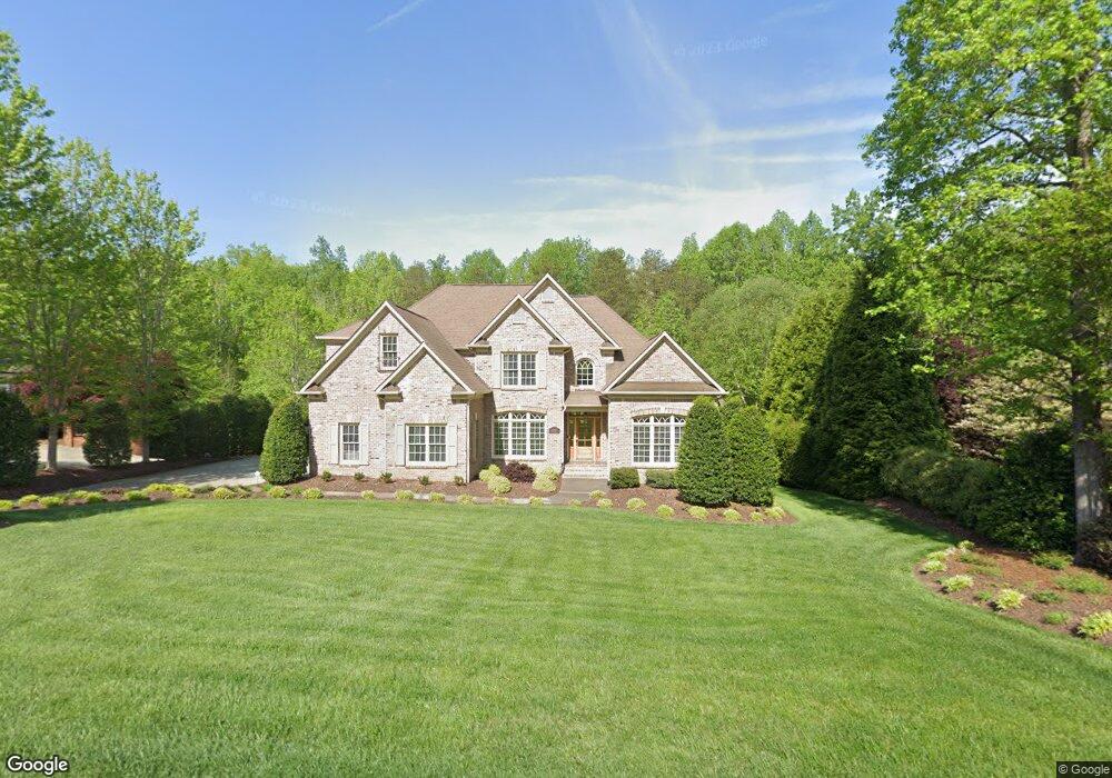
6325 Blue Aster Trace Summerfield, NC 27358
Estimated Value: $712,000 - $856,000
4
Beds
3
Baths
3,257
Sq Ft
$240/Sq Ft
Est. Value
About This Home
This home is located at 6325 Blue Aster Trace, Summerfield, NC 27358 and is currently estimated at $782,956, approximately $240 per square foot. 6325 Blue Aster Trace is a home located in Guilford County with nearby schools including Summerfield Elementary School, Northern Guilford Middle School, and Northern Guilford High School.
Ownership History
Date
Name
Owned For
Owner Type
Purchase Details
Closed on
Nov 20, 2025
Sold by
Pike James and Pike Susan
Bought by
Pike Family Trust and Pike
Current Estimated Value
Purchase Details
Closed on
Mar 30, 2005
Sold by
Pruitt Homes Inc
Bought by
Pike James and Pike Susan
Home Financials for this Owner
Home Financials are based on the most recent Mortgage that was taken out on this home.
Original Mortgage
$359,650
Interest Rate
5.57%
Mortgage Type
Construction
Create a Home Valuation Report for This Property
The Home Valuation Report is an in-depth analysis detailing your home's value as well as a comparison with similar homes in the area
Purchase History
| Date | Buyer | Sale Price | Title Company |
|---|---|---|---|
| Pike Family Trust | -- | None Listed On Document | |
| Pike James | $86,000 | -- |
Source: Public Records
Mortgage History
| Date | Status | Borrower | Loan Amount |
|---|---|---|---|
| Previous Owner | Pike James | $359,650 |
Source: Public Records
Tax History
| Year | Tax Paid | Tax Assessment Tax Assessment Total Assessment is a certain percentage of the fair market value that is determined by local assessors to be the total taxable value of land and additions on the property. | Land | Improvement |
|---|---|---|---|---|
| 2025 | $4,818 | $542,000 | $88,000 | $454,000 |
| 2024 | $4,818 | $542,000 | $88,000 | $454,000 |
| 2023 | $4,818 | $542,000 | $88,000 | $454,000 |
| 2022 | $4,818 | $542,000 | $88,000 | $454,000 |
| 2021 | $4,079 | $458,800 | $89,000 | $369,800 |
| 2020 | $4,079 | $458,800 | $89,000 | $369,800 |
| 2019 | $4,079 | $458,800 | $0 | $0 |
| 2018 | $4,058 | $458,800 | $0 | $0 |
| 2017 | $4,079 | $458,800 | $0 | $0 |
| 2016 | $4,154 | $454,700 | $0 | $0 |
| 2015 | $4,048 | $440,700 | $0 | $0 |
| 2014 | $4,092 | $440,700 | $0 | $0 |
Source: Public Records
Map
Nearby Homes
- 7637 Henson Forest Dr
- 6305 Blue Aster Trace
- 6307 Alley Ridge Way
- 7003 Pearson Run Ct
- 7819 Wilson Farm Rd
- 7006 Westfield Village Cir
- 5507 Whispering Pines Dr
- 7585 Dubach Rd
- 5603 Monk Ct
- 7376 Henson Forest Dr
- 6998 Colleen Ct
- 7300 Haw Ridge Rd
- 2327 Scalesville Rd
- 7511 Greenlawn Dr
- 7204 Woodfield Heights Dr
- 7729 Carson Path
- 5408 Briardenn Ct
- 7410 Dickinben Dr
- 5405 Briardenn Ct
- 7645 Braelands Dr
- 6323 Blue Aster Trace
- 6327 Blue Aster Trace
- 6321 Blue Aster Trace
- 6324 Blue Aster Trace
- 6322 Blue Aster Trace
- 6329 Blue Aster Trace
- 6328 Blue Aster Trace
- 6334 Poplar Forest Dr
- 6330 Poplar Forest Dr
- 6330 Blue Aster Trace
- 6336 Poplar Forest Dr
- 6317 Blue Aster Trace
- 6328 Poplar Forest Dr
- 6314 Blue Aster Trace
- 6332 Blue Aster Trace
- 6338 Poplar Forest Dr
- 6333 Blue Aster Trace
- 6320 Blue Aster Trace
- 6310 Blue Aster Trail
- 7607 Blue Sage Ct
Your Personal Tour Guide
Ask me questions while you tour the home.