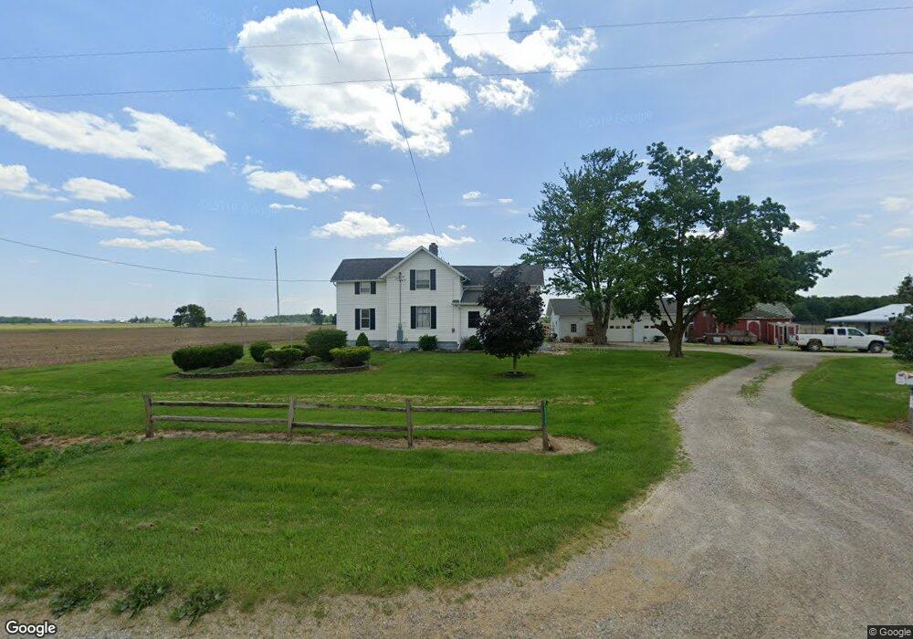
6325 Laberdee Rd Britton, MI 49229
Estimated Value: $196,000 - $257,000
3
Beds
2
Baths
1,123
Sq Ft
$200/Sq Ft
Est. Value
About This Home
This home is located at 6325 Laberdee Rd, Britton, MI 49229 and is currently estimated at $224,474, approximately $199 per square foot. 6325 Laberdee Rd is a home located in Lenawee County with nearby schools including Blissfield Elementary School, Blissfield Middle School, and Blissfield High School.
Ownership History
Date
Name
Owned For
Owner Type
Purchase Details
Closed on
May 22, 2007
Sold by
Federal Home Loan Mortgage Corporation
Bought by
Bogedain Shantell L
Current Estimated Value
Home Financials for this Owner
Home Financials are based on the most recent Mortgage that was taken out on this home.
Original Mortgage
$115,500
Outstanding Balance
$70,408
Interest Rate
6.21%
Mortgage Type
New Conventional
Estimated Equity
$154,066
Purchase Details
Closed on
Dec 7, 2006
Sold by
Fisher Steven D and Prince Financial Group Inc
Bought by
Federal Home Loan Mortgage Corporation
Create a Home Valuation Report for This Property
The Home Valuation Report is an in-depth analysis detailing your home's value as well as a comparison with similar homes in the area
Home Values in the Area
Average Home Value in this Area
Purchase History
| Date | Buyer | Sale Price | Title Company |
|---|---|---|---|
| Bogedain Shantell L | $117,000 | Attorneys Title Agency Llc | |
| Federal Home Loan Mortgage Corporation | $133,055 | None Available |
Source: Public Records
Mortgage History
| Date | Status | Borrower | Loan Amount |
|---|---|---|---|
| Open | Bogedain Shantell L | $115,500 |
Source: Public Records
Tax History
| Year | Tax Paid | Tax Assessment Tax Assessment Total Assessment is a certain percentage of the fair market value that is determined by local assessors to be the total taxable value of land and additions on the property. | Land | Improvement |
|---|---|---|---|---|
| 2025 | $2,655 | $111,100 | $0 | $0 |
| 2024 | $10 | $106,800 | $0 | $0 |
| 2022 | $2,016 | $87,100 | $0 | $0 |
| 2021 | $1,943 | $79,600 | $0 | $0 |
| 2020 | $1,948 | $77,100 | $0 | $0 |
| 2019 | $162,407 | $72,300 | $0 | $0 |
| 2018 | $1,986 | $72,258 | $0 | $0 |
| 2017 | $1,909 | $70,149 | $0 | $0 |
| 2016 | $1,308 | $49,228 | $0 | $0 |
| 2014 | -- | $45,668 | $0 | $0 |
Source: Public Records
Map
Nearby Homes
- 6584 Holloway Rd
- 1102 Wellsville Hwy
- 3125 N Rogers Hwy
- 1531 S Raisin Center Hwy
- 2519 N Wilmoth Hwy
- 3284 Sutton Rd
- 3324 Sutton Rd
- 3508 N Wilmoth Hwy
- 3811 Torin Ln Unit Parcel G
- 5517 Billmyer Hwy
- 4615 Green Hwy
- 2577 E Valley Rd
- 2571 E Valley Rd
- 2829 Sutton Rd
- 5377 Palmyra Rd
- 6111 Billmyer Hwy
- 6000 Occidental Hwy Unit 6000 Blk Occidental
- 4259 Haviland Dr
- 2000 blk Sutton Rd Unit Parcel B
- 2600 Blk Sutton Rd Unit Parcel C
- 6000 Laberdee Rd Unit BLK
- 6000 Laberdee Rd Unit BLK
- 6000 Laberdee Rd Unit BLK
- 1805 Grosvenor Hwy
- 5759 Laberdee Rd
- 2891 Laberdee Rd
- 1427 Grosvenor Hwy
- 5645 Laberdee Rd
- 1578 Grosvenor Hwy
- 2591 Kerr Hwy
- 1555 Grosvenor Hwy
- 1328 Grosvenor Hwy
- 2639 Kerr Hwy Unit BLK
- 6162 Mitchell Rd
- 2687 Kerr Hwy
- 6502 Mitchell Rd
- 6901 Laberdee Rd
- 1348 N Wellsville Hwy
- 6583 Mitchell Rd
- 1844 N Wellsville Hwy
Your Personal Tour Guide
Ask me questions while you tour the home.