Estimated Value: $215,693 - $281,000
2
Beds
2
Baths
1,206
Sq Ft
$201/Sq Ft
Est. Value
About This Home
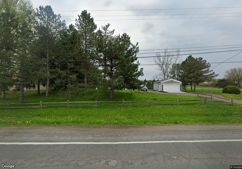
This home is located at 6329 Holt Rd, Holt, MI 48842 and is currently estimated at $241,923, approximately $200 per square foot. 6329 Holt Rd is a home located in Ingham County with nearby schools including Dimondale Elementary School, Washington Woods Middle School, and Holt Junior High School.
Ownership History
Date
Name
Owned For
Owner Type
Purchase Details
Closed on
Oct 20, 2008
Sold by
Hanks Steven W
Bought by
Arsenault Bradley and Arsenault Jennifer
Current Estimated Value
Purchase Details
Closed on
Feb 26, 2007
Sold by
Perdue Donald L
Bought by
Hanks Steven W
Purchase Details
Closed on
Feb 23, 2007
Sold by
Perdue Wanda D
Bought by
Perdue Donald L
Purchase Details
Closed on
Aug 29, 2005
Sold by
Hanks Steven W
Bought by
Steven W Hanks Trust
Purchase Details
Closed on
Feb 1, 2002
Sold by
Sturk Jay
Bought by
Hanks Steven W
Purchase Details
Closed on
Dec 1, 1993
Purchase Details
Closed on
Aug 6, 1993
Create a Home Valuation Report for This Property
The Home Valuation Report is an in-depth analysis detailing your home's value as well as a comparison with similar homes in the area
Home Values in the Area
Average Home Value in this Area
Purchase History
| Date | Buyer | Sale Price | Title Company |
|---|---|---|---|
| Arsenault Bradley | -- | None Available | |
| Hanks Steven W | -- | None Available | |
| Perdue Donald L | -- | None Available | |
| Steven W Hanks Trust | -- | None Available | |
| Hanks Steven W | $65,000 | First American Title Ins Co | |
| Estate Of Carl Homer Sturk | $47,500 | First American Title Ins Co | |
| -- | $47,500 | -- | |
| -- | $47,500 | -- |
Source: Public Records
Tax History Compared to Growth
Tax History
| Year | Tax Paid | Tax Assessment Tax Assessment Total Assessment is a certain percentage of the fair market value that is determined by local assessors to be the total taxable value of land and additions on the property. | Land | Improvement |
|---|---|---|---|---|
| 2025 | $4,972 | $86,900 | $14,600 | $72,300 |
| 2024 | $4,719 | $77,500 | $14,600 | $62,900 |
| 2023 | $4,719 | $75,500 | $14,600 | $60,900 |
| 2022 | $4,459 | $69,500 | $14,100 | $55,400 |
| 2021 | $4,396 | $67,800 | $13,000 | $54,800 |
| 2020 | $4,408 | $63,900 | $13,000 | $50,900 |
| 2019 | $4,335 | $59,500 | $13,000 | $46,500 |
| 2018 | $4,331 | $58,800 | $13,000 | $45,800 |
| 2017 | $4,212 | $58,800 | $13,000 | $45,800 |
| 2016 | $3,969 | $58,700 | $13,000 | $45,700 |
| 2015 | $3,889 | $58,400 | $26,051 | $32,349 |
| 2014 | $3,889 | $56,900 | $32,812 | $24,088 |
Source: Public Records
Map
Nearby Homes
- 6355 Holt Rd
- 6414 Savanna Way
- 2360 Gilbert Rd
- Parcel C Bailey Rd
- Parcel B Bailey Rd
- Parcel A Bailey Rd
- 5707 N Michigan Rd
- 1915 Hollowbrook Dr
- 6454 Pleasant River Dr
- 2616 Michigan 99
- The Windsor Plan at Meadow Ridge
- The Nantucket Plan at Meadow Ridge
- The Norway Plan at Meadow Ridge
- The Newton Plan at Meadow Ridge
- The Hatfield Plan at Meadow Ridge
- The Hickory Plan at Meadow Ridge
- The Westfield Plan at Meadow Ridge
- The Hartwell Plan at Meadow Ridge
- The Waverly Plan at Meadow Ridge
- 1851 Hollowbrook Dr
- 6315 Holt Rd
- 6305 Holt Rd
- 1992 Crossroads Dr
- 1982 Crossroads Dr
- 1972 Crossroads Dr
- 6295 Holt Rd
- 1942 Crossroads Dr
- 6284 Holt Rd
- 1965 Crossroads Dr
- 1955 Crossroads Dr
- 1932 Crossroads Dr
- 1945 Crossroads Dr
- 1979 Boysenberry
- 1968 Boysenberry
- 1920 Sunshine Path
- 1950 Boysenberry
- 1929 Crossroads Dr
- 1938 Boysenberry