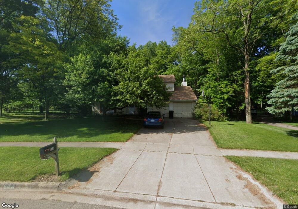
633 Aldersgate Dr Portage, MI 49024
Estimated Value: $328,887 - $406,000
4
Beds
3
Baths
2,160
Sq Ft
$173/Sq Ft
Est. Value
About This Home
This home is located at 633 Aldersgate Dr, Portage, MI 49024 and is currently estimated at $372,972, approximately $172 per square foot. 633 Aldersgate Dr is a home located in Kalamazoo County with nearby schools including Central Elementary School, Portage Central Middle School, and Portage Central High School.
Ownership History
Date
Name
Owned For
Owner Type
Purchase Details
Closed on
Oct 18, 2018
Sold by
Brown Vaikai K and Brown Elaine S
Bought by
Brown Vaikai K and Brown Elaine S
Current Estimated Value
Create a Home Valuation Report for This Property
The Home Valuation Report is an in-depth analysis detailing your home's value as well as a comparison with similar homes in the area
Home Values in the Area
Average Home Value in this Area
Purchase History
| Date | Buyer | Sale Price | Title Company |
|---|---|---|---|
| Brown Vaikai K | -- | None Available |
Source: Public Records
Tax History Compared to Growth
Tax History
| Year | Tax Paid | Tax Assessment Tax Assessment Total Assessment is a certain percentage of the fair market value that is determined by local assessors to be the total taxable value of land and additions on the property. | Land | Improvement |
|---|---|---|---|---|
| 2025 | $4,893 | $142,900 | $0 | $0 |
| 2024 | $4,308 | $137,500 | $0 | $0 |
| 2023 | $4,106 | $120,300 | $0 | $0 |
| 2022 | $4,437 | $108,200 | $0 | $0 |
| 2021 | $4,288 | $104,100 | $0 | $0 |
| 2020 | $4,195 | $100,600 | $0 | $0 |
| 2019 | $378 | $92,200 | $0 | $0 |
| 2018 | $0 | $92,900 | $0 | $0 |
| 2017 | $0 | $90,700 | $0 | $0 |
| 2016 | -- | $93,500 | $0 | $0 |
| 2015 | -- | $86,900 | $0 | $0 |
| 2014 | -- | $85,800 | $0 | $0 |
Source: Public Records
Map
Nearby Homes
- 10010 Lloy St
- 9766 S Westnedge Ave
- 404 Pimlico Ct
- 9744 Chambray St
- 442 Pinewood Cir
- 341 Cliffwood Ave
- 10565 Pierport Dr
- 550 Ludington Ave
- 10029 Kearns Ct
- 775 Chloe Jane Ave
- 739 Chloe Jane Ave
- 10545 Sharon Lee Ln
- 729 Chloe Jane Ave
- 580 Ludington Ave
- 10631 Gracie Ln Unit 6
- 10118 Pennridge Dr
- 735 Briella Ct
- 721 Briella Ct
- 821 Janelle Ct
- 811 Anchor Ln
- 657 Aldersgate Dr
- 607 Aldersgate Dr
- 655 Aldersgate Dr
- 612 Aldersgate Dr
- 9884 Wexford Dr
- 565 Aldersgate Dr
- 656 Aldersgate Dr
- 675 Aldersgate Dr
- 562 Aldersgate Dr
- 9902 Wexford Dr
- 0 Aldersgate Dr
- 601 Montague Dr
- 542 Aldersgate Dr
- 9922 Wexford Dr
- 565 Montague Dr
- 515 Aldersgate Dr
- 9887 Wexford Dr
- 636 Montague Dr
- 514 Aldersgate Dr
- 9942 Wexford Dr