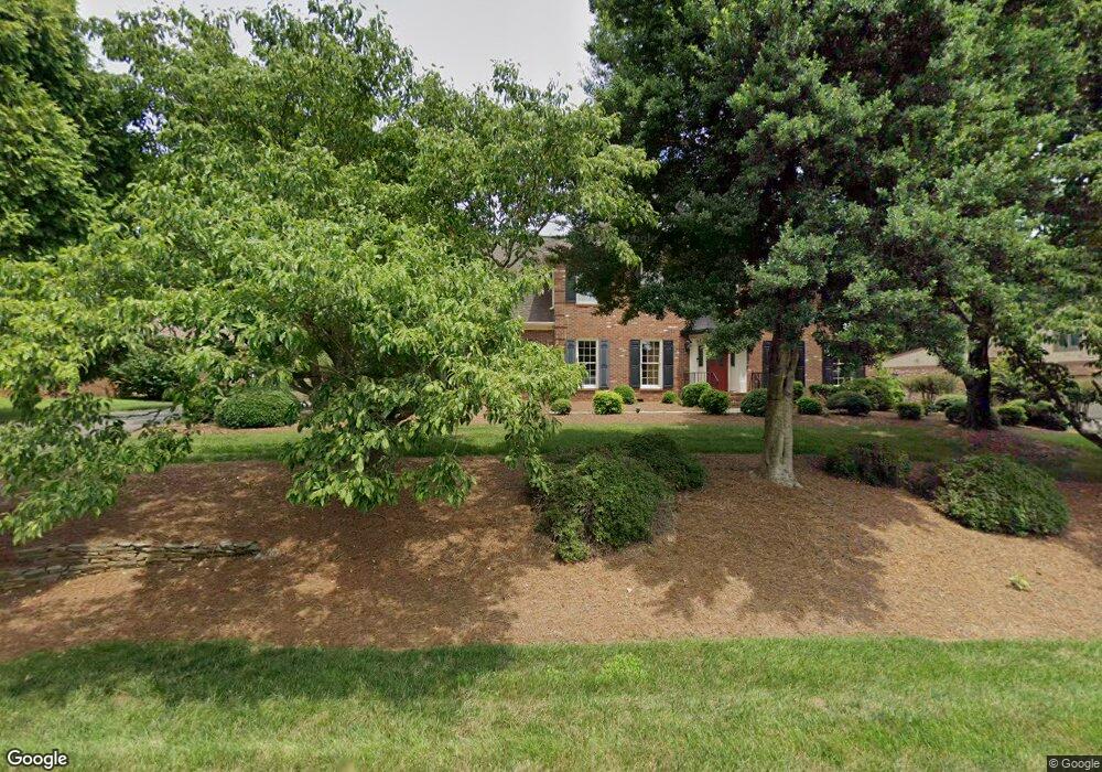
633 Doe Run Dr Kernersville, NC 27284
Woodbridge NeighborhoodEstimated Value: $493,000 - $531,000
8
Beds
6
Baths
5,423
Sq Ft
$95/Sq Ft
Est. Value
About This Home
This home is located at 633 Doe Run Dr, Kernersville, NC 27284 and is currently estimated at $512,692, approximately $94 per square foot. 633 Doe Run Dr is a home located in Forsyth County with nearby schools including Cash Elementary, East Forsyth Middle, and East Forsyth High School.
Ownership History
Date
Name
Owned For
Owner Type
Purchase Details
Closed on
May 20, 2000
Sold by
Vernon Borgwardt and Suzanne Borgwardt
Bought by
Coyle James L and Coyle Cynthia M
Current Estimated Value
Home Financials for this Owner
Home Financials are based on the most recent Mortgage that was taken out on this home.
Original Mortgage
$204,000
Outstanding Balance
$70,476
Interest Rate
8.14%
Estimated Equity
$442,216
Create a Home Valuation Report for This Property
The Home Valuation Report is an in-depth analysis detailing your home's value as well as a comparison with similar homes in the area
Home Values in the Area
Average Home Value in this Area
Purchase History
| Date | Buyer | Sale Price | Title Company |
|---|---|---|---|
| Coyle James L | $255,000 | -- |
Source: Public Records
Mortgage History
| Date | Status | Borrower | Loan Amount |
|---|---|---|---|
| Open | Coyle James L | $204,000 | |
| Closed | Coyle James L | $25,500 |
Source: Public Records
Tax History Compared to Growth
Tax History
| Year | Tax Paid | Tax Assessment Tax Assessment Total Assessment is a certain percentage of the fair market value that is determined by local assessors to be the total taxable value of land and additions on the property. | Land | Improvement |
|---|---|---|---|---|
| 2025 | $4,227 | $477,000 | $70,000 | $407,000 |
| 2024 | $4,145 | $326,900 | $57,000 | $269,900 |
| 2023 | $4,145 | $326,900 | $57,000 | $269,900 |
| 2022 | $4,135 | $326,900 | $57,000 | $269,900 |
| 2021 | $4,135 | $326,900 | $57,000 | $269,900 |
| 2020 | $3,877 | $288,200 | $51,000 | $237,200 |
| 2019 | $3,906 | $288,200 | $51,000 | $237,200 |
| 2018 | $3,819 | $288,200 | $51,000 | $237,200 |
| 2016 | $3,855 | $290,776 | $51,000 | $239,776 |
| 2015 | $3,775 | $290,776 | $51,000 | $239,776 |
| 2014 | $3,734 | $290,776 | $51,000 | $239,776 |
Source: Public Records
Map
Nearby Homes
- 2337 Willow Bend Dr
- 0 Doe Run Dr
- 487 Raven Ridge Dr
- Mayfair Plan at Pisgah Park
- Canton Plan at Pisgah Park
- Ellerbe Plan at Pisgah Park
- Raleigh Plan at Pisgah Park
- Drexel Plan at Pisgah Park
- Davidson Plan at Pisgah Park
- Cypress Plan at Pisgah Park
- Fenwick Plan at Pisgah Park
- Avery Plan at Pisgah Park
- 501 Buck Run Dr
- 2249 Pisgah Church Rd
- 924 Star Gate Dr
- 0 Hastings Hill Ln
- 170 Gerry Dr
- 215 Gerry Dr
- 2171 Castle Stone Ct
- 2389 Robbins Perch Ct W
- 637 Doe Run Dr
- 629 Doe Run Dr
- 625 Doe Run Dr
- 2325 Willow Bend Dr
- 2329 Willow Bend Dr
- 636 Doe Run Dr
- 640 Doe Run Dr
- 2321 Willow Bend Dr
- 2333 Willow Bend Dr
- 644 Doe Run Dr
- 632 Doe Run Dr
- 2317 Willow Bend Dr
- 621 Doe Run Dr
- 628 Doe Run Dr
- 2313 Willow Bend Dr
- 2341 Willow Bend Dr
- 00 Doe Run Dr
- 649 Doe Run Dr
- 2320 Willow Bend Dr
- 2324 Willow Bend Dr