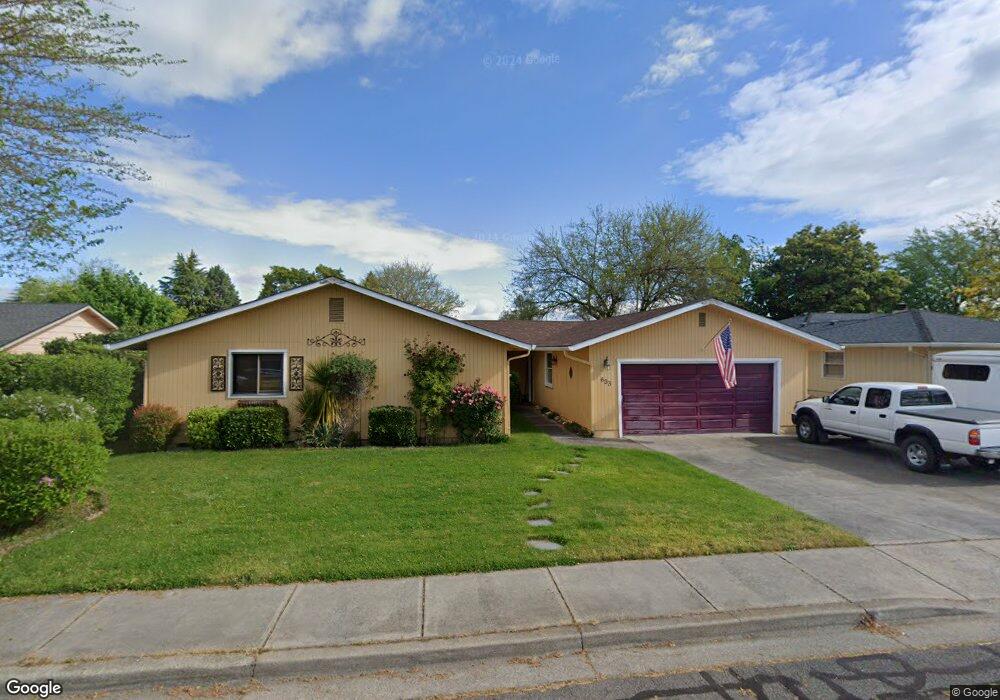
633 Hemlock Ave Central Point, OR 97502
Estimated Value: $390,000 - $430,000
4
Beds
2
Baths
1,666
Sq Ft
$244/Sq Ft
Est. Value
About This Home
This home is located at 633 Hemlock Ave, Central Point, OR 97502 and is currently estimated at $406,005, approximately $243 per square foot. 633 Hemlock Ave is a home located in Jackson County with nearby schools including Central Point Elementary School, Scenic Middle School, and Crater High School.
Ownership History
Date
Name
Owned For
Owner Type
Purchase Details
Closed on
Dec 30, 2014
Sold by
Adams Patrice Elaine
Bought by
Adams Richard M
Current Estimated Value
Purchase Details
Closed on
Jan 30, 2002
Sold by
Adams Richard M
Bought by
Adams Richard M and Adams Patrice Elaine
Home Financials for this Owner
Home Financials are based on the most recent Mortgage that was taken out on this home.
Original Mortgage
$143,820
Outstanding Balance
$56,790
Interest Rate
7.01%
Mortgage Type
VA
Estimated Equity
$349,215
Purchase Details
Closed on
Jan 7, 2002
Sold by
Maartense Michael R
Bought by
Adams Richard M
Home Financials for this Owner
Home Financials are based on the most recent Mortgage that was taken out on this home.
Original Mortgage
$143,820
Outstanding Balance
$56,790
Interest Rate
7.01%
Mortgage Type
VA
Estimated Equity
$349,215
Create a Home Valuation Report for This Property
The Home Valuation Report is an in-depth analysis detailing your home's value as well as a comparison with similar homes in the area
Purchase History
| Date | Buyer | Sale Price | Title Company |
|---|---|---|---|
| Adams Richard M | -- | None Available | |
| Adams Richard M | -- | Amerititle | |
| Adams Richard M | $141,000 | Amerititle Inc |
Source: Public Records
Mortgage History
| Date | Status | Borrower | Loan Amount |
|---|---|---|---|
| Open | Adams Richard M | $143,820 |
Source: Public Records
Tax History Compared to Growth
Tax History
| Year | Tax Paid | Tax Assessment Tax Assessment Total Assessment is a certain percentage of the fair market value that is determined by local assessors to be the total taxable value of land and additions on the property. | Land | Improvement |
|---|---|---|---|---|
| 2026 | $3,360 | $230,260 | $124,000 | $106,260 |
| 2025 | $3,277 | $228,680 | $59,130 | $169,550 |
| 2024 | $3,277 | $222,020 | $57,410 | $164,610 |
| 2023 | $3,172 | $215,560 | $55,740 | $159,820 |
| 2022 | $3,098 | $215,560 | $55,740 | $159,820 |
| 2021 | $3,009 | $209,290 | $54,120 | $155,170 |
| 2020 | $2,922 | $203,200 | $52,540 | $150,660 |
| 2019 | $2,850 | $191,550 | $49,530 | $142,020 |
| 2018 | $2,763 | $185,980 | $48,090 | $137,890 |
| 2017 | $2,694 | $185,980 | $48,090 | $137,890 |
| 2016 | $2,615 | $175,320 | $45,330 | $129,990 |
| 2015 | $2,506 | $175,320 | $45,330 | $129,990 |
| 2014 | $2,442 | $165,270 | $42,730 | $122,540 |
Source: Public Records
Map
Nearby Homes
- 755 S 4th St
- 571 Briarwood Dr
- 1065 Edwina Ave
- 3364 Bursell Rd
- 851 Juanita Way
- 555 Freeman Rd Unit 128
- 555 Freeman Rd Unit 254
- 555 Freeman Rd Unit 105
- 555 Freeman Rd Unit 209
- 3358 Bursell Rd
- 887 Silver Fox Dr
- 739 S Haskell St
- 921 Pittview Ave
- 114 Cedar St
- 301 Freeman Rd Unit 100
- 301 Freeman Rd Unit 30
- 301 Freeman Rd Unit 23
- 827 Isherwood Dr
- 831 Isherwood Dr
- 350 Alder St
- 625 Hemlock Ave
- 641 Hemlock Ave
- 662 Prairie Ct
- 654 Prairie Rd
- 662 Prairie Rd
- 638 Prairie Rd
- 617 Hemlock Ave
- 649 Hemlock Ave
- 634 Hemlock Ave Unit 3
- 628 Hemlock Ave
- 642 Hemlock Ave
- 626 Prairie Rd
- 674 Prairie Rd
- 609 Hemlock Ave
- 624 Hemlock Ave
- 657 Hemlock Ave
- 652 Hemlock Ave
- 614 Prairie Rd
- 616 Hemlock Ave
- 658 Hemlock Ave