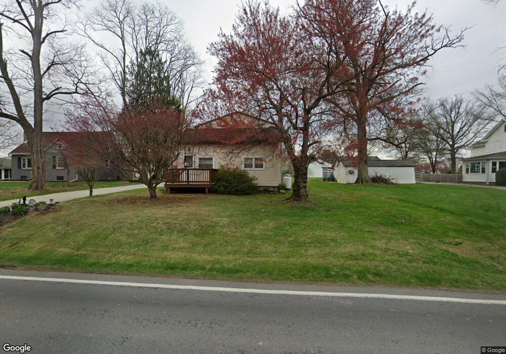
633 Lincoln Rd Birdsboro, PA 19508
Exeter NeighborhoodEstimated Value: $304,000 - $339,000
3
Beds
2
Baths
2,340
Sq Ft
$138/Sq Ft
Est. Value
About This Home
This home is located at 633 Lincoln Rd, Birdsboro, PA 19508 and is currently estimated at $322,879, approximately $137 per square foot. 633 Lincoln Rd is a home located in Berks County with nearby schools including Lorane Elementary School, Exeter Township Junior High School, and Exeter Township Senior High School.
Ownership History
Date
Name
Owned For
Owner Type
Purchase Details
Closed on
Aug 20, 2008
Sold by
White Francis G
Bought by
White Stacy L and White John F
Current Estimated Value
Home Financials for this Owner
Home Financials are based on the most recent Mortgage that was taken out on this home.
Original Mortgage
$69,020
Interest Rate
6.29%
Mortgage Type
FHA
Create a Home Valuation Report for This Property
The Home Valuation Report is an in-depth analysis detailing your home's value as well as a comparison with similar homes in the area
Home Values in the Area
Average Home Value in this Area
Purchase History
| Date | Buyer | Sale Price | Title Company |
|---|---|---|---|
| White Stacy L | -- | None Available |
Source: Public Records
Mortgage History
| Date | Status | Borrower | Loan Amount |
|---|---|---|---|
| Closed | White Stacy L | $69,020 |
Source: Public Records
Tax History Compared to Growth
Tax History
| Year | Tax Paid | Tax Assessment Tax Assessment Total Assessment is a certain percentage of the fair market value that is determined by local assessors to be the total taxable value of land and additions on the property. | Land | Improvement |
|---|---|---|---|---|
| 2025 | $1,408 | $91,500 | $32,500 | $59,000 |
| 2024 | $4,345 | $91,500 | $32,500 | $59,000 |
| 2023 | $4,203 | $91,500 | $32,500 | $59,000 |
| 2022 | $4,156 | $91,500 | $32,500 | $59,000 |
| 2021 | $4,093 | $91,500 | $32,500 | $59,000 |
| 2020 | $4,048 | $91,500 | $32,500 | $59,000 |
| 2019 | $4,003 | $91,500 | $32,500 | $59,000 |
| 2018 | $3,991 | $91,500 | $32,500 | $59,000 |
| 2017 | $3,934 | $91,500 | $32,500 | $59,000 |
| 2016 | $961 | $91,500 | $32,500 | $59,000 |
| 2015 | $961 | $91,500 | $32,500 | $59,000 |
| 2014 | $926 | $91,500 | $32,500 | $59,000 |
Source: Public Records
Map
Nearby Homes
- 217 Knollwood Ln
- 312 Hampshire Ave
- 400 Allenbrook Ln
- 410 Allenbrook Ln
- 301 Hampshire Ave
- 30 Keystone Rd
- 43 Thayer Rd
- 1322 Budd St
- 6221 Perkiomen Ave
- 313 Bordic Rd
- 201 Bordic Rd
- 515 Buddies Ct
- 314 Fairview Rd
- 105 Bordic Rd
- 140 Heister Rd
- 105 Fairmount Ave
- 129 Virginia Ave
- 0 Old River Rd Unit PABK2055042
- 207 Lincoln Dr
- 100 Pineland Rd
- 641 Lincoln Rd
- 621 Lincoln Rd
- 31 Ogden Dr
- 630 Lincoln Rd
- 6020 Long Pond Dr
- 6030 Long Pond Dr
- 653 Lincoln Rd
- 41 Ogden Dr
- 657 Lincoln Rd
- 6040 Long Pond Dr
- 568 Pintail Ln
- 30 Ogden Dr
- 6011 Long Pond Dr
- 6021 Long Pond Dr
- 6031 Long Pond Dr
- 6041 Long Pond Dr
- 564 Pintail Ln
- 6050 Long Pond Dr
- 5950 Littlefield Ave
- 40 Ogden Dr