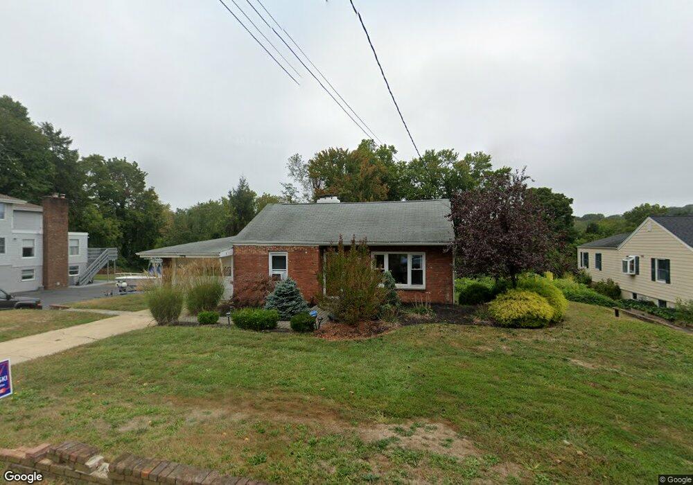
633 Locust Point Rd Rumson, NJ 07760
Estimated Value: $689,000 - $1,216,000
3
Beds
2
Baths
1,923
Sq Ft
$496/Sq Ft
Est. Value
About This Home
This home is located at 633 Locust Point Rd, Rumson, NJ 07760 and is currently estimated at $954,614, approximately $496 per square foot. 633 Locust Point Rd is a home located in Monmouth County with nearby schools including Navesink Elementary School, Bayshore Middle School, and Middletown - South High School.
Ownership History
Date
Name
Owned For
Owner Type
Purchase Details
Closed on
Jan 15, 2010
Sold by
Kurpakus Adrienne
Bought by
Kurpakus Adrienne and Mcbride Sean P
Current Estimated Value
Create a Home Valuation Report for This Property
The Home Valuation Report is an in-depth analysis detailing your home's value as well as a comparison with similar homes in the area
Home Values in the Area
Average Home Value in this Area
Purchase History
| Date | Buyer | Sale Price | Title Company |
|---|---|---|---|
| Kurpakus Adrienne | -- | All Pro Title Group Llc |
Source: Public Records
Tax History
| Year | Tax Paid | Tax Assessment Tax Assessment Total Assessment is a certain percentage of the fair market value that is determined by local assessors to be the total taxable value of land and additions on the property. | Land | Improvement |
|---|---|---|---|---|
| 2025 | $10,146 | $792,500 | $601,400 | $191,100 |
| 2024 | $9,284 | $616,800 | $429,300 | $187,500 |
| 2023 | $9,284 | $534,200 | $355,700 | $178,500 |
| 2022 | $7,852 | $397,900 | $222,300 | $175,600 |
| 2021 | $7,852 | $378,500 | $222,300 | $156,200 |
| 2020 | $7,872 | $368,200 | $215,600 | $152,600 |
| 2019 | $7,973 | $377,500 | $215,600 | $161,900 |
| 2018 | $8,753 | $403,900 | $249,600 | $154,300 |
| 2017 | $8,852 | $404,400 | $249,600 | $154,800 |
| 2016 | $8,247 | $387,000 | $236,100 | $150,900 |
| 2015 | $8,532 | $386,600 | $236,100 | $150,500 |
| 2014 | $7,945 | $351,100 | $213,600 | $137,500 |
Source: Public Records
Map
Nearby Homes
- 96 East Ave Unit 82
- 96 East Ave Unit 76
- 96 East Ave Unit 97
- 26 King James Ln
- 498 Central Ave
- 96 E East Ave Unit 37
- 502 Central Ave
- 500 Central Ave
- 7100 Prospect Ave
- 6998 Prospect Ave
- 114 Memorial Pkwy
- 50 Memorial Pkwy
- 254 1st Ave
- 19 Summit Ave
- 48 Starr Ct
- 104 E Washington Ave
- 119 Chestnut Ave
- 20 Brianna Ct Unit 20
- 16 E Garfield Ave
- 12 E Garfield Ave
- 629 Locust Point Rd
- 637 Locust Point Rd
- 634 Locust Point Rd
- 625 Locust Point Rd
- 641 Locust Point Rd
- 638 Locust Point Rd
- 628 Locust Point Rd
- 621 Locust Point Rd
- 642 Locust Point Rd
- 645 Locust Point Rd
- 617 Locust Point Rd
- 650 Locust Point Rd
- 649 Locust Point Rd
- 613 Locust Point Rd
- 35 Latham Ave
- 1 Trovillo Ct
- 7 Trovillo Ct
- 653 Locust Point Rd
- 609 Locust Point Rd
- 9 Trovillo Ct
Your Personal Tour Guide
Ask me questions while you tour the home.