Estimated Value: $550,049 - $640,000
3
Beds
2
Baths
1,990
Sq Ft
$296/Sq Ft
Est. Value
About This Home
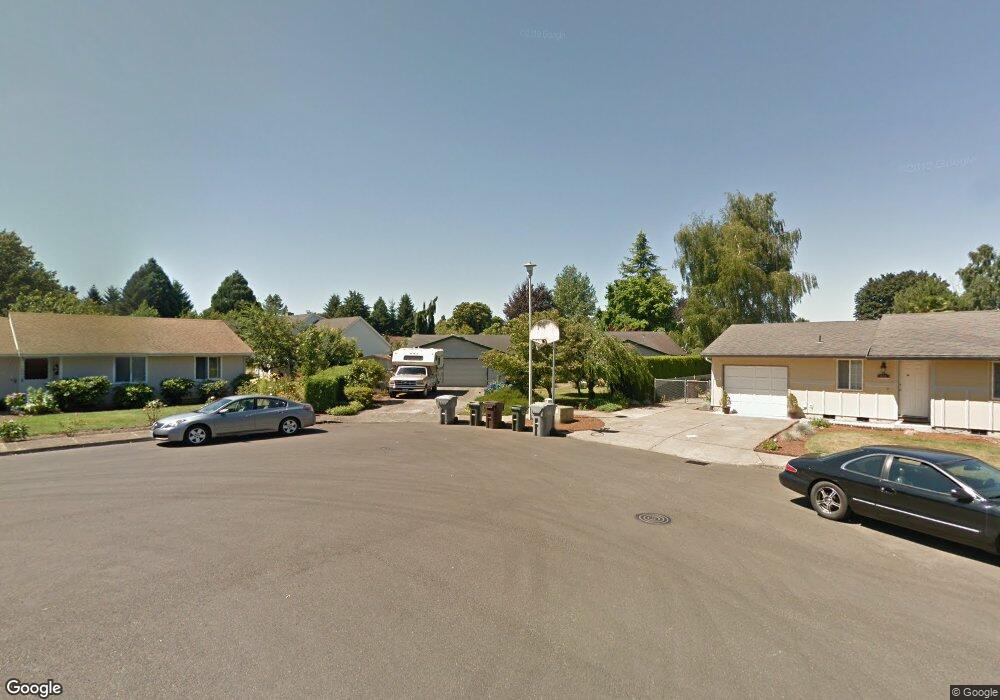
This home is located at 633 NE 21st Place, Canby, OR 97013 and is currently estimated at $589,512, approximately $296 per square foot. 633 NE 21st Place is a home located in Clackamas County with nearby schools including Josefa L. Sambrano Elementary School, Baker Prairie Middle School, and Canby High School.
Ownership History
Date
Name
Owned For
Owner Type
Purchase Details
Closed on
Apr 27, 2022
Sold by
Goetchius Scott R and Goetchius Susan E
Bought by
Scott And Susan Goetchius Trust
Current Estimated Value
Purchase Details
Closed on
Nov 18, 1998
Sold by
Griffith Irene
Bought by
Goetchius Scott R and Goetchius Susan E
Home Financials for this Owner
Home Financials are based on the most recent Mortgage that was taken out on this home.
Original Mortgage
$137,250
Interest Rate
6.42%
Create a Home Valuation Report for This Property
The Home Valuation Report is an in-depth analysis detailing your home's value as well as a comparison with similar homes in the area
Home Values in the Area
Average Home Value in this Area
Purchase History
| Date | Buyer | Sale Price | Title Company |
|---|---|---|---|
| Scott And Susan Goetchius Trust | -- | None Listed On Document | |
| Goetchius Scott R | $185,000 | Pacific Nw Title |
Source: Public Records
Mortgage History
| Date | Status | Borrower | Loan Amount |
|---|---|---|---|
| Previous Owner | Goetchius Scott R | $137,250 |
Source: Public Records
Tax History Compared to Growth
Tax History
| Year | Tax Paid | Tax Assessment Tax Assessment Total Assessment is a certain percentage of the fair market value that is determined by local assessors to be the total taxable value of land and additions on the property. | Land | Improvement |
|---|---|---|---|---|
| 2025 | $5,781 | $326,301 | -- | -- |
| 2024 | $5,619 | $316,798 | -- | -- |
| 2023 | $5,619 | $307,571 | $0 | $0 |
| 2022 | $5,168 | $298,613 | $0 | $0 |
| 2021 | $4,977 | $289,916 | $0 | $0 |
| 2020 | $4,888 | $281,472 | $0 | $0 |
| 2019 | $4,654 | $273,274 | $0 | $0 |
| 2018 | $4,551 | $265,315 | $0 | $0 |
| 2017 | $4,435 | $257,587 | $0 | $0 |
| 2016 | $4,287 | $250,084 | $0 | $0 |
| 2015 | $4,140 | $242,800 | $0 | $0 |
| 2014 | $4,021 | $235,728 | $0 | $0 |
Source: Public Records
Map
Nearby Homes
- 660 NE 20th Ave
- 2152 N Laurelwood St
- 1751 N Laurelwood Loop
- 832 NE 17th Ave
- 838 NE 17th Ave
- 844 NE 17th Ave
- 1200 NE Territorial Rd Unit 93
- 1750 N Oak St
- 853 NE 17th Ave
- 878 NE 17th Ave
- 952 NE 17th Ave
- 947 NE 17th Ave
- 1009 NE 17th Ave
- 312 NE 14th Ave
- 860 NE 14th Ave
- 1721 N Hyssop St
- 1422 NE 18th Place
- 187 NE 14th Ave
- 1346 NE 16th Ave
- 1614 NW 16th Ave
- 642 NE 21st Place
- 631 NE 22nd Ave
- 647 NE 21st Place
- 637 NE 22nd Ave
- 2121 N Maple St
- 645 NE 22nd Ave
- 673 NE 21st Place
- 615 NE 22nd Ave
- 641 NE 22nd Ave
- 627 NE 22nd Ave
- 675 NE 22nd Ave
- 599 NE 22nd Ave
- 676 NE 21st Place
- 2137 NE 21st (2540-47) Place
- 2137 NE 21st (2811-47) Place
- 597 NE 22nd Ave
- 695 NE 22nd Ave
- 655 NE 21st Ave
- 552 NE 21st Place
- 556 NE 21st Place