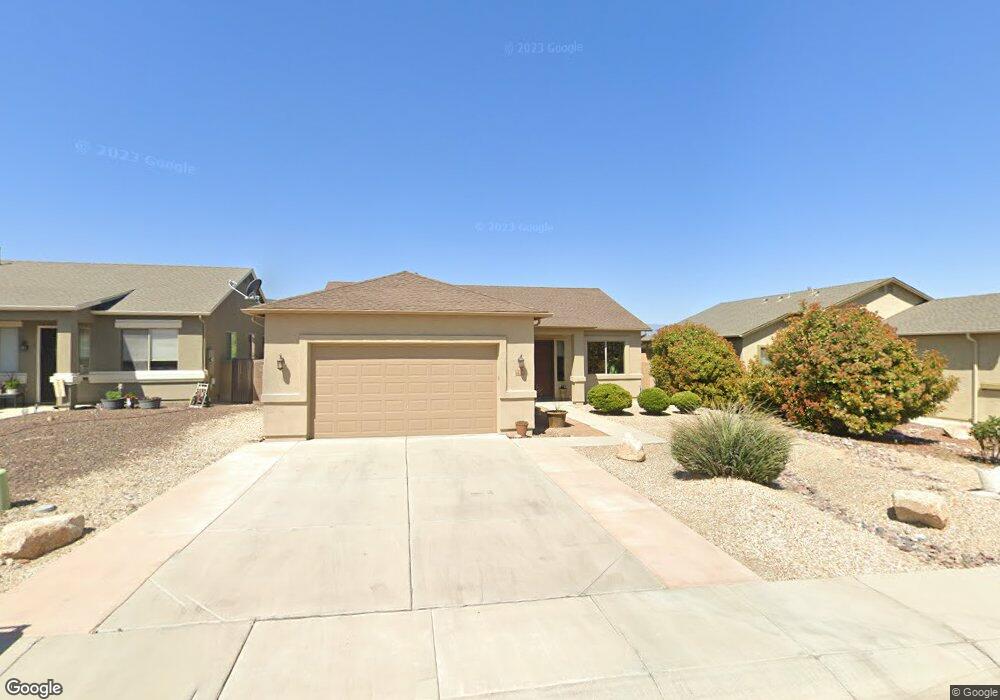
633 Rowdy Ranch Rd Camp Verde, AZ 86322
3
Beds
--
Bath
1,660
Sq Ft
6,534
Sq Ft Lot
About This Home
This home is located at 633 Rowdy Ranch Rd, Camp Verde, AZ 86322. 633 Rowdy Ranch Rd is a home located in Yavapai County with nearby schools including Camp Verde Elementary School, Camp Verde Middle School, and Camp Verde High School.
Ownership History
Date
Name
Owned For
Owner Type
Purchase Details
Closed on
May 19, 2023
Sold by
Bullard William Brady and Valeri Dawn
Bought by
Swatzell Family Trust
Purchase Details
Closed on
Mar 7, 2012
Sold by
White Shawn D and White Angela R
Bought by
Bullard William Brady and Bullard Valeri Dawn
Purchase Details
Closed on
Sep 16, 2008
Sold by
Demar Sandra C
Bought by
White Shawn D and White Angela R
Home Financials for this Owner
Home Financials are based on the most recent Mortgage that was taken out on this home.
Original Mortgage
$194,085
Interest Rate
6.31%
Mortgage Type
VA
Create a Home Valuation Report for This Property
The Home Valuation Report is an in-depth analysis detailing your home's value as well as a comparison with similar homes in the area
Home Values in the Area
Average Home Value in this Area
Purchase History
| Date | Buyer | Sale Price | Title Company |
|---|---|---|---|
| Swatzell Family Trust | $421,500 | Pioneer Title | |
| Bullard William Brady | $102,000 | Yavapai Title Agency Inc | |
| White Shawn D | $190,000 | Yavapai Title Agency Inc |
Source: Public Records
Mortgage History
| Date | Status | Borrower | Loan Amount |
|---|---|---|---|
| Previous Owner | White Shawn D | $194,085 |
Source: Public Records
Tax History Compared to Growth
Tax History
| Year | Tax Paid | Tax Assessment Tax Assessment Total Assessment is a certain percentage of the fair market value that is determined by local assessors to be the total taxable value of land and additions on the property. | Land | Improvement |
|---|---|---|---|---|
| 2026 | $1,749 | $34,345 | -- | -- |
| 2024 | $1,728 | $34,295 | -- | -- |
| 2023 | $1,728 | $28,151 | $2,487 | $25,664 |
| 2022 | $1,661 | $24,274 | $2,854 | $21,420 |
| 2021 | $1,713 | $22,197 | $2,685 | $19,512 |
| 2020 | $1,672 | $0 | $0 | $0 |
| 2019 | $1,654 | $0 | $0 | $0 |
| 2018 | $1,577 | $0 | $0 | $0 |
| 2017 | $1,552 | $0 | $0 | $0 |
| 2016 | $1,508 | $0 | $0 | $0 |
| 2015 | -- | $0 | $0 | $0 |
| 2014 | -- | $0 | $0 | $0 |
Source: Public Records
Map
Nearby Homes
- 870 W Deep Gorge Rd
- 509 S Longhorn Dr
- 836 Arizona 260
- 667 E Cliffs Pkwy
- 639 S Azure Dr
- 778 W Salt Mine Rd
- 556 S Azure Dr
- 539 W Saddle Creek Dr
- 1145 W Thorton Rd
- 12 Ranch Dr
- 1053 W Wheeler Rd
- 1114 W Thorton Rd
- 660 S Dakota Dr
- 0000 W General Crook Trail
- 477 Arizona 260
- 421 S Dakota Dr
- 104 S Copper Canyon Loop
- 80 S Copper Canyon Loop
- 75 S Copper Canyon Loop
- 61 S Copper Canyon Loop