Estimated Value: $240,000 - $304,000
3
Beds
2
Baths
1,420
Sq Ft
$191/Sq Ft
Est. Value
About This Home
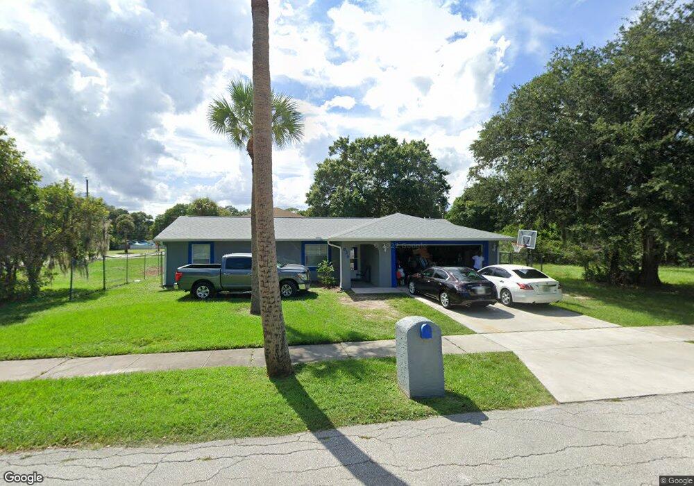
This home is located at 633 S Kentucky Ave, Cocoa, FL 32922 and is currently estimated at $270,544, approximately $190 per square foot. 633 S Kentucky Ave is a home located in Brevard County with nearby schools including Endeavour Elementary Magnet, Ronald McNair Magnet Middle School, and Rockledge Senior High School.
Ownership History
Date
Name
Owned For
Owner Type
Purchase Details
Closed on
Feb 9, 2024
Sold by
Lindsey Barbara A
Bought by
Lindsey Barbara A and Lindsey C W
Current Estimated Value
Purchase Details
Closed on
Dec 15, 1998
Sold by
Range Luke O
Bought by
Lindsey Barbara A
Home Financials for this Owner
Home Financials are based on the most recent Mortgage that was taken out on this home.
Original Mortgage
$2,255
Interest Rate
6.94%
Purchase Details
Closed on
Aug 28, 1998
Sold by
Smith Marguerite A
Bought by
Range Luke O
Purchase Details
Closed on
Jun 30, 1992
Sold by
Weaver Ardie S and Collins Ardie S
Bought by
Range Luke
Create a Home Valuation Report for This Property
The Home Valuation Report is an in-depth analysis detailing your home's value as well as a comparison with similar homes in the area
Home Values in the Area
Average Home Value in this Area
Purchase History
| Date | Buyer | Sale Price | Title Company |
|---|---|---|---|
| Lindsey Barbara A | $100 | None Listed On Document | |
| Lindsey Barbara A | $100 | None Listed On Document | |
| Lindsey Barbara A | $77,000 | -- | |
| Range Luke O | -- | -- | |
| Range Luke | $1,200 | -- |
Source: Public Records
Mortgage History
| Date | Status | Borrower | Loan Amount |
|---|---|---|---|
| Previous Owner | Lindsey Barbara A | $2,255 |
Source: Public Records
Tax History
| Year | Tax Paid | Tax Assessment Tax Assessment Total Assessment is a certain percentage of the fair market value that is determined by local assessors to be the total taxable value of land and additions on the property. | Land | Improvement |
|---|---|---|---|---|
| 2025 | $1,277 | $219,620 | -- | -- |
| 2024 | $1,230 | $87,880 | -- | -- |
| 2023 | $1,230 | $85,330 | $0 | $0 |
| 2022 | $1,114 | $82,850 | $0 | $0 |
| 2021 | $1,089 | $80,440 | $0 | $0 |
| 2020 | $1,053 | $79,330 | $0 | $0 |
| 2019 | $1,020 | $77,550 | $0 | $0 |
| 2018 | $894 | $76,110 | $0 | $0 |
| 2017 | $886 | $74,550 | $0 | $0 |
| 2016 | $889 | $73,020 | $6,000 | $67,020 |
| 2015 | $901 | $72,520 | $6,000 | $66,520 |
| 2014 | $854 | $71,950 | $6,000 | $65,950 |
Source: Public Records
Map
Nearby Homes
- 618 S Varr Ave
- 633 S Varr Ave
- Xxxx S Fiske Blvd
- 00 S Georgia Ave
- 621 S Georgia Ave
- 714 S Georgia Ave
- 708 Ixora Ave
- 838 Georgia Ave
- Xxxx Fiske
- 000 Unknown Ln
- 128 Aurora St
- 989 S Fiske Blvd Unit 989 & 991
- 989 S Fiske Blvd
- 935 S Varr Ave
- 1009 S Fiske Blvd
- 145 Ruth Ave
- 714 Johnson St
- 535 Bernard St
- 515 S Wilson Ave
- 480 Sorrento Dr
- 627 S Kentucky Ave
- 632 S Varr Ave
- 630 S Kentucky Ave
- 619 S Kentucky Ave
- 626 S Kentucky Ave
- 702 S Varr Ave
- 707 S Kentucky Ave
- 616 S Kentucky Ave
- 610 S Varr Ave
- 711 S Kentucky Ave
- 708 S Varr Ave
- 627 S Varr Ave
- 607 S Fiske Blvd
- 612 S Kentucky Ave
- 1004 Counts St
- 605 S Fiske Blvd
- 611 S Varr Ave
- 603 S Kentucky Ave
- 606 S Varr Ave
- 715 S Kentucky Ave
Your Personal Tour Guide
Ask me questions while you tour the home.