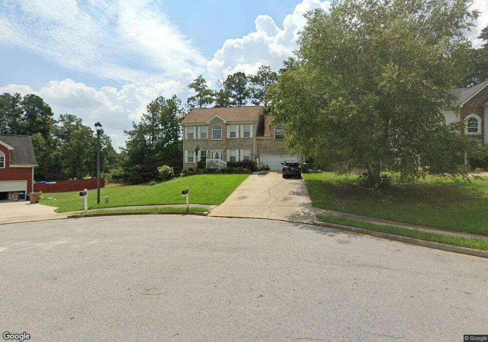
633 Seaport Dr Jonesboro, GA 30238
Estimated Value: $280,709 - $287,000
4
Beds
3
Baths
2,184
Sq Ft
$130/Sq Ft
Est. Value
About This Home
This home is located at 633 Seaport Dr, Jonesboro, GA 30238 and is currently estimated at $283,855, approximately $129 per square foot. 633 Seaport Dr is a home located in Clayton County with nearby schools including Brown Elementary School, Mundys Mill Middle School, and Mundy's Mill High School.
Ownership History
Date
Name
Owned For
Owner Type
Purchase Details
Closed on
Oct 7, 2011
Sold by
Secretary Of Housing And U
Bought by
Bourdeau Eddy and Bourdeau Alberte
Current Estimated Value
Purchase Details
Closed on
Jun 7, 2011
Sold by
Sease Marvin
Bought by
Wells Fargo Bk Na
Purchase Details
Closed on
May 15, 2001
Sold by
Crimson Homes Llc
Bought by
Sease Marvin
Home Financials for this Owner
Home Financials are based on the most recent Mortgage that was taken out on this home.
Original Mortgage
$166,450
Interest Rate
7.11%
Mortgage Type
FHA
Create a Home Valuation Report for This Property
The Home Valuation Report is an in-depth analysis detailing your home's value as well as a comparison with similar homes in the area
Home Values in the Area
Average Home Value in this Area
Purchase History
| Date | Buyer | Sale Price | Title Company |
|---|---|---|---|
| Bourdeau Eddy | $73,000 | -- | |
| Wells Fargo Bk Na | $161,212 | -- | |
| Sease Marvin | $169,100 | -- |
Source: Public Records
Mortgage History
| Date | Status | Borrower | Loan Amount |
|---|---|---|---|
| Previous Owner | Sease Marvin | $166,450 |
Source: Public Records
Tax History Compared to Growth
Tax History
| Year | Tax Paid | Tax Assessment Tax Assessment Total Assessment is a certain percentage of the fair market value that is determined by local assessors to be the total taxable value of land and additions on the property. | Land | Improvement |
|---|---|---|---|---|
| 2024 | $2,770 | $80,040 | $9,600 | $70,440 |
| 2023 | $2,890 | $80,040 | $9,600 | $70,440 |
| 2022 | $2,704 | $77,920 | $9,600 | $68,320 |
| 2021 | $2,512 | $72,640 | $9,600 | $63,040 |
| 2020 | $2,613 | $74,392 | $9,600 | $64,792 |
| 2019 | $2,166 | $62,418 | $8,400 | $54,018 |
| 2018 | $1,890 | $55,631 | $8,400 | $47,231 |
| 2017 | $1,617 | $48,807 | $8,400 | $40,407 |
| 2016 | $1,711 | $51,122 | $8,400 | $42,722 |
| 2015 | $1,351 | $0 | $0 | $0 |
| 2014 | $1,343 | $42,800 | $8,400 | $34,400 |
Source: Public Records
Map
Nearby Homes
- 9348 Lantana Trail
- 692 Sedgwick Dr
- 439 Windy Ct
- 443 Windy Ct
- 447 Windy Ct
- 770 Four Winds Ln
- 9381 Windward Ct
- 532 Flint Ridge Ct Unit 1
- 9579 Fayetteville Rd
- 9579 Highway 54 W
- 445 Westside Dr
- 709 Willow Bend Dr
- 631 Crestmont Ct
- 0 Highway 54 Unit 10613856
- 755 Dunaire Way
- 1506 Mundys Mill Rd
- 157 Tyler Ridge Unit II
- 8857 Woodridge Ct
- 8843 Fayetteville Rd
- 6648 Coker Way
- 625 Seaport Dr
- 641 Seaport Dr
- 617 Seaport Dr
- 636 Pristine Place
- 9379 Chatemere Ct
- 642 Seaport Dr
- 9387 Chatemere Ct
- 635 Pristine Place
- 9340 Flowering Trail
- S Pristine Place
- 9352 Flowering Trail
- 648 Seaport Dr
- 609 Seaport Dr
- 9471 Flowering Trail
- 9358 Flowering Trail
- 629 Pristine Place
- 9326 Flowering Trail
- 9393 Chatemere Ct
- 617 Pristine Place
- 617 Pristine Place Unit 42