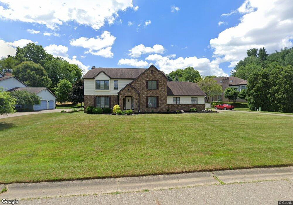
6330 Andalor St NW Canton, OH 44708
Estimated Value: $359,000 - $445,641
4
Beds
4
Baths
2,560
Sq Ft
$162/Sq Ft
Est. Value
About This Home
This home is located at 6330 Andalor St NW, Canton, OH 44708 and is currently estimated at $415,910, approximately $162 per square foot. 6330 Andalor St NW is a home located in Stark County with nearby schools including Lake Cable Elementary School, Jackson Memorial Middle School, and Jackson High School.
Ownership History
Date
Name
Owned For
Owner Type
Purchase Details
Closed on
Feb 7, 2008
Sold by
Morrison John W and Morrison Melissa A
Bought by
Lasorella Anthony P and Lasorella Karen
Current Estimated Value
Home Financials for this Owner
Home Financials are based on the most recent Mortgage that was taken out on this home.
Original Mortgage
$156,000
Outstanding Balance
$99,119
Interest Rate
6.2%
Mortgage Type
Purchase Money Mortgage
Estimated Equity
$316,791
Purchase Details
Closed on
Jul 30, 2001
Sold by
Williams James J and Williams Constance H
Bought by
Morrison John W and Morrison Melissa A
Home Financials for this Owner
Home Financials are based on the most recent Mortgage that was taken out on this home.
Original Mortgage
$206,513
Interest Rate
7.16%
Mortgage Type
Purchase Money Mortgage
Purchase Details
Closed on
Nov 30, 1989
Create a Home Valuation Report for This Property
The Home Valuation Report is an in-depth analysis detailing your home's value as well as a comparison with similar homes in the area
Home Values in the Area
Average Home Value in this Area
Purchase History
| Date | Buyer | Sale Price | Title Company |
|---|---|---|---|
| Lasorella Anthony P | $195,000 | Fidelity Title | |
| Morrison John W | $212,900 | -- | |
| -- | $169,500 | -- |
Source: Public Records
Mortgage History
| Date | Status | Borrower | Loan Amount |
|---|---|---|---|
| Open | Lasorella Anthony P | $156,000 | |
| Previous Owner | Morrison John W | $206,513 |
Source: Public Records
Tax History Compared to Growth
Tax History
| Year | Tax Paid | Tax Assessment Tax Assessment Total Assessment is a certain percentage of the fair market value that is determined by local assessors to be the total taxable value of land and additions on the property. | Land | Improvement |
|---|---|---|---|---|
| 2025 | -- | $138,050 | $34,970 | $103,080 |
| 2024 | -- | $138,050 | $34,970 | $103,080 |
| 2023 | $4,978 | $100,030 | $26,530 | $73,500 |
| 2022 | $4,953 | $100,030 | $26,530 | $73,500 |
| 2021 | $4,972 | $100,030 | $26,530 | $73,500 |
| 2020 | $4,849 | $89,670 | $23,590 | $66,080 |
| 2019 | $4,671 | $89,670 | $23,590 | $66,080 |
| 2018 | $4,695 | $89,670 | $23,590 | $66,080 |
| 2017 | $4,455 | $80,960 | $22,090 | $58,870 |
| 2016 | $4,485 | $80,960 | $22,090 | $58,870 |
| 2015 | $4,540 | $80,960 | $22,090 | $58,870 |
| 2014 | $289 | $73,150 | $19,950 | $53,200 |
| 2013 | $2,111 | $73,150 | $19,950 | $53,200 |
Source: Public Records
Map
Nearby Homes
- 3151 Perry Dr NW
- 6457 Beckleigh Cir NW
- 3182 Edinburg Ave NW
- 2889 Vicksburg Ave NW
- Aviano Plan at Aberdeen Oaks
- Hudson Plan at Aberdeen Oaks
- Allegheny Plan at Aberdeen Oaks
- Columbia Plan at Aberdeen Oaks
- 2873 Olympia Dr NW
- 3436 Cardiff Ave NW
- 3467 Briardale Dr NW
- 3051 Blue Ash Ave NW
- 3490 Cardiff Ave NW
- 3273 Dellwood Ave NW
- 1702 Thornridge Rd NW
- 5966 Hawks Nest Cir NW
- 5843 Hawks Nest Cir NW
- 3591 Harris Ave NW
- 3432 Stillwater Ave NW
- 5845 Hawks Nest Cir NW
- 6300 Andalor St NW
- 2982 Mill Ridge Cir NW
- 3008 Mill Ridge Cir NW
- 6341 Andalor St NW
- 6301 Andalor St NW
- 3044 Mill Ridge Cir NW
- 2958 Mill Ridge Cir NW
- 3001 Mill Ridge Cir NW
- 3074 Mill Ridge Cir NW
- 2985 Mill Ridge Cir NW
- 2957 Mill Ridge Cir NW
- 2949 Mill Ridge Cir NW
- 3011 Mill Ridge Cir NW
- 3031 Mill Ridge Cir NW
- 2995 Mill Ridge Cir NW
- 3051 Mill Ridge Cir NW
- 3075 Mill Ridge Cir NW
- 3026 Falcons Ridge Cir NW
- 3006 Falcons Ridge Cir NW
- 3050 Falcons Ridge Cir NW