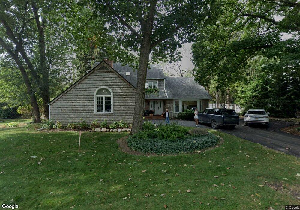
6330 Sheringham Rd Bloomfield Hills, MI 48301
Estimated Value: $798,977 - $890,000
4
Beds
3
Baths
2,558
Sq Ft
$332/Sq Ft
Est. Value
About This Home
This home is located at 6330 Sheringham Rd, Bloomfield Hills, MI 48301 and is currently estimated at $848,494, approximately $331 per square foot. 6330 Sheringham Rd is a home located in Oakland County with nearby schools including Conant Elementary School, South Hills Middle School, and Bloomfield Hills High School.
Ownership History
Date
Name
Owned For
Owner Type
Purchase Details
Closed on
Jan 11, 2024
Sold by
Combs Randy
Bought by
Sharon E Combs Living Trust and Combs
Current Estimated Value
Home Financials for this Owner
Home Financials are based on the most recent Mortgage that was taken out on this home.
Original Mortgage
$300,000
Outstanding Balance
$294,016
Interest Rate
6.25%
Mortgage Type
New Conventional
Estimated Equity
$554,478
Create a Home Valuation Report for This Property
The Home Valuation Report is an in-depth analysis detailing your home's value as well as a comparison with similar homes in the area
Home Values in the Area
Average Home Value in this Area
Purchase History
| Date | Buyer | Sale Price | Title Company |
|---|---|---|---|
| Sharon E Combs Living Trust | $600,000 | Ata National Title | |
| Sharon E Combs Living Trust | $600,000 | Ata National Title |
Source: Public Records
Mortgage History
| Date | Status | Borrower | Loan Amount |
|---|---|---|---|
| Open | Sharon E Combs Living Trust | $300,000 | |
| Closed | Sharon E Combs Living Trust | $300,000 |
Source: Public Records
Tax History Compared to Growth
Tax History
| Year | Tax Paid | Tax Assessment Tax Assessment Total Assessment is a certain percentage of the fair market value that is determined by local assessors to be the total taxable value of land and additions on the property. | Land | Improvement |
|---|---|---|---|---|
| 2024 | $4,398 | $418,180 | $0 | $0 |
| 2023 | $4,257 | $384,620 | $0 | $0 |
| 2022 | $9,716 | $340,960 | $0 | $0 |
| 2021 | $8,824 | $348,560 | $0 | $0 |
| 2020 | $3,893 | $345,810 | $0 | $0 |
| 2019 | $7,063 | $294,850 | $0 | $0 |
| 2018 | $8,655 | $267,060 | $0 | $0 |
| 2017 | $8,559 | $262,570 | $0 | $0 |
| 2016 | $8,259 | $252,180 | $0 | $0 |
| 2015 | -- | $239,030 | $0 | $0 |
| 2014 | -- | $234,070 | $0 | $0 |
| 2011 | -- | $186,720 | $0 | $0 |
Source: Public Records
Map
Nearby Homes
- 6572 Spruce Dr
- 4456 W Maple Rd
- 750 Trailwood Path Unit B
- 450 Billingsgate Ct Unit C
- 1760 Trailwood Path
- 6750 Wing Lake Rd
- 5904 Wing Lake Rd
- 6660 Woodbank Dr
- 6701 Franklin Rd
- 6940 Wing Lake Rd
- 6386 Thorncrest Dr
- 6041 Eastmoor Rd
- 7005 Cathedral Dr
- 6952 Sandalwood Dr
- 7100 Wing Lake Rd
- 5630 S Adams Way
- 4603 Hedgewood Dr
- 6720 Castle Dr
- 6360 Hills Dr
- 4597 Broughton Dr
- 6311 Wing Lake Rd
- 6360 Sheringham Rd
- 6355 Wing Lake Rd
- 6325 Sheringham Rd
- 6345 Sheringham Rd
- 6301 Sheringham Rd
- 6375 Wing Lake Rd
- 6380 Sunningdale Dr
- 6270 Thurber Rd
- 6290 Thurber Rd
- 6200 Thurber Rd
- 6420 Sheringham Rd
- 6290 Wing Lake Rd
- 6300 Wing Lake Rd
- 6411 Sheringham Rd
- 6400 Sunningdale Dr
- 6201 Wing Lake Rd
- 6380 Wing Lake Rd
- 6188 Thurber Rd
- 6336 Thurber Rd