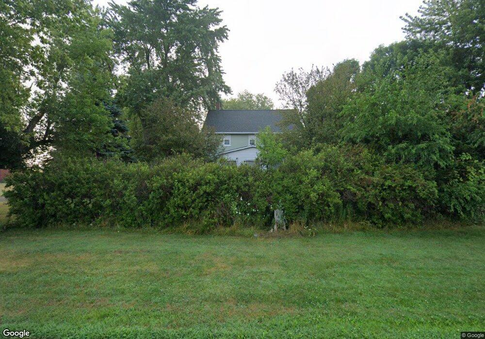
6331 8 Mile Rd Freeland, MI 48623
Estimated Value: $246,832 - $574,000
--
Bed
1
Bath
2,188
Sq Ft
$165/Sq Ft
Est. Value
About This Home
This home is located at 6331 8 Mile Rd, Freeland, MI 48623 and is currently estimated at $361,958, approximately $165 per square foot. 6331 8 Mile Rd is a home located in Bay County with nearby schools including Thrasher Attendance Center, Mackensen Elementary School, and Western Middle School.
Ownership History
Date
Name
Owned For
Owner Type
Purchase Details
Closed on
Oct 16, 2023
Sold by
Collet Jeffrey R
Bought by
Jeff Collet Trust
Current Estimated Value
Purchase Details
Closed on
Aug 4, 2023
Sold by
Collet Jeffrey R
Bought by
Jeff Collet Trust
Purchase Details
Closed on
Aug 17, 2021
Sold by
Collet Judith J
Bought by
Collet Jeffrey P
Purchase Details
Closed on
Apr 19, 2012
Sold by
Collet Alfred J and Collet Judith
Bought by
Collet Alfred J and Collet Judith
Purchase Details
Closed on
Apr 17, 1986
Sold by
Warmbier William H and Mary Ellen
Bought by
Collet Alfred J and Collet Judith
Create a Home Valuation Report for This Property
The Home Valuation Report is an in-depth analysis detailing your home's value as well as a comparison with similar homes in the area
Home Values in the Area
Average Home Value in this Area
Purchase History
| Date | Buyer | Sale Price | Title Company |
|---|---|---|---|
| Jeff Collet Trust | -- | None Listed On Document | |
| Jeff Collet Trust | -- | None Listed On Document | |
| Collet Jeffrey P | -- | None Available | |
| Collet Alfred J | -- | None Available | |
| Collet Alfred J | $45,700 | -- |
Source: Public Records
Tax History Compared to Growth
Tax History
| Year | Tax Paid | Tax Assessment Tax Assessment Total Assessment is a certain percentage of the fair market value that is determined by local assessors to be the total taxable value of land and additions on the property. | Land | Improvement |
|---|---|---|---|---|
| 2025 | $275 | $113,550 | $0 | $0 |
| 2024 | $260 | $89,650 | $0 | $0 |
| 2023 | $260 | $0 | $0 | $0 |
| 2022 | $245 | $54,800 | $0 | $0 |
| 2021 | $1,426 | $53,450 | $53,450 | $0 |
| 2020 | $1,384 | $54,800 | $54,800 | $0 |
| 2019 | $1,311 | $50,950 | $0 | $0 |
| 2018 | $1,276 | $50,700 | $0 | $0 |
| 2017 | $1,220 | $48,250 | $0 | $0 |
| 2016 | $1,221 | $52,800 | $0 | $52,800 |
| 2015 | $1,203 | $36,300 | $0 | $36,300 |
| 2014 | $1,203 | $34,700 | $0 | $34,700 |
Source: Public Records
Map
Nearby Homes
- 4079 S 8 Mile Rd
- 9325 Hospital Rd
- 0 S Auburn Rd
- 10399 Webster Rd
- 319 Price St
- 267 W Midland Rd
- 5749 11 Mile Rd
- 9924 Garner Ln
- 6641 Pierce Rd
- 305 Renshar Dr
- 4649 Stephanie Ct
- 6790 Hospital Rd
- 1029 Raven Dr
- 1048 Pheasant Dr
- 10585 Prairie View Ct
- 4819 Cardinal Dr
- 8421 Waxwing Dr
- 8599 Ashland Place
- 9100 Brook Hollow Ln
- 9160 Brook Hollow Ln
- 6346 Hospital Rd
- 5978 S 8 Mile Rd
- 6346 8 Mile Rd
- 6346 8 Mile Rd
- 6265 8 Mile Rd
- 6375 Hospital Rd
- 6437 8 Mile Rd
- 6244 8 Mile Rd
- 10000 Hospital Rd
- 7014 Buck Rd
- 0 S 8 Mile Rd
- 6138 Hospital Rd
- 6138 8 Mile Rd
- 6535 8 Mile Rd
- 6524 Hospital Rd
- 6126 8 Mile Rd
- 6551 8 Mile Rd
- 6114 Hospital Rd
- 6114 S Eight Mile
- 7328 Buck Rd