Estimated Value: $335,850 - $469,000
5
Beds
3
Baths
2,252
Sq Ft
$184/Sq Ft
Est. Value
About This Home
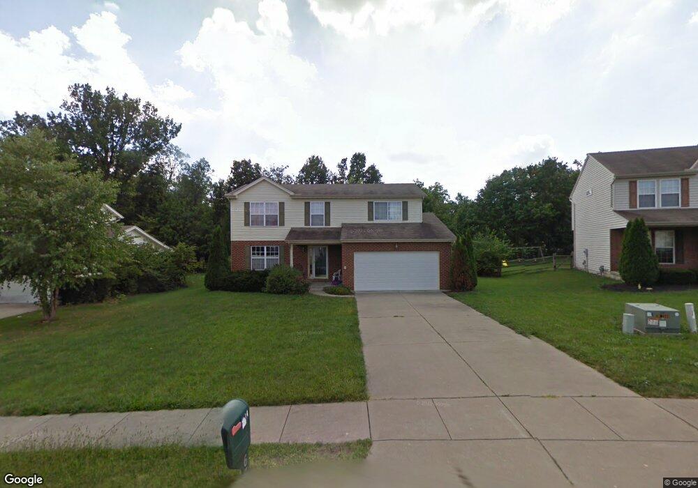
This home is located at 6331 Fireside Dr, Mason, OH 45040 and is currently estimated at $415,213, approximately $184 per square foot. 6331 Fireside Dr is a home located in Warren County with nearby schools including Mason Intermediate Elementary School, Mason Middle School, and William Mason High School.
Ownership History
Date
Name
Owned For
Owner Type
Purchase Details
Closed on
Mar 3, 2022
Sold by
Sue Ross Clara
Bought by
Dirck Francesca and Dirck Nathan
Current Estimated Value
Home Financials for this Owner
Home Financials are based on the most recent Mortgage that was taken out on this home.
Original Mortgage
$138,400
Outstanding Balance
$127,881
Interest Rate
3.76%
Mortgage Type
New Conventional
Estimated Equity
$287,332
Purchase Details
Closed on
Dec 2, 1997
Sold by
Hutchinson Homes Inc
Bought by
Ross Clara S and Lipari Joseph A
Home Financials for this Owner
Home Financials are based on the most recent Mortgage that was taken out on this home.
Original Mortgage
$260,000
Interest Rate
6.25%
Mortgage Type
New Conventional
Create a Home Valuation Report for This Property
The Home Valuation Report is an in-depth analysis detailing your home's value as well as a comparison with similar homes in the area
Home Values in the Area
Average Home Value in this Area
Purchase History
| Date | Buyer | Sale Price | Title Company |
|---|---|---|---|
| Dirck Francesca | $173,000 | Prodigy Title | |
| Ross Clara S | $147,000 | -- |
Source: Public Records
Mortgage History
| Date | Status | Borrower | Loan Amount |
|---|---|---|---|
| Open | Dirck Francesca | $138,400 | |
| Previous Owner | Ross Clara S | $260,000 |
Source: Public Records
Tax History
| Year | Tax Paid | Tax Assessment Tax Assessment Total Assessment is a certain percentage of the fair market value that is determined by local assessors to be the total taxable value of land and additions on the property. | Land | Improvement |
|---|---|---|---|---|
| 2025 | $4,201 | $103,520 | $24,500 | $79,020 |
| 2024 | $4,201 | $103,520 | $24,500 | $79,020 |
| 2023 | $3,879 | $80,752 | $10,762 | $69,989 |
| 2022 | $3,829 | $80,752 | $10,763 | $69,990 |
| 2021 | $3,627 | $80,752 | $10,763 | $69,990 |
| 2020 | $3,440 | $65,653 | $8,750 | $56,903 |
| 2019 | $3,162 | $65,653 | $8,750 | $56,903 |
| 2018 | $3,173 | $65,653 | $8,750 | $56,903 |
| 2017 | $2,895 | $55,937 | $8,274 | $47,663 |
| 2016 | $2,982 | $55,937 | $8,274 | $47,663 |
| 2015 | $2,989 | $55,937 | $8,274 | $47,663 |
| 2014 | $2,995 | $52,280 | $7,730 | $44,540 |
| 2013 | $3,002 | $59,170 | $8,750 | $50,420 |
Source: Public Records
Map
Nearby Homes
- 6300 Amber Ct
- 6411 Coverage Ct
- 6404 Coverage Ct
- 6394 Coverage Ct
- 6382 Coverage Ct
- 6378 Coverage Ct
- 6364 Coverage Ct
- 6354 Coverage Ct
- 6379 Coverage Ct
- 6375 Coverage Ct
- 6358 Coverage Ct
- 6403 Nicholas Way
- 6393 Nicholas Way
- 6179 Nicholas Way
- 6175 Nicholas Way
- 6171 Nicholas Way
- 6361 Coverage Ct
- 6342 Coverage Ct
- 6160 Nicholas Way
- 6168 Nicholas Way
- 6341 Fireside Dr
- 6319 Fireside Dr
- 504 Charles Ct
- 6357 Fireside Dr
- 506 Charles Ct
- 6307 Fireside Dr
- 6336 Fireside Dr
- 6308 Fireside Dr
- 500 Charles Ct
- 6348 Fireside Dr
- 1171 Anthony Ln
- 6299 Fireside Dr
- 509 Charles Ct
- 6377 Fireside Dr
- 6274 Fireside Dr
- 1167 Anthony Ln
- 6275 Fireside Dr
- 6374 Fireside Dr
- 1179 Anthony Ln
- 6260 Fireside Dr
Your Personal Tour Guide
Ask me questions while you tour the home.