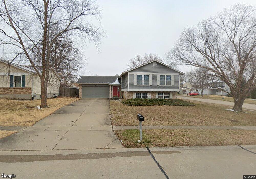
6331 Long Timber Dr O Fallon, MO 63368
Estimated Value: $287,000 - $310,000
3
Beds
2
Baths
1,143
Sq Ft
$260/Sq Ft
Est. Value
About This Home
This home is located at 6331 Long Timber Dr, O Fallon, MO 63368 and is currently estimated at $297,588, approximately $260 per square foot. 6331 Long Timber Dr is a home located in St. Charles County with nearby schools including Pheasant Point Elementary School, Fort Zumwalt South Middle School, and Fort Zumwalt South High School.
Ownership History
Date
Name
Owned For
Owner Type
Purchase Details
Closed on
Jul 14, 2006
Sold by
Buck Cathy
Bought by
Holmes Daniel R
Current Estimated Value
Purchase Details
Closed on
May 30, 2002
Sold by
Holmes Daniel R and Holmes Barbara J
Bought by
Holmes Daniel R and Holmes Barbara J
Home Financials for this Owner
Home Financials are based on the most recent Mortgage that was taken out on this home.
Original Mortgage
$63,144
Interest Rate
6.89%
Create a Home Valuation Report for This Property
The Home Valuation Report is an in-depth analysis detailing your home's value as well as a comparison with similar homes in the area
Home Values in the Area
Average Home Value in this Area
Purchase History
| Date | Buyer | Sale Price | Title Company |
|---|---|---|---|
| Holmes Daniel R | -- | None Available | |
| Holmes Daniel R | -- | -- |
Source: Public Records
Mortgage History
| Date | Status | Borrower | Loan Amount |
|---|---|---|---|
| Previous Owner | Holmes Daniel R | $63,144 |
Source: Public Records
Tax History
| Year | Tax Paid | Tax Assessment Tax Assessment Total Assessment is a certain percentage of the fair market value that is determined by local assessors to be the total taxable value of land and additions on the property. | Land | Improvement |
|---|---|---|---|---|
| 2025 | $2,865 | $47,546 | -- | -- |
| 2023 | $2,868 | $43,350 | $0 | $0 |
| 2022 | $2,524 | $35,528 | $0 | $0 |
| 2021 | $2,531 | $35,528 | $0 | $0 |
| 2020 | $2,429 | $32,837 | $0 | $0 |
| 2019 | $2,435 | $32,837 | $0 | $0 |
| 2018 | $2,323 | $29,962 | $0 | $0 |
| 2017 | $2,282 | $29,962 | $0 | $0 |
| 2016 | $2,171 | $27,384 | $0 | $0 |
| 2015 | $2,024 | $27,384 | $0 | $0 |
| 2014 | $1,887 | $25,191 | $0 | $0 |
Source: Public Records
Map
Nearby Homes
- 703 Tinsley Ct
- 531 John Pitman Dr
- 6519 Star Buck Dr
- 101 Winterbrooke Ct
- 249 Dardenne Farms Dr
- 178 Christina Marie Dr
- 174 Christina Marie Dr
- 1343 Avondale Spring Dr
- 1319 Commons Cir
- 10 Muir Trail Ct
- 71 Harrisburg Ct
- 425 Round Tower Dr W
- 112 Auburn Trace Pointe Ct
- 103 Auburn Trace Point
- 527 Auburn Trace Ln
- 6025 Mo-N Unit # 1
- 6024 Mo-N Unit #2
- 8020 Cotswald Trail
- 8012 Cotswald Trail
- 1003 Santiago Trail
- 6335 Long Timber Dr
- 6316 Sprucefield Dr
- 6325 Long Timber Dr
- 6339 Long Timber Dr
- 6330 Long Timber Dr
- 6311 Sprucefield Dr
- 6336 Star Buck Dr
- 6334 Long Timber Dr
- 6332 Star Buck Dr
- 6326 Long Timber Dr
- 6338 Long Timber Dr
- 6343 Long Timber Dr
- 6315 Sprucefield Dr
- 6340 Star Buck Dr
- 6321 Long Timber Dr
- 6319 Sprucefield Dr
- 6342 Long Timber Dr
- 6322 Long Timber Dr
- 6323 Sprucefield Dr
- 6347 Long Timber Dr
Your Personal Tour Guide
Ask me questions while you tour the home.