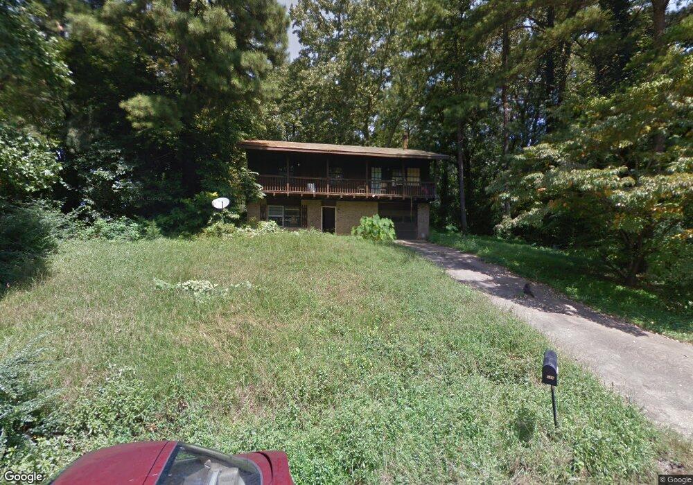
6332 Laurel Wood Trail Flowery Branch, GA 30542
Estimated Value: $286,000 - $410,000
3
Beds
2
Baths
1,120
Sq Ft
$286/Sq Ft
Est. Value
About This Home
This home is located at 6332 Laurel Wood Trail, Flowery Branch, GA 30542 and is currently estimated at $319,803, approximately $285 per square foot. 6332 Laurel Wood Trail is a home located in Hall County with nearby schools including Flowery Branch Elementary School, West Hall Middle School, and West Hall High School.
Ownership History
Date
Name
Owned For
Owner Type
Purchase Details
Closed on
Aug 10, 2015
Sold by
Rindfleisch Racheal Marie
Bought by
Bisbing Douglas Eugene
Current Estimated Value
Purchase Details
Closed on
Feb 23, 2007
Sold by
Egan Michael T and Egan Rose M C
Bought by
Bisbing Douglas and Rindfleisch Racheal
Home Financials for this Owner
Home Financials are based on the most recent Mortgage that was taken out on this home.
Original Mortgage
$100,700
Interest Rate
6.17%
Mortgage Type
New Conventional
Purchase Details
Closed on
Mar 23, 1999
Sold by
Egan Michael T
Bought by
Egan Michael T
Home Financials for this Owner
Home Financials are based on the most recent Mortgage that was taken out on this home.
Original Mortgage
$64,819
Interest Rate
6.85%
Mortgage Type
New Conventional
Purchase Details
Closed on
Mar 1, 1991
Create a Home Valuation Report for This Property
The Home Valuation Report is an in-depth analysis detailing your home's value as well as a comparison with similar homes in the area
Home Values in the Area
Average Home Value in this Area
Purchase History
| Date | Buyer | Sale Price | Title Company |
|---|---|---|---|
| Bisbing Douglas Eugene | -- | -- | |
| Bisbing Douglas | $106,000 | -- | |
| Egan Michael T | -- | -- | |
| -- | $63,600 | -- |
Source: Public Records
Mortgage History
| Date | Status | Borrower | Loan Amount |
|---|---|---|---|
| Previous Owner | Bisbing Douglas | $100,700 | |
| Previous Owner | Egan Michael T | $64,819 |
Source: Public Records
Tax History Compared to Growth
Tax History
| Year | Tax Paid | Tax Assessment Tax Assessment Total Assessment is a certain percentage of the fair market value that is determined by local assessors to be the total taxable value of land and additions on the property. | Land | Improvement |
|---|---|---|---|---|
| 2024 | $1,919 | $76,680 | $20,960 | $55,720 |
| 2023 | $1,816 | $69,600 | $14,760 | $54,840 |
| 2022 | $1,281 | $48,800 | $7,360 | $41,440 |
| 2021 | $1,279 | $47,880 | $7,360 | $40,520 |
| 2020 | $1,268 | $46,200 | $7,360 | $38,840 |
| 2019 | $1,127 | $40,640 | $7,360 | $33,280 |
| 2018 | $1,565 | $54,920 | $7,360 | $47,560 |
| 2017 | $1,505 | $53,360 | $7,720 | $45,640 |
| 2016 | $1,327 | $48,111 | $6,647 | $41,464 |
| 2015 | $1,338 | $48,111 | $6,647 | $41,464 |
| 2014 | $1,338 | $48,111 | $6,647 | $41,464 |
Source: Public Records
Map
Nearby Homes
- 6262 Laurel Wood Trail
- 6237 Stillwater Place
- 5904 Clipper Bay
- 6121 Stillwater Trail
- 6284 Brookridge Dr
- 6241 Brookridge Dr
- 6749 Leigh St
- 6740 Leigh St
- 6732 Leigh St
- 6737 Leigh St
- 6745 Leigh St
- SUDBURY 24' TOWNHOME Plan at Waypoint
- ADDINGTON Plan at Waypoint
- SALISBURY 24' TOWNHOME Plan at Waypoint
- AMESBURY Plan at Waypoint
- 6338 Laurel Wood Trail
- 6236 Sweetgum Trail
- 6236 Sweetgum Trail Unit 60
- 6238 Sweetgum Trail
- 6230 Sweetgum Trail
- 6346 Laurel Wood Trail
- 6113 Woodbridge Dr
- 0 Woodbridge Dr
- 6339 Laurel Wood Trail
- 6226 Sweetgum Trail
- 6323 Laurel Wood Trail
- 6248 Sweetgum Trail
- 6345 Laurel Wood Trail
- 6350 Laurel Wood Trail
- 6349 Laurel Wood Trail
- 6233 Sweetgum Trail
- 6241 Sweetgum Trail
- 6319 Laurel Wood Trail
- 6229 Sweetgum Trail
- 6218 Sweetgum Trail