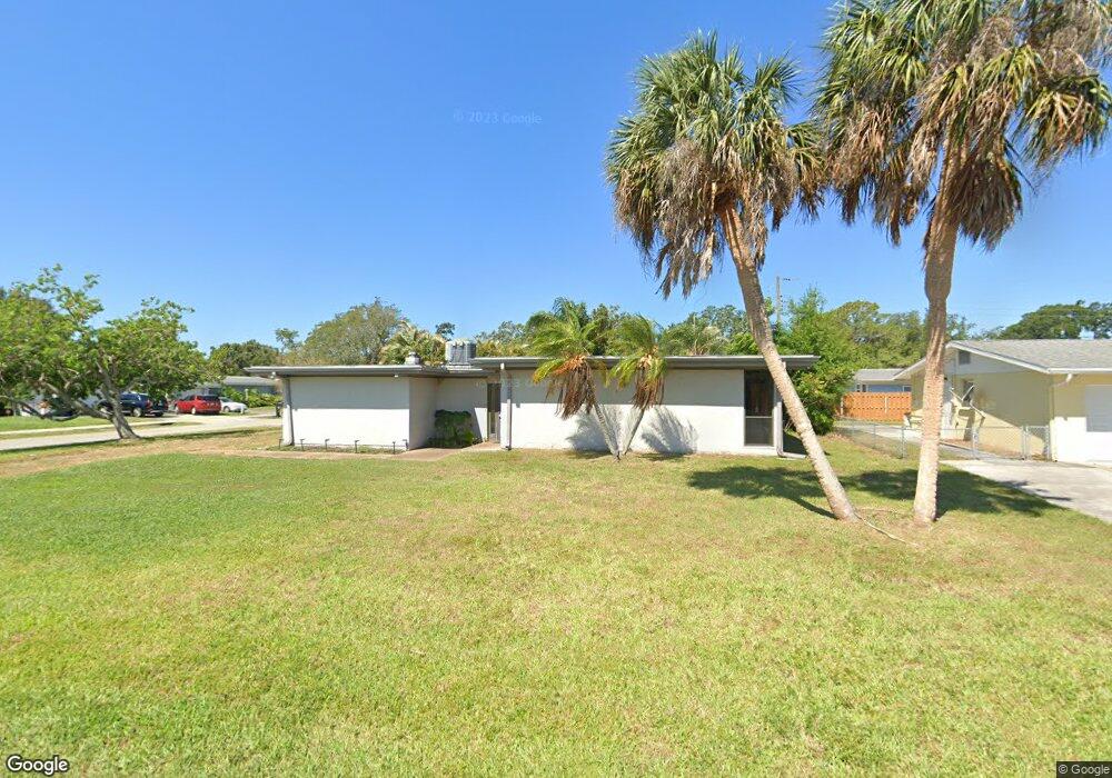
6332 Pauline Ave Sarasota, FL 34231
Estimated Value: $365,310 - $461,000
3
Beds
2
Baths
1,679
Sq Ft
$250/Sq Ft
Est. Value
About This Home
This home is located at 6332 Pauline Ave, Sarasota, FL 34231 and is currently estimated at $419,078, approximately $249 per square foot. 6332 Pauline Ave is a home located in Sarasota County with nearby schools including Gulf Gate Elementary School, Riverview High School, and Brookside Middle School.
Ownership History
Date
Name
Owned For
Owner Type
Purchase Details
Closed on
Mar 29, 2002
Sold by
Wright Carla
Bought by
Eggebrecht Andrew D
Current Estimated Value
Home Financials for this Owner
Home Financials are based on the most recent Mortgage that was taken out on this home.
Original Mortgage
$105,000
Outstanding Balance
$43,652
Interest Rate
6.85%
Estimated Equity
$375,426
Purchase Details
Closed on
Mar 31, 1995
Sold by
Bowles Robert L and Bowles Kelly L
Bought by
Wright Carla
Home Financials for this Owner
Home Financials are based on the most recent Mortgage that was taken out on this home.
Original Mortgage
$84,867
Interest Rate
8.86%
Mortgage Type
FHA
Create a Home Valuation Report for This Property
The Home Valuation Report is an in-depth analysis detailing your home's value as well as a comparison with similar homes in the area
Home Values in the Area
Average Home Value in this Area
Purchase History
| Date | Buyer | Sale Price | Title Company |
|---|---|---|---|
| Eggebrecht Andrew D | $140,000 | -- | |
| Wright Carla | $85,000 | -- |
Source: Public Records
Mortgage History
| Date | Status | Borrower | Loan Amount |
|---|---|---|---|
| Open | Eggebrecht Andrew D | $105,000 | |
| Previous Owner | Wright Carla | $84,867 |
Source: Public Records
Tax History Compared to Growth
Tax History
| Year | Tax Paid | Tax Assessment Tax Assessment Total Assessment is a certain percentage of the fair market value that is determined by local assessors to be the total taxable value of land and additions on the property. | Land | Improvement |
|---|---|---|---|---|
| 2024 | $1,435 | $117,079 | -- | -- |
| 2023 | $1,435 | $113,669 | $0 | $0 |
| 2022 | $1,359 | $110,358 | $0 | $0 |
| 2021 | $1,341 | $107,144 | $0 | $0 |
| 2020 | $1,327 | $105,665 | $0 | $0 |
| 2019 | $1,259 | $103,289 | $0 | $0 |
| 2018 | $1,210 | $101,363 | $0 | $0 |
| 2017 | $1,200 | $99,278 | $0 | $0 |
| 2016 | $1,194 | $134,000 | $56,500 | $77,500 |
| 2015 | $1,209 | $126,700 | $53,800 | $72,900 |
| 2014 | $1,202 | $94,378 | $0 | $0 |
Source: Public Records
Map
Nearby Homes
- 6220 Murdock Ave
- 3024 Williamsburg St
- 2833 Valley Forge St
- 2918 Williamsburg St
- 3040 New England St
- 3274 Savage Rd
- 6711 S Lockwood Ridge Rd
- 6051 Carlton Ave
- 2938 Clark Rd Unit 103
- 2924 Clark Rd Unit 205
- 3231 Yorktown St
- 2460 Terry Ln
- 2065 Sun Home St Unit Lot A-23
- 2227 Circlewood Dr Unit 52
- 6947 Woodwind Dr Unit 77
- 6906 Woodwind Dr Unit 12
- 6637 Bowline Dr
- 3003 Bispham Rd
- 3310 Lexington St
- 6146 Rockefeller Ave
- 6320 Pauline Ave
- 6335 Camphor Ave
- 6323 Camphor Ave
- 6333 Pauline Ave
- 3018 Savage Rd
- 3024 Savage Rd
- 6308 Pauline Ave
- 6321 Pauline Ave
- 3012 Savage Rd
- 6311 Camphor Ave
- 3030 Savage Rd
- 6309 Pauline Ave
- 3006 Savage Rd
- 6240 Pauline Ave
- 3036 Savage Rd
- 6330 Nutmeg Ave
- 6237 Camphor Ave
- 6318 Nutmeg Ave
- 6239 Pauline Ave
- 3000 Savage Rd