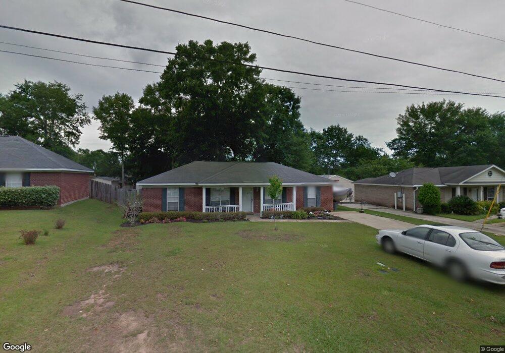
6332 Woodside Dr S Theodore, AL 36582
Westfield NeighborhoodEstimated Value: $198,643 - $221,000
4
Beds
2
Baths
1,404
Sq Ft
$150/Sq Ft
Est. Value
About This Home
This home is located at 6332 Woodside Dr S, Theodore, AL 36582 and is currently estimated at $211,161, approximately $150 per square foot. 6332 Woodside Dr S is a home located in Mobile County with nearby schools including Nan Gray Davis Elementary School, Katherine H Hankins Middle School, and Theodore High School.
Ownership History
Date
Name
Owned For
Owner Type
Purchase Details
Closed on
May 14, 1999
Sold by
Benchmark Homes Inc
Bought by
Williams Ralph Matthew and Williams Sherry R
Current Estimated Value
Home Financials for this Owner
Home Financials are based on the most recent Mortgage that was taken out on this home.
Original Mortgage
$82,050
Outstanding Balance
$33,554
Interest Rate
6.98%
Estimated Equity
$177,607
Create a Home Valuation Report for This Property
The Home Valuation Report is an in-depth analysis detailing your home's value as well as a comparison with similar homes in the area
Home Values in the Area
Average Home Value in this Area
Purchase History
| Date | Buyer | Sale Price | Title Company |
|---|---|---|---|
| Williams Ralph Matthew | -- | -- |
Source: Public Records
Mortgage History
| Date | Status | Borrower | Loan Amount |
|---|---|---|---|
| Open | Williams Ralph Matthew | $82,050 |
Source: Public Records
Tax History Compared to Growth
Tax History
| Year | Tax Paid | Tax Assessment Tax Assessment Total Assessment is a certain percentage of the fair market value that is determined by local assessors to be the total taxable value of land and additions on the property. | Land | Improvement |
|---|---|---|---|---|
| 2024 | $802 | $14,420 | $2,800 | $11,620 |
| 2023 | $753 | $13,990 | $2,800 | $11,190 |
| 2022 | $537 | $12,460 | $2,800 | $9,660 |
| 2021 | $482 | $11,320 | $2,800 | $8,520 |
| 2020 | $475 | $11,180 | $2,800 | $8,380 |
| 2019 | $502 | $11,740 | $0 | $0 |
| 2018 | $475 | $11,180 | $0 | $0 |
| 2017 | $480 | $11,280 | $0 | $0 |
| 2016 | $464 | $10,940 | $0 | $0 |
| 2013 | $491 | $11,400 | $0 | $0 |
Source: Public Records
Map
Nearby Homes
- 6293 Woodside Dr S
- 6521 Barnes Rd
- 6624 Morgan Jackson Ct
- 6913 Gray Oaks Dr
- 6780 Boykin Rd
- 6425 Boykin Rd
- 6987 Magnolia Trace
- 5950 Theodore Dawes Rd
- 6799 Foxwood Dr
- 6361 Rester Rd
- 6795 Browder Dr
- 6631 Sandra Dr
- 0 Rester Rd
- 6840 Highmont Dr
- 6028 Creek Side Trail
- 7340 Broadview Dr E
- 7347 Broadview Dr E
- 6178 Sperry Rd
- 0 Highway 90 Unit 7630566
- 0 Highway 90 Unit 7394848
- 6322 Woodside Dr S
- 6342 Woodside Dr S
- 6341 Woodside Dr
- 6351 Woodside Dr
- 6351 Woodside Dr Unit 2
- 6312 Woodside Dr S
- 6352 Woodside Dr S
- 6321 Woodside Dr
- 6361 Woodside Dr
- 6323 Woodside Dr S
- 6333 Woodside Dr S
- 6362 Woodside Dr S
- 6311 Woodside Dr Unit 1
- 6371 Woodside Dr
- 6313 Woodside Dr S
- 6302 Woodside Dr S
- 6381 Woodside Dr
- 6303 Woodside Dr N
- 6303 Woodside Dr S
- 6301 Woodside Dr