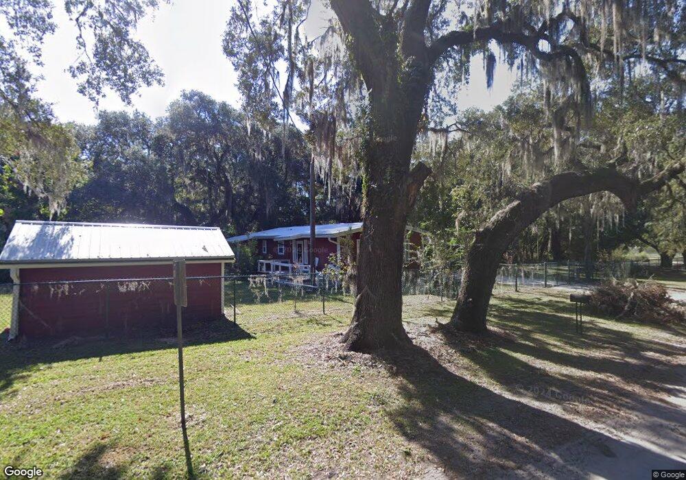
6333 5th St Keystone Heights, FL 32656
Estimated Value: $235,000 - $320,000
2
Beds
2
Baths
1,570
Sq Ft
$177/Sq Ft
Est. Value
About This Home
This home is located at 6333 5th St, Keystone Heights, FL 32656 and is currently estimated at $278,288, approximately $177 per square foot. 6333 5th St is a home located in Clay County with nearby schools including Keystone Heights Elementary School and Keystone Heights Junior/Senior High School.
Ownership History
Date
Name
Owned For
Owner Type
Purchase Details
Closed on
Oct 10, 2002
Sold by
Wetherington Gertrude A
Bought by
Carlson John M and Carlson Kathleen Ann
Current Estimated Value
Home Financials for this Owner
Home Financials are based on the most recent Mortgage that was taken out on this home.
Original Mortgage
$79,800
Interest Rate
6.18%
Mortgage Type
Purchase Money Mortgage
Purchase Details
Closed on
Mar 6, 2002
Sold by
Wetherington Gertrude
Bought by
Wetherington Gertrude A
Create a Home Valuation Report for This Property
The Home Valuation Report is an in-depth analysis detailing your home's value as well as a comparison with similar homes in the area
Home Values in the Area
Average Home Value in this Area
Purchase History
| Date | Buyer | Sale Price | Title Company |
|---|---|---|---|
| Carlson John M | $106,000 | -- | |
| Wetherington Gertrude A | -- | -- |
Source: Public Records
Mortgage History
| Date | Status | Borrower | Loan Amount |
|---|---|---|---|
| Closed | Carlson John M | $79,800 |
Source: Public Records
Tax History Compared to Growth
Tax History
| Year | Tax Paid | Tax Assessment Tax Assessment Total Assessment is a certain percentage of the fair market value that is determined by local assessors to be the total taxable value of land and additions on the property. | Land | Improvement |
|---|---|---|---|---|
| 2024 | $324 | $134,463 | -- | -- |
| 2023 | $324 | $130,547 | $0 | $0 |
| 2022 | $210 | $126,745 | $0 | $0 |
| 2021 | $223 | $123,054 | $0 | $0 |
| 2020 | $226 | $121,356 | $0 | $0 |
| 2019 | $226 | $118,628 | $0 | $0 |
| 2018 | $211 | $116,416 | $0 | $0 |
| 2017 | $211 | $114,022 | $0 | $0 |
| 2016 | $211 | $111,677 | $0 | $0 |
| 2015 | $230 | $110,901 | $0 | $0 |
| 2014 | $230 | $110,021 | $0 | $0 |
Source: Public Records
Map
Nearby Homes
- 0 3rd St
- 6283 Vanderbilt Dr
- 6357 Wofford Dr
- 6314 Wofford Dr
- 6326 Vanderbilt Dr
- 6376 Swarthmore Dr
- 6272 Vanderbilt Dr
- 8012 Floral Ridge Cir
- 6334 Vassar Dr
- 6333 Tulsa Dr
- 6291 Drake Ave
- 6312 Drake Ave
- 7315 Yale St
- 6339 Bucknell Ave
- 6376 Bucknell Ave
- 6312 Bowdoin Ave
- 6509 Baylor Ave
- 7210 Skidmore St
- 6090 County Road 214
- 7232 Woodstock St
- 7908 Lake Geneva Ln
- 0 Lake Geneva Ln Unit 979028
- 0 Lake Geneva Ln Unit 1168721
- 0 Lake Geneva Ln
- 7868 Lake Geneva Ln
- 6320 5th St
- 7906 State Road 100
- Lots 8 & 9 Lake Geneva Ln
- 000 Lake Geneva Ln
- 02 Lake Geneva Ln
- 01 Lake Geneva Ln
- 00 Lake Geneva Ln
- 7914 Lake Geneva Ln
- 6322 6th St
- 6326 5th St
- 7890 Lake Geneva Ln
- 7918 Lake Geneva Ln
- 8409 State Route 100
- 7920 Lake Geneva Ln
- 7882 Lake Geneva Ln