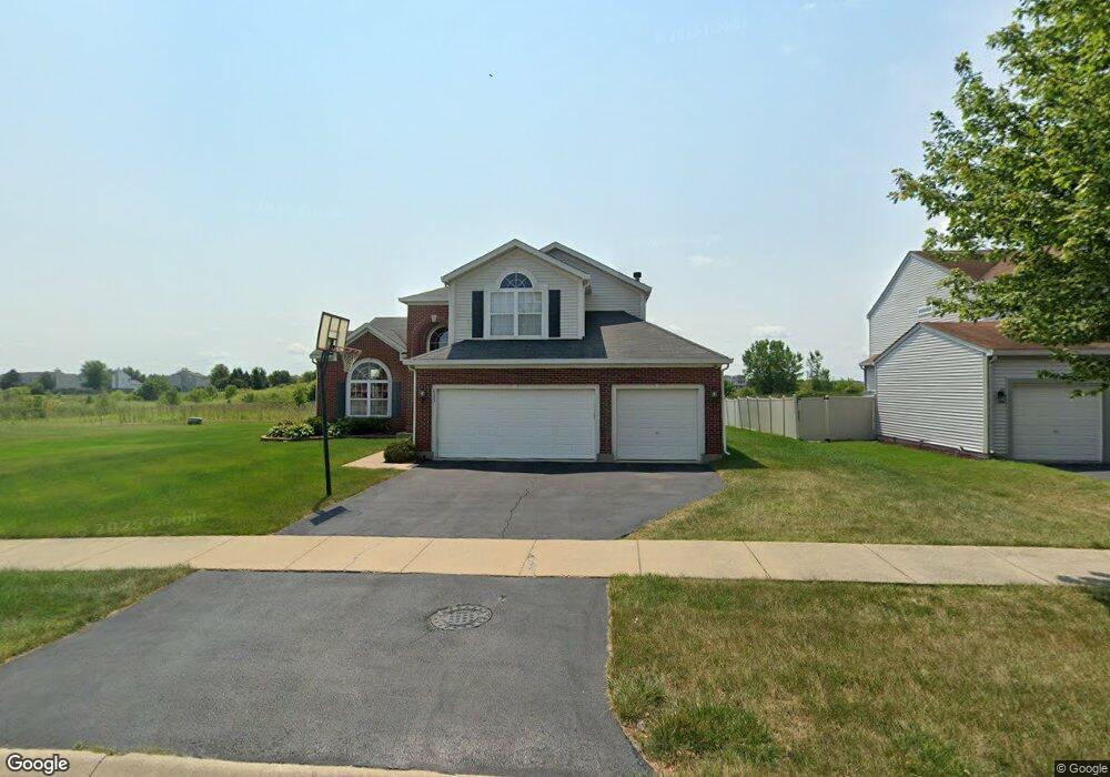
6333 Cornfield Rd Matteson, IL 60443
West Matteson NeighborhoodEstimated Value: $389,000 - $415,683
About This Home
This home is located at 6333 Cornfield Rd, Matteson, IL 60443 and is currently estimated at $402,671, approximately $137 per square foot. 6333 Cornfield Rd is a home located in Cook County with nearby schools including Colin Powell Middle School and Southland College Prep.
Ownership History
We collect this data history from publicly available records. To have your information removed, we recommend requesting removal directly through your county’s website.
Purchase Details
Purchase Details
Home Financials for this Owner
Home Financials are based on the most recent Mortgage that was taken out on this home.Home Values in the Area
Average Home Value in this Area
Purchase History
We collect this data history from publicly available records. To have your information removed, we recommend requesting removal directly through your county’s website.
| Date | Buyer | Sale Price | Title Company |
|---|---|---|---|
| -- | None Listed On Document | ||
| $298,500 | Cti |
Mortgage History
We collect this data history from publicly available records. To have your information removed, we recommend requesting removal directly through your county’s website.
| Date | Status | Borrower | Loan Amount |
|---|---|---|---|
| Previous Owner | $283,250 |
Tax History
We collect this data history from publicly available records. To have your information removed, we recommend requesting removal directly through your county’s website.
| Year | Tax Paid | Tax Assessment Tax Assessment Total Assessment is a certain percentage of the fair market value that is determined by local assessors to be the total taxable value of land and additions on the property. | Land | Improvement |
|---|---|---|---|---|
| 2025 | $12,427 | $33,294 | $5,459 | $27,835 |
| 2024 | $12,427 | $33,294 | $5,459 | $27,835 |
| 2023 | $7,917 | $33,294 | $5,459 | $27,835 |
| 2022 | $7,917 | $18,207 | $4,714 | $13,493 |
| 2021 | $8,039 | $18,206 | $4,714 | $13,492 |
| 2020 | $9,160 | $20,643 | $4,714 | $15,929 |
| 2019 | $10,126 | $21,962 | $4,218 | $17,744 |
| 2018 | $10,598 | $23,118 | $4,218 | $18,900 |
| 2017 | $10,336 | $23,118 | $4,218 | $18,900 |
| 2016 | $9,209 | $20,292 | $3,721 | $16,571 |
| 2015 | $8,978 | $20,292 | $3,721 | $16,571 |
| 2014 | $8,762 | $20,292 | $3,721 | $16,571 |
| 2013 | $9,880 | $24,105 | $3,721 | $20,384 |
Map
- 6216 Pond View Dr
- 909 Berkshire Dr
- 21143 Gray Hawk Dr Unit 2554
- 6503 Blue Sky Ln Unit 2502
- 21218 Shannon Ave
- 6500 Pasture Side Trail
- 6704 Bridle Path Dr
- 0 Ridgeland Ave
- 1010 Regent Dr
- 997 Regent Dr
- 21229 Sophia Dr
- 21249 Sophia Dr
- 6616 Old Plank Blvd
- 21223 Alessandra Dr
- 6508 Fawn Ct
- 818 Princeton Ave
- 3601 W Lincoln Hwy
- 232 Highland Rd
- 5631 Colgate Ln
- 151 Oriole Rd
- 6337 Cornfield Rd
- 6329 Cornfield Rd
- 6341 Cornfield Rd
- 6332 Cornfield Rd
- 6325 Cornfield Rd
- 6326 Cornfield Rd Unit 11
- 6345 Cornfield Rd
- 6321 Cornfield Rd
- 819 Tall Grass Trail
- 6322 Cornfield Rd
- 826 Tall Grass Trail
- 6318 Cornfield Rd
- 6317 Cornfield Rd
- 815 Tall Grass Trail
- 818 Tall Grass Trail
- 6313 Cornfield Rd
- 6314 Cornfield Rd
- 811 Tall Grass Trail
- 814 Tall Grass Trail
- 6306 Cornfield Rd
Ask me questions while you tour the home.