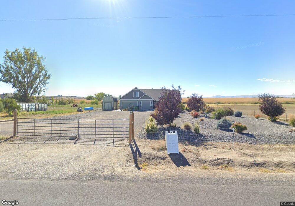
6335 Pershall Rd Marsing, ID 83639
Estimated Value: $693,889 - $912,000
5
Beds
3
Baths
2,586
Sq Ft
$310/Sq Ft
Est. Value
About This Home
This home is located at 6335 Pershall Rd, Marsing, ID 83639 and is currently estimated at $802,945, approximately $310 per square foot. 6335 Pershall Rd is a home located in Owyhee County with nearby schools including Marsing Elementary School, Marsing Middle School, and Marsing High School.
Ownership History
Date
Name
Owned For
Owner Type
Purchase Details
Closed on
Oct 9, 2014
Sold by
Loucks Leslie Leroy and Loucks Amy Beth
Bought by
Loucks Les
Current Estimated Value
Home Financials for this Owner
Home Financials are based on the most recent Mortgage that was taken out on this home.
Original Mortgage
$243,750
Interest Rate
4.08%
Mortgage Type
Construction
Create a Home Valuation Report for This Property
The Home Valuation Report is an in-depth analysis detailing your home's value as well as a comparison with similar homes in the area
Purchase History
| Date | Buyer | Sale Price | Title Company |
|---|---|---|---|
| Loucks Les | -- | Pioneer Title Company |
Source: Public Records
Mortgage History
| Date | Status | Borrower | Loan Amount |
|---|---|---|---|
| Closed | Loucks Les | $243,750 |
Source: Public Records
Tax History
| Year | Tax Paid | Tax Assessment Tax Assessment Total Assessment is a certain percentage of the fair market value that is determined by local assessors to be the total taxable value of land and additions on the property. | Land | Improvement |
|---|---|---|---|---|
| 2025 | -- | $610,928 | $123,818 | $487,110 |
| 2024 | -- | $602,753 | $115,643 | $487,110 |
| 2023 | -- | $598,213 | $115,643 | $482,570 |
| 2022 | $3,016 | $603,083 | $115,643 | $487,440 |
| 2021 | $2,342 | $409,430 | $96,580 | $312,850 |
| 2020 | $2,284 | $369,386 | $58,616 | $310,770 |
| 2019 | $2,252 | $317,264 | $58,616 | $258,648 |
| 2018 | $2,098 | $291,687 | $48,847 | $242,840 |
| 2017 | $2,024 | $290,036 | $48,847 | $241,189 |
| 2016 | $56 | $70,717 | $70,717 | $0 |
| 2014 | $37 | $4,660 | $4,660 | $0 |
| 2011 | -- | $4,333 | $4,333 | $0 |
Source: Public Records
Map
Nearby Homes
- TBD Canal St
- 912 W Main St
- 8065 Moonshine Ln
- 101 Twilight Trail
- 20056 Sunny Slope Rd
- 6617 Red Rock Rd
- TBD N Bruneau Rd
- 8142 Us Highway 95
- 19151 Symms Rd
- TBD Lot 5 Cabernet Ln
- TBD Cabernet Ln - Lot 5 Parcel A
- 518 Bass Run Ln
- 5054 Heritage Dr
- 547 Bass Run Ln
- 10430 Randall Ln
- TBD Riverside Rd
- 1406 Oak River Ln
- TBD Oak River Ln
- 11267 W Rio Rd
- TBD Island View Dr - Lot 1
- 6337 Pershall Rd
- 0 Hwy 78 Unit 98704279
- 0 Hwy 78 Unit 98698638
- 00 Hwy 78
- 0 Hwy 78 Unit 98647726
- 0 Hwy 78 Unit 98477950
- 0 Hwy 78 Unit 98423812
- 0 Hwy 78 Unit 98200992
- 0 Hwy 78 Unit 98734659
- 6249 Pershall Rd
- 6251 Pershall Rd
- 6036 State Highway 78
- 6056 State Highway 78
- 6012 State Hwy 78
- 6012 State Highway 78
- 6307 Shari Hill Way
- 6300 Shari Hill Way
- 6315 Shari Hill Way
- 6312 Shari Hill Way
- 6187 Pershall Rd
Your Personal Tour Guide
Ask me questions while you tour the home.